7 Wildlife Experiences in The Seven
Visit polar bears and alpacas, bison and bufflehead—no zoo required!
By Staff Writer, Northern Ontario Travel


Sometimes you have to wonder how a trail gets its name: is it the topography of the land that suggests the title, a translation from the original description given it by the Indigenous people who first explored it, or the experience of the hike itself?
I first heard about the Cup and Saucer Trail from friends who cottage on Manitoulin Island and who consider the trail a “must do.” I’ve since learned this is the opinion of everyone on Manitoulin Island! The name is intriguing in and of itself, and with its reputation as one of Northeastern Ontario’s most popular hikes, I was curious to see what all the fuss was about.
After arriving at the trailhead and reviewing the map of the various routes, I decided on a 5-km piece of the White Trail that would take me as far as the 70-metre-high East Lookout – another name that sounded promising.
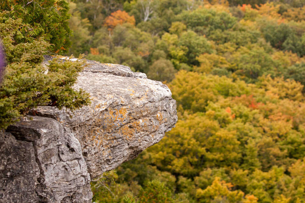
Having done a little research about the trail beforehand, I was surprised to learn that this lookout was part of the Niagara Escarpment. I had always thought that this geographic formation was a Southern Ontario feature that ended in the waters of Georgian Bay on the Bruce Peninsula. But as I started to get deeper and higher into the White Trail, I began to see moss-covered exposed dolomite that I recognized from trails that I had hiked farther south.
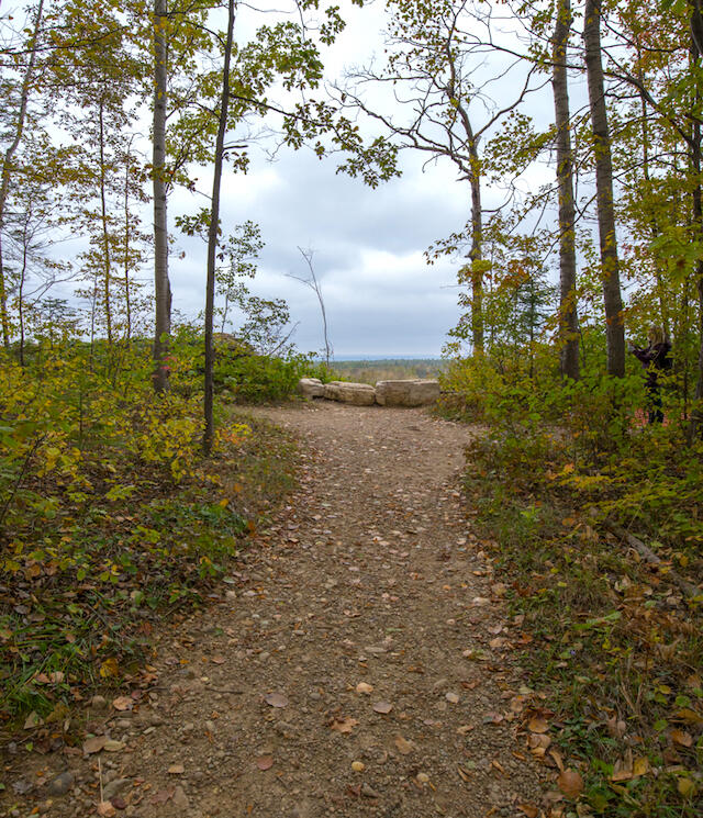
A 70-metre-high view meant I would have to climb to get there, so I took the map seriously when it identified a couple of steep places along the White Trail. The map proved to be accurate, and both of these sections of trail involved scaling a steep rocky path. I’m no mountain goat, so I chose my footholds carefully, but the climb was doable, the huffing and puffing was short-lived, and was soon replaced with anticipation of the view ahead as the trail began to level out.
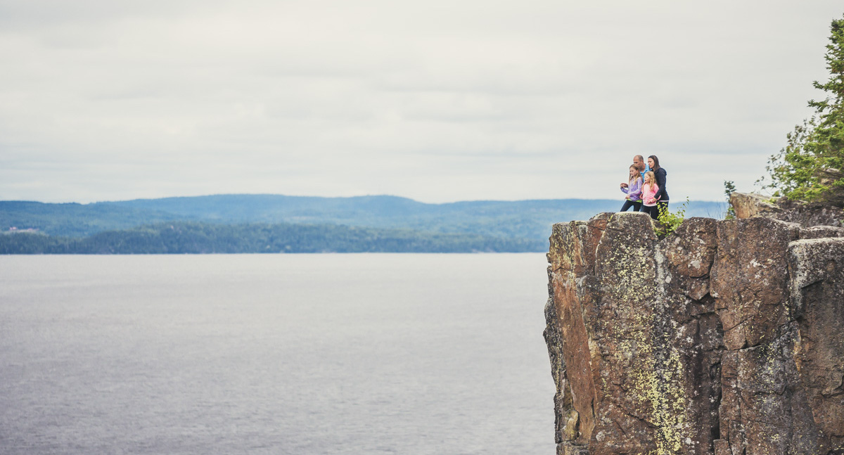
Even before reaching the official East Lookout vantage point, the trail gives you a glimpse of what’s to come: a break along the edge reveals treetops stretching out in front of you, extending to the edge of the island and the “big water” of Lake Huron beyond. On either side, the Escarpment’s rock ledges jutted in and out from the edge creating natural overlooks, and off to the left, its exposed cliffs continued into the distance.
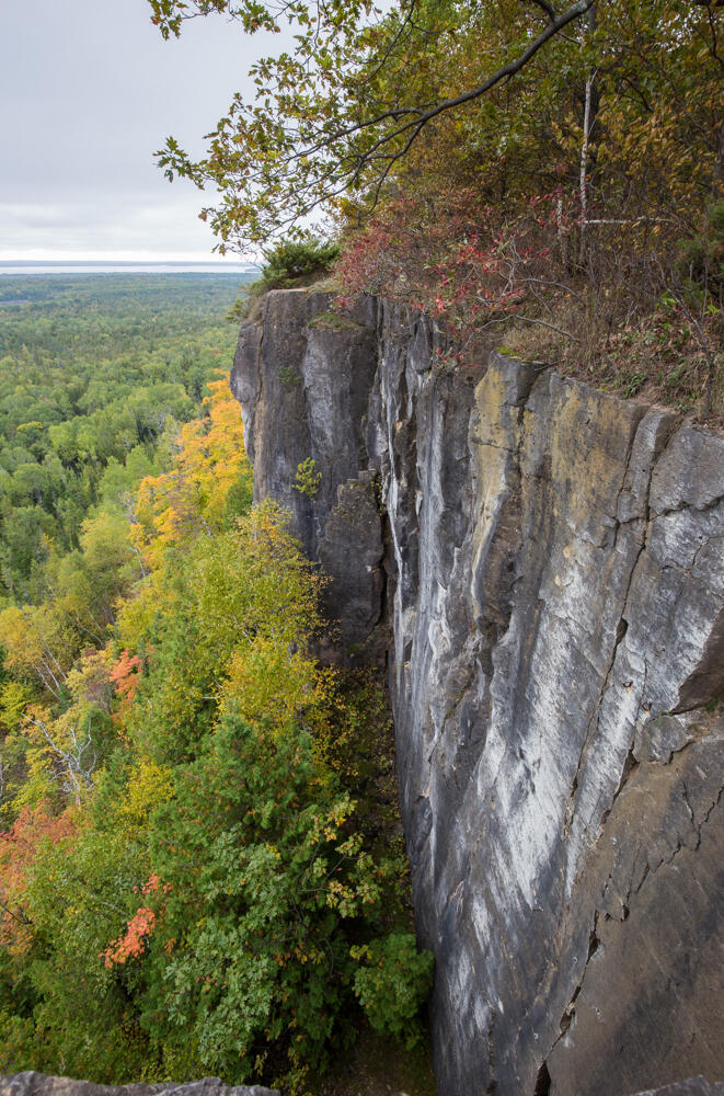
With no fences anywhere, and narrow crevices that in some places creep in close to the trail itself, this is no place for children – or adults – to be reckless. But the path itself is well-groomed, and if you continue about a half kilometre past an unofficial marker that I’ve nicknamed “Bubba Gump Stump,” even more impressive views await at the East Lookout.
Here, stepping out onto a wide ledge, the 180-degree panorama was breathtaking and I could understand then why everyone raved about this trail: there isn’t a better view to be had of Manitoulin or anywhere on Manitoulin, and I spent more than a few minutes just taking it all in. In fact, having reached my original destination, I didn’t really want the hike to end here.
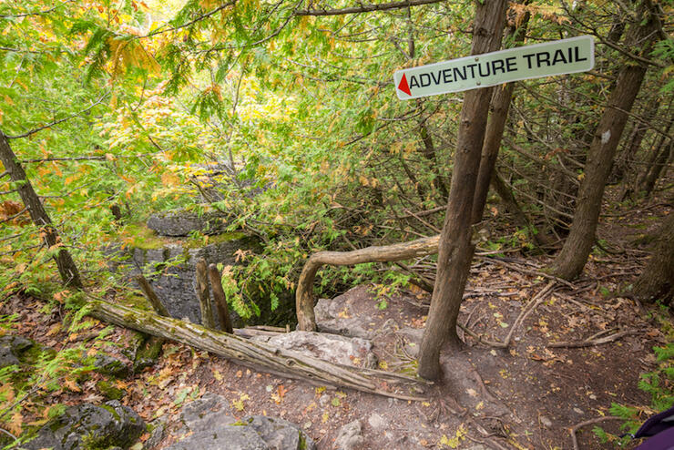
Fortunately, the Cup and Saucer Trail offers much more than just fantastic overlooks. There are 15 km of trails in total, for various levels of hikers, so having conquered the trail to the East Lookout, I decided to challenge myself with another short trail appropriately named the “Adventure Trail,” which was only a short distance from the Lookout.
Kudos to the people who named this trail, because the Adventure Trail lives up to its promise. Although a deceptively short distance on the map (.5 km), this trail takes a bit of time to hike because of its rugged nature. But it’s well worth it if you are agile and reasonably fit.
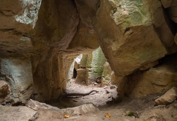
This is definitely a hike, not a walk, and it begins by descending a wooden log ladder (with the odd rung missing) and following a narrow, rocky trail at the bottom that skirts the base of a cliff face. The actual trail markers could use a refresh, because there are places where the blue trail markings are difficult to spot on the trees, and you aren’t sure exactly where to go next. But the trail literally hugs the cliff, and in some cases blue markers point you into the cliff itself. Yes, there is a point where you literally crawl through a crevice to continue on the trail! Definitely fun, definitely an adventure, but definitely requires good knees and hiking footwear.
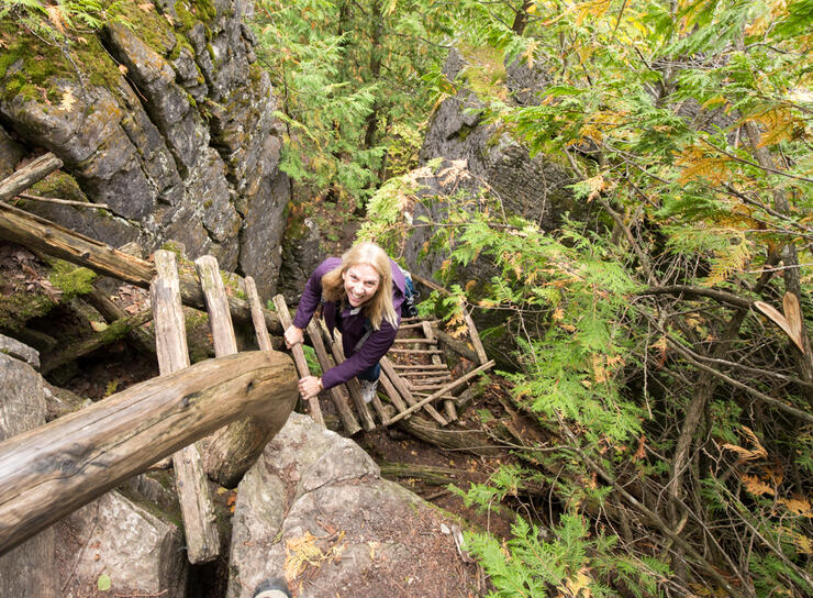
Climbing up the ladder at the far end of the trail (also missing a rung!) to join up again with the White Trail was bittersweet: knowing that the Adventure Trail was behind me felt great, but it also meant that it was time to head back and the day’s adventure would also end soon.
I realized then why people come back again and again to explore this place, and why the Cup and Saucer name now made sense, at least to me: this was no one-trick trail – not only do the trails here reward you with an incredible perch where you can drink in a spectacular view, but when it comes to the range of hiking offered here, this Cup definitely “runneth over.”
The turnoff to the Cup and Saucer Trail is marked by a sign at the junction of Hwy 540 and Bidwell Road and the parking lot is large and well-marked.
White Trail: 2 with steeper areas that qualify as a 3
Adventure Trail: 4
The trail map at the parking lot is almost 100% accurate (the “You Are Here” indicator is actually a little off!). Where the map says steep, the trails require climbing and the footing could be treacherous, especially in wet conditions.
White Trail is well-trod but has few actual markers. There are, however, signs along the way at major trail junctions.
Adventure Trail (Blue Trail) markings are fading, so when in doubt, hug the edge of the cliff and don’t go down. Note: People with short legs could find the ladders and some of the climbs over boulders challenging.
NOTE: At the very beginning of the Cup and Saucer Trail, the main trail looks like it branches off to the left with a double-track. Do NOT take this trail as it is NOT a part of this trail system. Stay to the right to follow the White Trail.
There are garbage bins, but no restroom facilities or nearby places to buy water or snacks.
The Manitoulin Hotel and Conference Centre is a new facility built in 2013. The Native influence is reflected in the hotel’s simple, natural aesthetic (local timber and stone were used in the construction) and the main stylized “teepee” reception area is impressive and welcoming. Our room was basic but comfortable, and the location was within walking distance of Little Current’s main street (convenient since the dining options at the hotel were limited and somewhat pricey).
(Evaluated by an occasional hiker, 50+, reasonably fit with no mobility issues and who is able to walk 3-5 kilometres and climb 5-10 flights of stairs with no difficulty)
LEVEL 1: Easy. Trails are easy to follow, with good footing and gradual slopes, although surface would not be suitable for strollers. (May even have handrails, stairs or other assists in certain places.) Comfortable, closed footwear recommended.
LEVEL 2: Moderate. Trails have the occasional incline, with roots and/or rocks to step over. Running shoes with good tread and support, or hiking footwear recommended.
LEVEL 3: Moderate with some challenging areas. Trails may be rocky, requiring careful footing, with some steep inclines, or the trail could involve sustained uphill hiking for longer sections. Hiking footwear recommended.
LEVEL 4: Challenging. Requires agility and a good level of cardiovascular fitness as there may be steep sections, climbing over and around large boulders, roots, etc. May involve water crossings on rocks or logs with rough or narrow surfaces where balance is required. Hiking boots/footwear required.
LEVEL 5: Expert. (Basically a sustained Level 4 throughout most of the trail, with occasional sections that are easier) Hiking boots required.