

Spring Smelt Fishing in Ontario
Smelts are running! Fishing with Carter Dorscht.
By Carter Dorscht


The Sault Ste. Marie Region Conservation Authority owns 1865 hectares (4600 acres) of diverse ecosystems including forest, wetlands and shorelines. All are yours to explore and enjoy. Conservation areas offer a wide range of natural experiences. If you're looking for a place where you can appreciate nature, get some exercise and learn about our environment, there is an adventure waiting for you at a nearby conservation area!
Here are 5 locations that will take you to the best places to commune with nature right within the city of Sault Ste. Marie.
The Fort Creek Conservation Area
The Fort Creek Conservation Area is owned by the Sault Ste. Marie Region Conservation Authority and was purchased to address flood control concerns experienced by businesses and residents living downstream. The Fort Creek Dam was constructed between 1968 and 1971 and has a reservoir of approximately 3.24 hectares (8 acres).
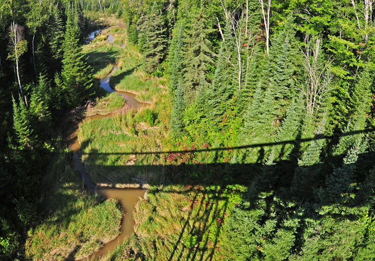
Photo Credit: John Odonnell and Paula Trus | www.thenorthviewtv.com - www.northviewfineart.com - www.lakesuperiorpark.com
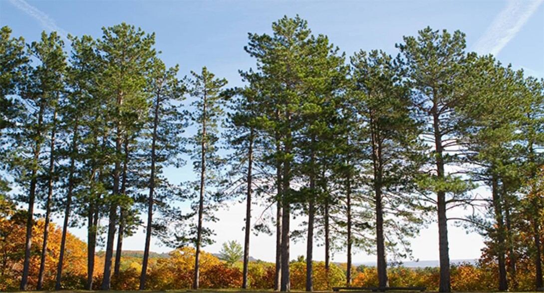
In addition to its primary purpose of flood control the Fort Creek Conservation Area also provides the ancillary benefit of green space, recreational opportunities and wildlife habitat. In the summer the hikers can enjoy the diversity of scenery and trail difficulty level or have lunch under the sheltered picnic area. Offering a delightful diversion in the winter visitors can go snow shoeing, tobogganing or cross country skiing. This conservation area covers approximately 77 hectares (191 acres) and is situated off Second Line, east of Peoples Road creating a sense of tranquility in the heart of the city and is a small example of the beautiful Great Lakes-St. Lawrence Forest and wetlands.
Fort Creek Trail Map
Fort Creek Brochure (4.5MB) pdf
Interesting Fact About The Area
Hub Trail
The Hub Trail is a 24 km multi-use non-motorized trail system for various types of users, such as cycling, walking, in-line skating, cross country skiing and is wheel chair accessible. The trail connects many significant points of interest including the waterfront walkway, Bellevue Park, Algoma University College, Sault College, the new hospital and Fort Creek Conservation Area.
Photo Credit: John Odonnell and Paula Trus | www.thenorthviewtv.com - www.northviewfineart.com - www.lakesuperiorpark.com
Prior to the construction of the HUB trail, the Sault Naturalists of Ontario and Michigan conducted a Biological Inventory in the Fort Creek Conservation Area in order to identify any Species At Risk. As a result of this investigation a report was prepared by Don Hall and Marjorie Hall and later submitted to the SSMRCA titled Fort Creek Hub Trail – Biological Inventory.
For more information on the Hub Trail please visit the Sault Tourism website.
The Watershed
The Sault Ste. Marie Region Conservation Authority (SSMRCA), completed the Fort Creek dam and reservoir in 1970 to prevent frequent flooding of the city's west end. The SSMRCA also purchased land around the reservoir to control development and protect forest and vegetation in the area. Forests are a natural flood control measure slowing the melting of snow in the spring, allowing water to penetrate the soil and to recharge groundwater.
Wildlife
Along the hiking trails, you may spot beavers, skunks, hares, and various mice and moles. You may also notice tracks from the more shy mink or fox. Birds include the ruffed grouse, woodpeckers, ducks, great blue herons and ravens. Native songbirds to the area are the yellow-shafted flicker, red-winged blackbird, black-capped chickadee and the American robin. By the reservoir you may see cormorants and raccoons. Water inhabitants are minnows, catfish (not native), painted and snapping turtles, insects and leopard frogs.
Vegetation
Reforestation has been undertaken in the Fort Creek Conservation Area, which lost many trees to logging and natural impacts such as fire, wind, disease and beavers. Local Boy Scout groups and school children have in the past planted trees in the Spring. Usually pine, cedar and spruce have been planted, although trees native to the area also include balsam fir, poplar, aspen, white birch, yellow birch, red maple and sugar maple. Some of the plants that can be found in the area are fireweed, twin flower, wild lily of the valley, common buttercup, starflower, white sweet clover and American vetch.
An Outdoor Classroom
The SSMRCA encourages schools and other groups to make use of the Conservation Area to teach children about nature. Besides the reservoir, there are two ponds in the early stages of growth. Children can see how pond life develops and how the surrounding vegetation turns bare ground, overtime, into mature forest.
Gros Cap Conservation Area
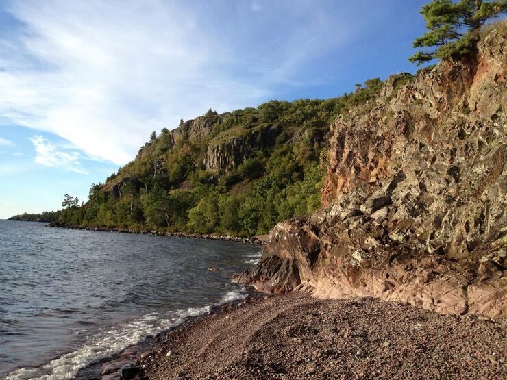
Cobbles beaches, rock faces and bluffs highlight the rugged, natural characteristics of Gros Cap. Steep cliffs rise from the water to a height of 60 to 90 metres (200 to 300 feet) overlooking Lake Superior and the shipping lanes. Take Highway 550 to its end and enjoy the lakeside vistas. The North Gros Cap Road provides access by car to the north of the site in the summer months.
The geology of Gros Cap is unusual because the property is situated on a batholith, a large deep-seated body of intrusive igneous rock consisting of coarse-grained granite rock. This was created when the magma (hot liquid rock) miles below forced its way upward.
Gros Cap exhibits a wide variety of vegetation types including mixed forest, cedar swamp, hardwood stand and significantly rare wildflowers. This diversity in habitat has created plentiful wildlife. Mammals that can be seen daily include squirrels, hares, chipmunks and various species of birds.
The 40 kilometer (25 mile) Saulteaux section of the Voyageur Trail starts in the Gros Cap Conservation Area and runs through to the Hiawatha Highlands
Conservation Area.
Hiawatha Highlands Conservation Area
Something for Everyone!
Sault Ste Marie is fortunate to have the natural splendor of Hiawatha Highlands Conservation Area, located between Fifth and Sixth Line, east of Great Northern Road (Hwy.17 N). The Highlands offer magnificent scenery including breathtaking waterfalls and 35 kilometres (22 miles) of nature trails. Hundreds of hectares of forests with creeks, lakes and wetlands create the ideal habitat for more than 70 species of birds and 18 species of mammals.
In the winter many kilometers of groomed cross-country ski trails wind their way through the Conservation Area, Kinsmen Park, the City's Wishart Park and Crown property surrounding the provincial fish hatchery appealing to both novice and expert skiers. While skiers pay to use these trails in the winter and early spring, there is no charge to hikers the rest of the year.
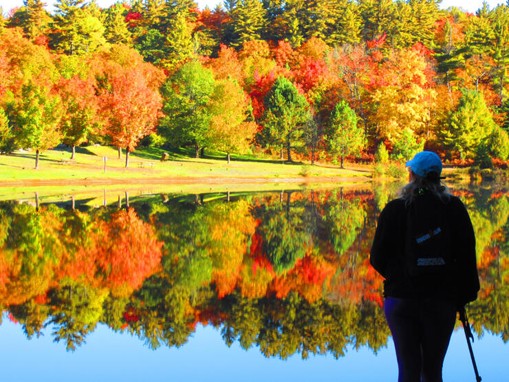
Photo Credit: John Odonnell | www.thenorthviewtv.com - www.northviewfineart.com - www.lakesuperiorpark.com
Within the Highlands is Kinsmen Park 97 hectares (240 acres) of land maintained by the Kinsmen Club. The park includes one of the most spectacular views of the Crystal Falls from the Crystal Creek Trail. For visitor safety and to prevent further exposed tree root damage, a wheelchair accessible boardwalk was constructed beside the trail. Although each trail within the park highlights unique terrain the park also includes a baseball diamond, children's playground, picnic area, and swimming area.
Photo Credit: John Odonnell | www.thenorthviewtv.com - www.northviewfineart.com - www.lakesuperiorpark.com
Download or Print the Hiawatha Highlands Brochure
Photo Credit: Donna Hopper | www.slackhopper.com
Other Area Attractions
Mockingbird Hill Farm - Vistors to the area can tep back in time and explore a pioneer farm. More information is available online at www.mockingbirdhillfarm.ca.
Crystal Creek Mountain Bike Trail - This is a single track mountain bike trail for intermediate to advance riders. Approximate riding time 45 minutes to 1 1/2 hours.
Tarentorous Fish Culture Station - open 9 am to 5 pm daily, allows visitors to see various trout species being reared for the Ministry of Natural Resource's fish release program. You are encouraged to call ahead to confirm the facility will be open on the day you intend to visit (705) 949-7271.
Mark's Bay Conservation Area
The Marks Bay property is a 103 hectare (254 acre) site including 3000 metres (10,000 feet) of shoreline on the St. Marys River. Take Airport Road (Hwy. 565) and turn left to the boat launch and beach. The sandy shoreline is perfect for swimming and sunning, boating or fishing. The forest creates picturesque surroundings for hiking, nature viewing or simply relaxing.
Photo Credit: www.ssmrca.ca
The forest is part of the Great Lakes-St. Lawrence forest region and is home to many different birds and small mammals. There is a red pine forest that is as striking as it is peaceful. Cedars scattered throughout the property provide the ideal habitat for deer as well as various species of rare plants of Algoma.
Although there are no formal trails, old logging roads and deer corridors run from one end of the property to the other.
Shore Ridges Conservation Area
The Shore Ridges Conservation Area is 443 hectares (1100acres) of land including 366 metres (1200feet) of shoreline. Found within the city limits at the junction of Sunnyside Beach Road and Shatruck Drive, the area is easily accessible to residents and visitors alike. The Conservation Area has two trails for year round use by hikers or cross-country skiers. The upper Indian Ridge Trail offers a view from the escarpment and winds its way through hardwood forest. The lower Beaver trail is on a beach terrace surrounded by marsh. There are also lesser used trails such as the Deer and Grouse Trails.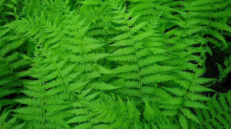
Photo Credit: John Odonnell and Paula Trus | www.thenorthviewtv.com - www.northviewfineart.com - www.lakesuperiorpark.com
View the Shore Ridges Brochure
Indian Ridge Trail
The trail follows a portion of the route once used by the Ojibwa Indians as they traveled along the ridge from their camp at Gros Cap to the Hudson's Bay Post in Sault Ste. Marie for trading.
The St. Marys River was an ideal trade route and gateway to the northern waterways. The Ojibwa and Iroquois Indians fought battles over its use. In 1663 about 2,000 Ojibwa warriors launched a surprise attack on the encamped Iroquois, near the present day Michigan Iroquios Point, at the mouth of the St. Marys River. The Iroquois were defeated, reducing their power and allowing the Ojibwa to remain. Today, archeologists are finding arrowheads and other artifacts used in such battles.
Geology
The Indian Ridge Trail follows the escarpment, giving visitors a striking view of Lake Superior and the surrounding forest. Below the ridge, you may want to investigate the freshwater spring, clay beds, natural erosion and fine sand deposits.
Vegetation
Along the trail you will notice a multitude of wildflowers, ferns, plants and trees. When you look at the forest, you will notice the line of birch trees at the bottom of the ridge that divide the hardwood from the softwood. Red oak, red maple and large tooth aspen cover the area at the top of the ridge. Striped maple, a unique tree identified by it slender green trunk marked with vertical white stripes, can be seen along the trail. Cedar and pine appear closer to the St. Marys River.
Wildlife
As you progress along the trail, you'll hear the chatter of squirrels and chipmunks in the forest. Other common animals are deer, skunks and hares which inhabit the thick undergrowth. Although less likely to be seen fox and Canadian lynx are predators native to this area.
Beaver Trail
The Beaver Trail is located on one of the beach terraces formed thousands of years ago when the water receded from glacial Lake Nippissing. The terraces were created by erosion as the water moved progressively closer to the present day shoreline of the St. Marys River. As you move from the upper ridge to the Beaver Trail, you will be walking along a sandy path in the midst of swamp and forest. These provide natural walkways for wildlife and were once used by loggers.
Vegetation
Due to the varied environment, the area around the Beaver Trail contains a wide variety of plant life. The land north of the trail is swampy, providing rich, wet soil ideal for speckled alder. This tree can be identified by its white speckled bark and toothed leaves. On the other side of the trail, the land is much drier. Red maple, trembling aspen, sumac, willow and white birch grow here. You will also notice bracken fern, red and yellow hawkweed, the blue flag iris and the ox eye daisy along the trail. The trillium Ontario's floral emblem flourishes throughout this area. The three-leafed, white flowered plant blooms in the spring. During the summer months, hikers may also find strawberries, blackberries and raspberries. Look for tamarack trees along the trail as well, it is the only conifer to shed its needles in the fall.
Wildlife
The plant life in this area attracts a number of mammals. Deer and moose visit the open areas to feed on vegetation in the swamps. Black bears have also been seen on occasion, feeding on summer berries. Birdwatchers who visit the trail will enjoy the varied species. You may catch sight of the broad winged hawk, sandhill crane and the great blue heron. More common are the cedar waxing, white throated sparrow, downy woodpecker and the red eyed vireo.
Visit www.ssmrca.ca to learn more about the Sault Ste. Marie Conservation Authority.


