
Uncovering Thunder Bay's Hidden Gems
7 Little-Known Spots to Discover in TBay
By Bonnie Schiedel


Number of kilometres traveled: 1300
Number of highways travelled on: 7
Number of Ontario Parks stopped in or driven past/through: 7*
Number of times I seriously believed I was going to run out of gas: 2
Number of times I actually ran out of gas: 0
Number of mosquito bites: 40**
I decided awhile back that this summer would be the summer of exploration through Northwest Ontario – via the open road. With a region this large it is impossible to cover it all in a single weekend so for the first leg of this regional discovery project, I would head west, from Thunder Bay to the Manitoba border and back.
Sitting down with a Google map, I planned out my route – what I began to refer to as the ‘11/17 loop’, referring to the two main highways connecting Northwest Ontario. 11/17 didn’t really describe it well however, because this trip was not about sticking to the main highways; it was about trying to cover as much ground as possible, in an extremely vast region, in a relatively short period of time.
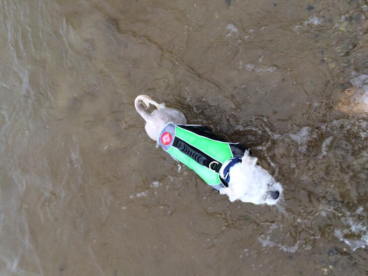
On a less than sunny Friday morning, I grabbed my dog (Jackie Chan) and some camping gear and left my house on the north side of Thunder Bay, heading out Highway 102. Turning off 102 onto Highway 17, we crossed into the Central Time Zone travelling toward Ignace before turning onto Highway 599 North to Pickle Lake.
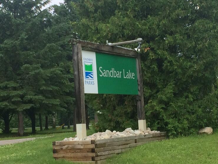
It was pouring as we approached our first intended rest stop at Sandbar Lake Provincial Park. As my passenger was fast asleep beside me I elected to just keep driving...

...except for a quick cell phone snap of the sign.
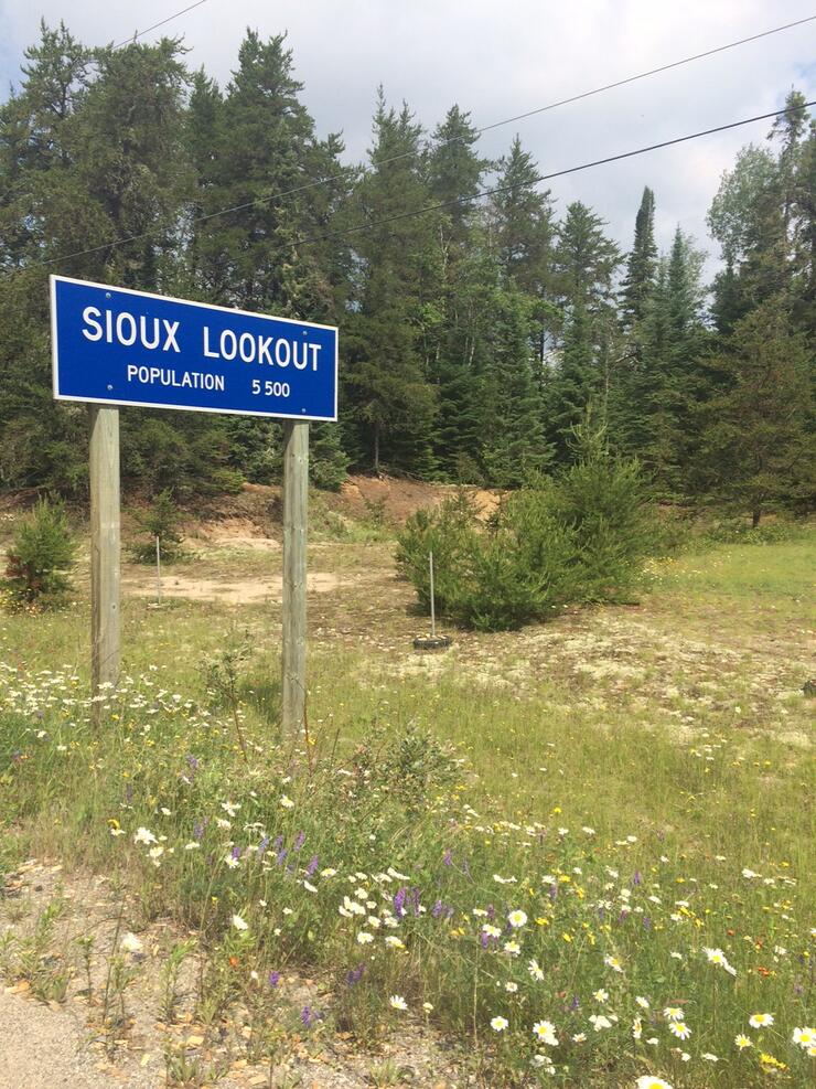
At Silver Dollar, the skies cleared as we turned onto the loneliest road of the route – Highway 642 to Sioux Lookout.
While I didn’t see a single other car on the 75km road, there was a deer sighting. Only the second of the trip to this point.
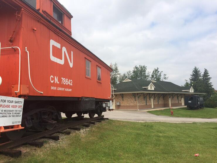
As I came in on a secondary highway I had to drive through Sioux Lookout, a town with a deep railway history, to get back onto the main highway.
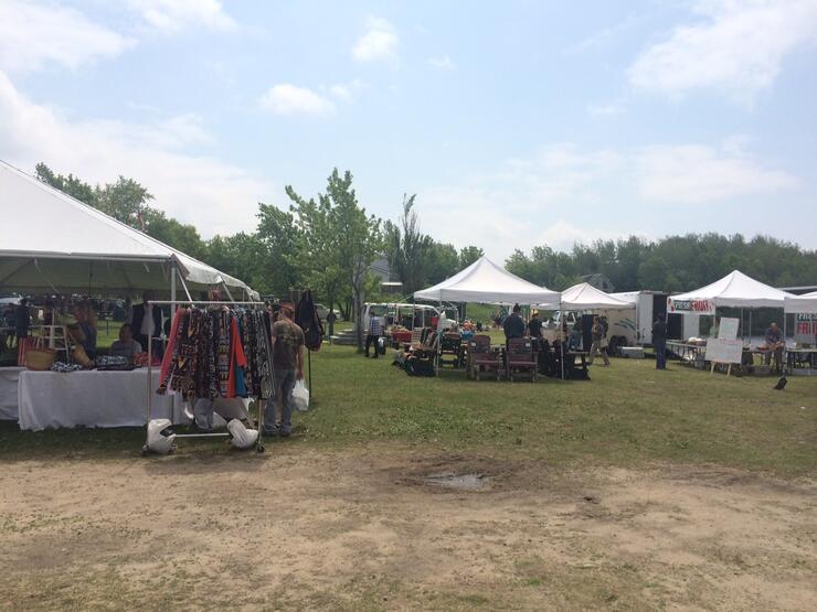
Fate – because as I passed through downtown I spotted a Farmer’s Market on the lake shore. There were 15-20 booths selling everything from fruits and vegetables, to elk meat, to honey and jams to clothing and more.
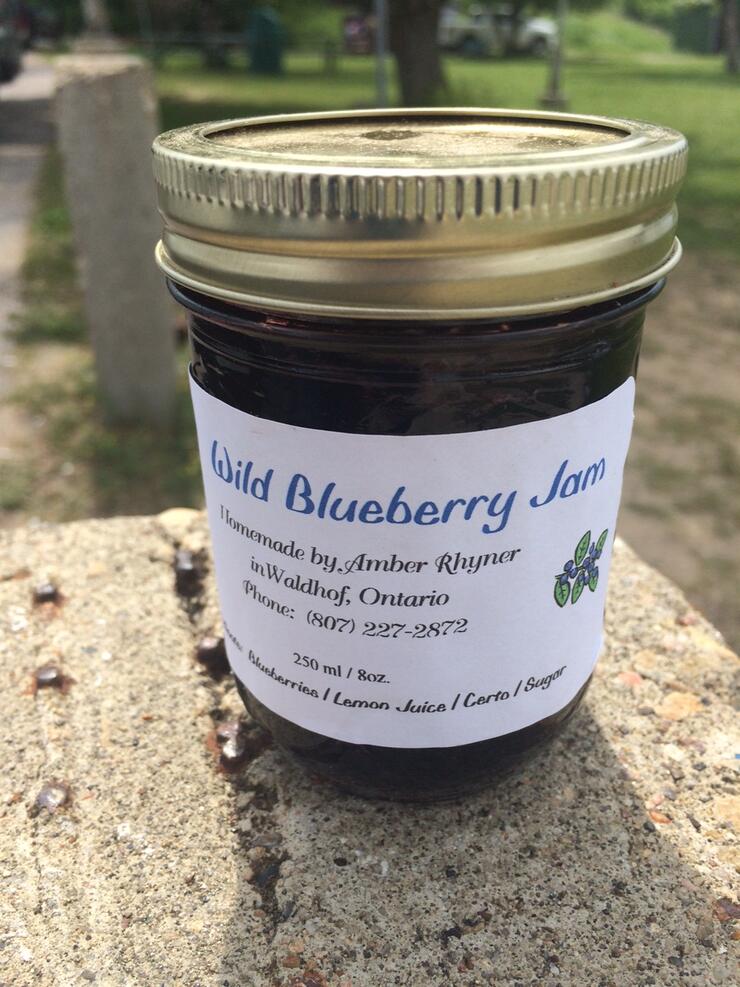
I stopped at the jam booth and purchased a jar of Wild Blueberry Jam - Sioux Lookout is wild blueberry country and even has an annual Blueberry Festival, so it seemed like the most fitting flavour to buy, and my taste buds agree.
Now heading south on Highway 72, I’m about 40km into a 100km stretch when I realize that I was so distracted by finding spreadable berry preserves that I had forgotten to get gas. The orange warning light comes on and I begin to mentally prepare myself for the inevitable situation of walking down the highway in search of fuel, accompanied by a lazy dog in a polo shirt.
The road trip gods smiled upon me and I made it without incident to a gas station in Dryden. A town of 8000, Dryden is according to the sign on the edge of town, the home of NHL Hall-of-Famer Chris Pronger. It also has all of the modern conveniences you might need on a road trip. For the first night of the trip the plan was to camp, so while in Dryden, I stopped at a supermarket and picked up some sausages and other items for dinner and got some cash from the ATM for firewood in the park.
Back on Highway 17, the 45km drive to Vermillion Bay is what this drive should’ve been all along – sunny, hot and a perfect Northwest Ontario experience.
Just a few kilometres further up the road we arrive at the day’s destination, the beautiful Blue Lake Provincial Park. I have been here before and as I arrive the scenery is just as incredible as I had remembered.
We check in, buy some firewood and wait for my friend Jeff who is driving from Winnipeg to meet us for the night. Once Jeff arrives, the three of us set up our campsite.
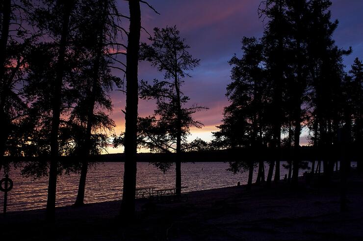
There is something so authentically Northwest Ontario about cooking on a campfire while watching the sunset beyond the water.
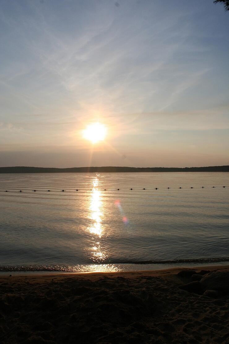
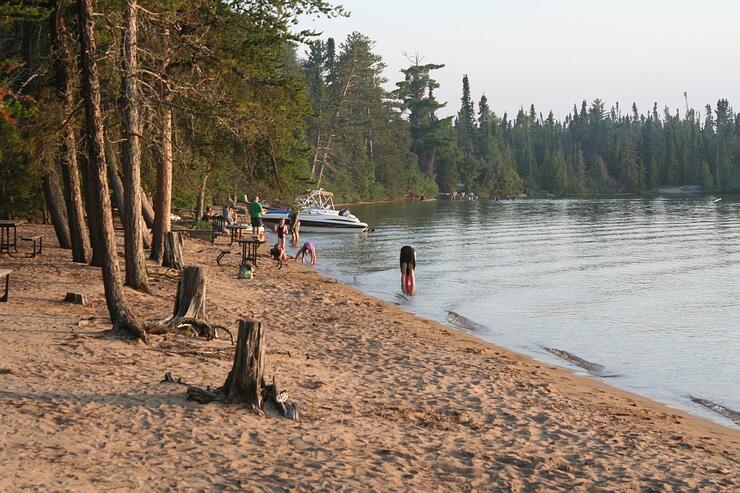
Once we all wake up we get our swimming gear on and head for the water. Blue Lake has a gorgeous sand beach and crystal clear water that make for an ideal place to spend a hot summer day.
After a morning filled with relaxing in the water we head back to camp to pack up. As soon as the cars are loaded we hit the road again, today heading to beautiful Kenora, ON on the shores of Lake of the Woods.
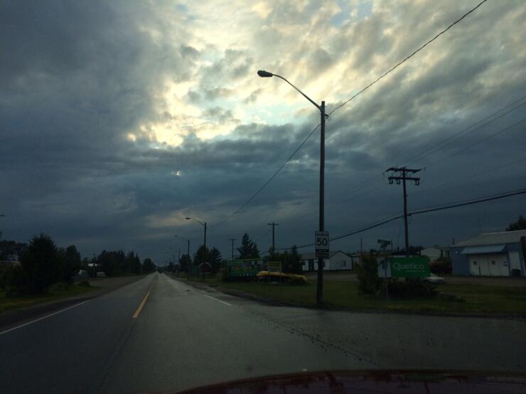
It’s a relatively short drive from Blue Lake to Kenora and there was a street festival happening when we arrived. The streets were filled with people, musicians, artists and various vendor booths. An exciting way to start a day. Jeff and I met up with an old friend and had a chance to catch up. As we walked around the very scenic waterfront, without much warning the sun gave way to black clouds. We got back into the cars and heading a little further west towards the Manitoba border. We are spending the night at another friend’s cabin and want to arrive there before this storm gets too crazy. Thankfully we get there about 30 minutes before the skies completely open up. The intense storm is the soundtrack (and the light show) for the rest of our evening.
In the morning, it’s still grey but it’s not raining, so I elect to head out right away. Back through Kenora, we turn on Highway 71 towards Sioux Narrows. I have every intention to stop along the way to photograph beautiful Northwest Ontario, but it pours rain for most of the day.
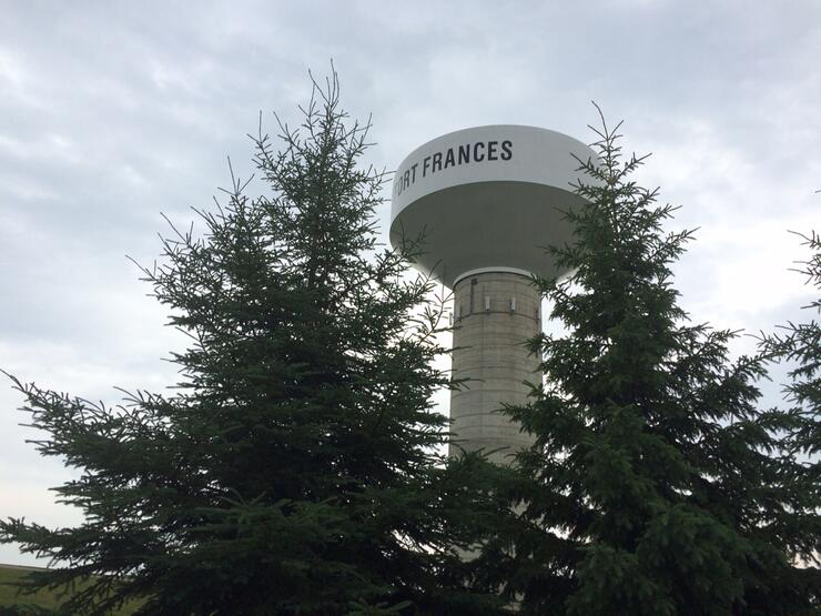
We turn onto Highway 11 and travel to Fort Frances.
It’s still raining and has been the entire time. It starts to clear up just as we are about to leave the eastern city limit. Just as the hot sun peeks through the clouds, to our right is a park with a public beach. It’s a miracle!
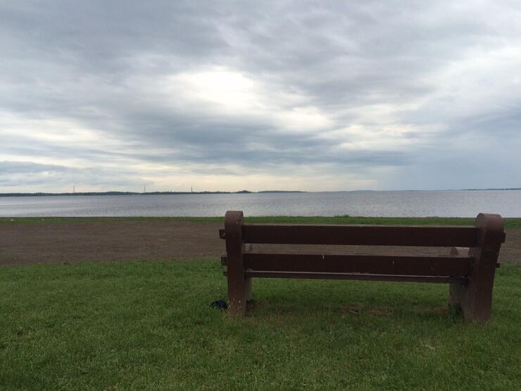
We pull in, suit up and are in the water in 2 minutes. After about 30 minutes of splashing and relaxing the clouds roll back in and it’s clear we only have a few minutes of sun left. Change into dry clothes and hit the road again.
Just outside of Fort Frances it starts to rain again. This continues until Atikokan.
I consider stopping in Atikokan for the night, as it is getting dark and late in the evening, but it’s only 200 or so kilometres more until Thunder Bay and the rain has slowed significantly so I decide to keep driving. About 20km east of Atikokan the storm becomes something beyond any of my previous experience. For the next 200km I never once got the car above 50km/h, the rain was coming down so hard it was impossible to see more than a few feet in front of the car. The winds were so strong; there were times when it felt as if it would blow the car over. There were also 3 moose, all on the roadway and another 3 transport trucks whose drivers had chosen to pull over on the side of the road instead on continuing to press on. This was by far the most intense part of the drive.
It stopped raining about 20km west of Thunder Bay and we cruised without incident to my house on the north side of the city where this journey had begun just a few days before. And just like that it was over.
Despite the fact that the abundance of rain hindered my plans to build an extensive photo library from the region, it was still a fantastic weekend excursion. One I will certainly do again, after looking for a favourable weather forecast of course, and one that I recommend anyone in the area try.
*Ontario Parks en route:
Kakabeka Falls Provincial Park
Sandbar Lake Provincial Park
Ojibway Provincial Park
Blue Lake Provincial Park
Rushing River Provincial Park
Sioux Narrows Provincial Park
Quetico Provincial Park
**40 mosquito bites is a conservative estimate