
Crown Land Camping
What it is and where you can camp in Ontario.
By Trish Manning


We all recognize the well-known black and white photograph featured in the introduction of Pierre Berton’s The Last Spike. All those men with the long beards, moustaches, and tall hats, including some of the major figures of Canadian history; Donald Smith, William Van Horne, and Sir Sandford Fleming. The photo captured the ceremonial driving of the Canadian Pacific Railway (CPR)'s last spike into the rail bed in the Craigellachie Mountains within British Columbia’s interior. This signified the finishing of the colossal tunnelling effort through the western mountains in the late 1800s.
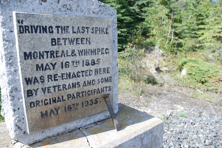
But there were other “last” spikes driven and significant tunnels dug, including some on the shores of Lake Superior. There are three tunnels to visit along Lake Superior; the best, the Jackfish tunnel, has a bonus with a commemorative cairn for the “last” spike driven on May 16, 1885 for the completion of the Montreal-to-Winnipeg track.
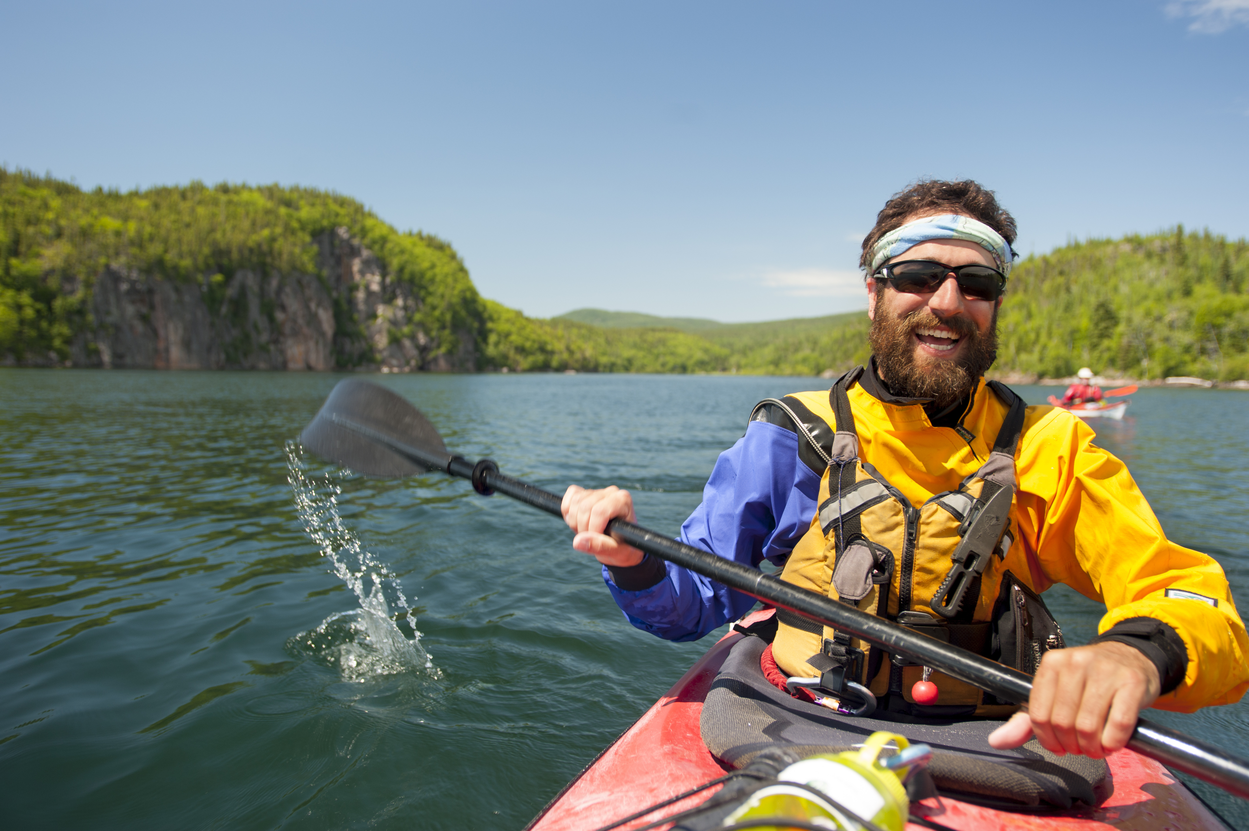
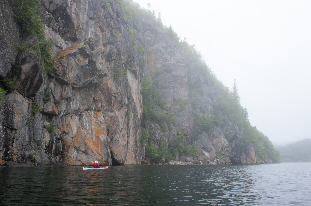
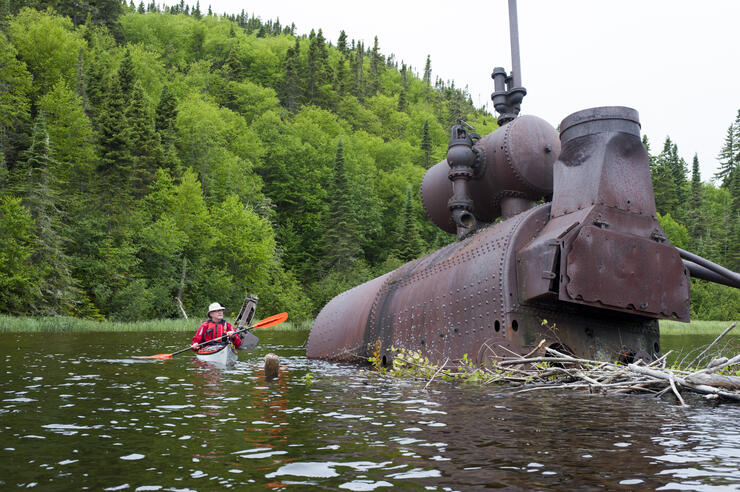
You can see this and other remants of the past while paddling along the Lake Superior shoreline.
A Superior Adventure
Building the CPR was more about achieving nationhood for Canada in the 1880s—coast to coast—than it was about building a railway as an elegant and showy operation. A lot of money and a lot of rock were eaten to build an all-Canadian route, rather than building through easier terrain in the United States as original CPR railway syndicate members would have preferred.
The Lake Superior section became costly and problematic, and construction was generally “slow” to complete. The cost of dynamiting and moving rock was appalling.
Jackfish, now a real ghost town, became the focal point for construction of the Lake Superior section of the CPR, even before the rails arrived. Beginning in the early 1880s, ships brought rail supplies (i.e. spikes, timbers, rails, switches, ties, explosives, etc.) into Jackfish. The village thrived as a stopover town until the late 1940s. By the early 1950s, there was no need for the new diesel-powered trains to stop for coal and soon after, even the passenger stops ended. By 1964, all permanent residents had left. Now, the village is overgrown with just remnants its history remaining.
At the Jackfish railway tunnel, you can see and appreciate how much of the line was chiselled into the rocky shore—using the technology of the 1880s.
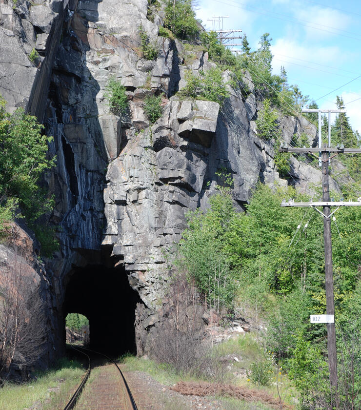
Lake Superior is always close at hand. Imagine what the terrain here was like before the railway came and how much rock had to be moved by horse and manual labour in the course of drilling and blasting the tunnel. Then the rock and fill had to be moved in to provide a roadbed suitable for laying track.
Think of the work involved in building a railway line in the 1880s. Between Marathon and Terrace Bay, you see how most of the hills are granite, with just enough soil to support trees. When you consider that railways usually rise a maximum of 2.2 units vertically for each 100 units travelled horizontally, the answer for early civil engineers was the proposed railway line had to “hug” the shoreline. The grade over distance had to be gradual.
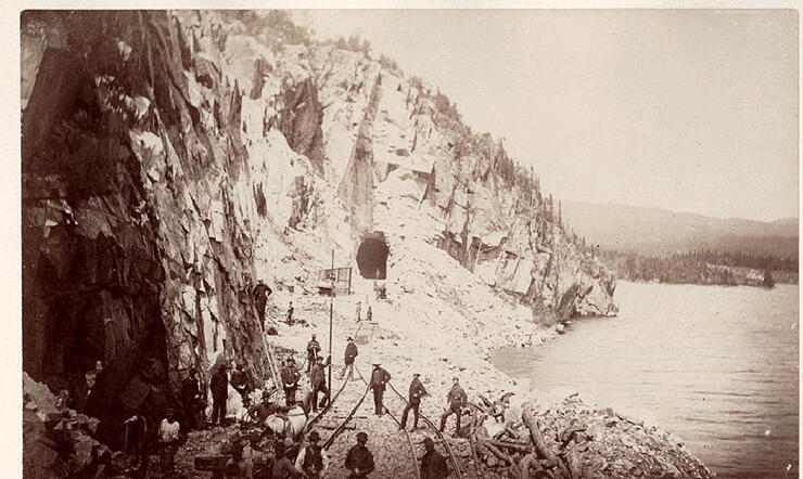
Instead of an impossible 1-km bridge, the train travels 5 km (three miles), close to lake level, around Jackfish Bay. As you watch a train go by, it is a very impressive experience because the train is dwarfed by its environment. The entire view probably won’t fit into your camera’s viewfinder. As you walk this section (stay off the tracks), the archives tell us this was one of the most expensive and difficult sections of railway construction. You can georeference this historic photo of the Jackfish Bay tunnel with your own candid shot at WGS 84 - UTM 16 U 502767 5406904 or N 48° 48.907’ W 86° 57.739’.
In summer of 1884 there were 15,000 men and 4,000 horses working on the North Shore of Lake Superior. Records indicate the workers consumed 12 tons of food per day and four tons of tobacco each month. It is amazing to consider that not one locomotive train, steam shovel or power drill was utilized on this rugged landscape. It was indeed labourious. The area near Jackfish, including three railway tunnels, cost $1,200,000 in capital dollars of the day.
As a bonus you will want to walk a short distance westwards to Noslo, a little less than 1 km, from the Jackfish Bay tunnel to one of those historic events we take for granted. (Noslo is Olson, a railway manager, spelled backwards. Many of the sidings and whistle stops are names spelled backwards; one near North Bay is Yellek, for one of the foremen named Kelley). For the railway construction crews of the day, it was a milestone, an accomplishment. This section of the Montreal-to-Winnipeg line was driven at mile 102.7 in May of 1885. You will want to read the inscription on the plaque. It is the “last spike” in completing this eastern section of railway construction. You will be near N48° 48.517’ W86 ° 58.488’ or WGS 84 16 U 501851 5406182.
Present was Colonel Oswald of the Montreal Light Infantry, along with his troops on the first train eastwards. They were returning home from the Riel Rebellion in Saskatchewan. It was one of the major factors in completing this difficult stretch of railway construction. These tunnels are more than just symbolic they link our historic events.
Access Heritage
Here is your chance to experience some early Canadian heritage part of bringing Canada together as a nation. For the Jackfish tunnel, you will travel west of Marathon or east of Terrace Bay.
If you have a kayak or canoe you could come ashore here and move towards the Jackfish Bay railway bridge which is in sight of Highway 17. Moving northwest, this would be a walk of less than 1 km; accessing Lake Superior from Marathon or Terrace Bay. The short cut is to put in at the picnic area at the base of the east-west hills on Jackfish Lake. It is at the east end of this stretch of highway; look for unmarked road at WGS 84 - 16 U 504220 5407585 or N48° 49.274’ W86° 56.551’.
HOW TO EXPLORE THIS AREA
For guided trips and equipment, check in with Naturally Superior Adventures (Wawa) and Superior Outfitters (Rossport). Another put-in is nearby Neys Provincial Park, between Marathon and Terrace Bay.