
Ontario’s Moose Hotspots
Your best chance of seeing a moose is by paddle.
By Marshall Veroni


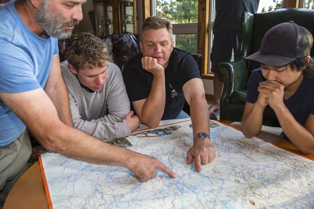

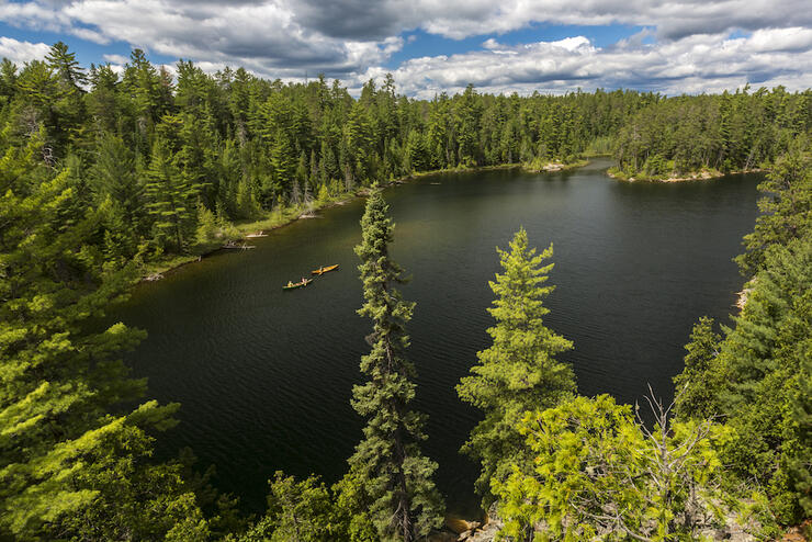
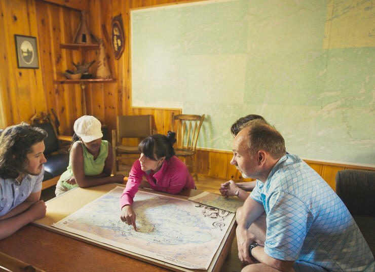
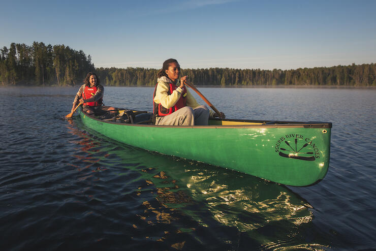
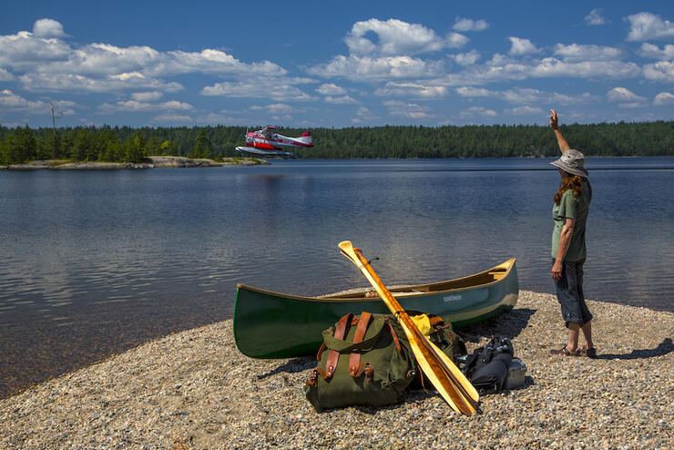
Going on a backcountry canoe trip to one of Ontario’s wilderness areas takes a lot of planning but it’s worth the effort. The first step is deciding on a general destination. Next you’ll gather information and maps in order to pick a route that fits your goals, timeframe and skill level.
There are many canoeing guidebooks, websites, blogs and discussion forums that can provide you with information about canoe routes, history, wildlife, Park regulations and more. Local outfitters and Park staff are also an invaluable source of knowledge. Getting one or more of the best canoe maps Ontario has to offer is essential for both planning and tripping. Read on to find the right one for your next adventure.
A canoe map used for planning is very different from a canoe route map that will be used while actually on a canoe trip.
When planning a canoe trip, you are deciding where to go (location, level of remoteness, etc.), what length of route to take, type of water travel (e.g. river, lake, whitewater), how many, how long and how difficult portages are suitable, what campsites to stay at, what highlights you want to see (e.g. waterfalls, wildlife, pictographs, etc.) and what other activities you want to do (e.g. fishing, hiking, photography, etc.). These maps provide high level detail and give you an overall picture of the region. They can be digital or paper.
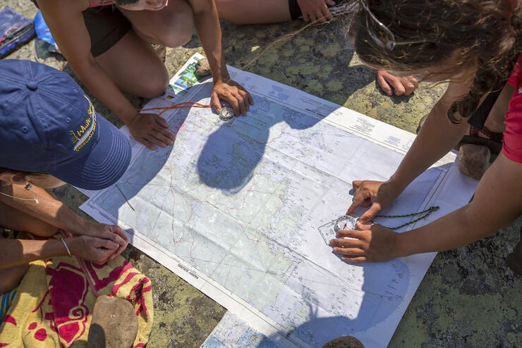
When you are on a trip, you need a canoe route map that provides accurate, detailed information that will help you determine where you are and where you are travelling to. You need to know exactly where portages and campsites are located plus topographic information about the area you are travelling in. Highlights and activity information is also very useful. Good quality waterproof canoe tripping maps are critical for backcountry paddling trips.
There are many places to find canoe maps in Ontario. You can download digital maps, purchase guidebooks, hard copy adventure maps and topographic (topo) maps online or at your favourite adventure store, bookstore, local outfitters or at Ontario Parks stores.
Canoeing guidebooks provide interesting, detailed information and canoe route maps that, while great for planning, should not be the only reference used while tripping. It is highly recommended that a hard-copy canoe route or topo map be used for navigation.
Many guidebooks feature a variety of routes and outline a timeframe, portages, distance, highlights, best campsite, fees, outfitters, topo maps, GPS coordinates and more. They are a great starting point for choosing a route. Some guidebooks feature just one paddling area and have very detailed information. Many Ontario Parks and Conservation Areas also produce printed guide pamphlets or canoe route maps.
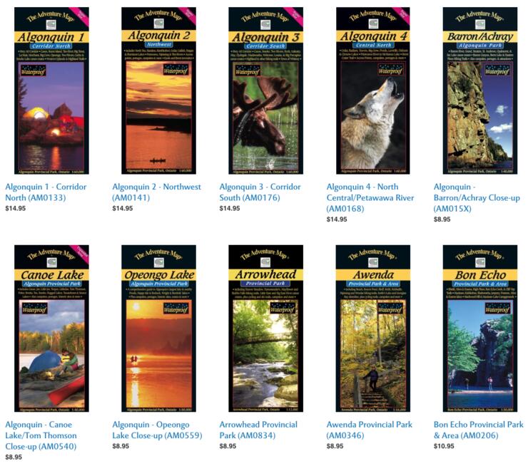
Look for books by renowned adventurers: Kevin Callan, Hap Wilson and Gary and Joanie McGuffin. Here is a small sample of excellent general canoeing guidebooks for Ontario.
There are many types of digital canoe route maps available online. These maps vary from general canoe route information to detailed topographic maps to maps created especially for canoe tripping. Although these are great for planning, a hard-copy map is recommended for canoe tripping. Some key sources for digital maps include:
Hard-copy canoe route maps are excellent for planning as well as canoe tripping. They have accurate detailed information about the landscape, canoe routes, campsites, highlights, etc. The maps come in a paper version or in a waterproof material. It is recommended that paper versions be laminated prior to going on a canoe trip or put in a waterproof holder.
The best sources for hard-copy canoe maps Ontario has to offer are listed below. They are recommended and trusted by the paddling community.
Chrismar – The Adventure Map® is Canada's finest series of original topographic recreation maps featuring National Parks, Provincial Parks and other popular destinations. These extraordinary guides are specifically designed for outdoor adventurers such as paddlers, hikers and backpackers who need an accurate, up-to-date, rugged map to get them into and safely back from Canada's finest wilderness recreation areas. They have the best selection of maps for Ontario canoe routes.
Unlostify Maps – These specially designed maps of Kawartha Highlands, Killarney, Massasauga, West French River, Algonquin (soon) provide both a planning map and a canoe tripping map. They feature accurate canoe route, campsite, portage and trail information plus water, nature and historical highlights as well as other activities. They are waterproof and tear-resistant.
Ontario Parks – Many of Ontario Parks or local “Friends of” organizations produce maps and small guidebooks for canoe routes located in the Park. These maps and other canoe route maps can be purchased through the Ontario Parks online store or in local Ontario Park stores.
A topographical (topo) map is a detailed, accurate graphic representation of natural and human-made features that appear on the Earth’s surface including contour lines, water bodies, roads, trees, etc. plus latitude and longitude and UTM coordinates. They can be used with a compass or a GPS unit and are invaluable for navigation. Produced by Natural Resources Canada (NRCan), topo maps are available in two standard scales: 1:50,000 and 1:250:000. Each map has a unique number. Learn more about topo maps.
Most paddling guidebooks provide a reference to the topo maps that you will need for featured canoe routes. You can purchase paper or laminated topo maps online or at a variety of retailers across Ontario as well as at many Ontario Parks stores and local outfitters. You can make a topo map of any area of Ontario that interests you through the Ministry of Natural Resources and Forestry. Here are some online sites where you can purchase topo maps.
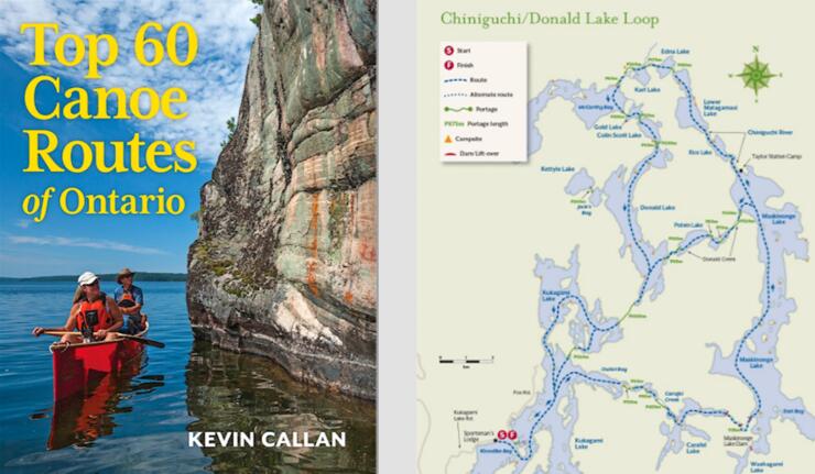
Many of the paddling guidebooks by Kevin Callan (e.g. Top 60 Canoe Routes of Ontario; A Paddler’s Guide to Ontario, A Paddler’s Guide to the Rivers of Ontario and Quebec) provide a great introduction and planning maps for the below canoe routes. Find interesting and informative blogs about various canoe routes at Ontario: Where the World Comes to Paddle.
The Friends of Algonquin offers a digital version of the official Algonquin Canoe Route Planning Map on their website. It can also be ordered in a full-size print version for just $4.95, and is also available at most local outfitters. Chrismar also offers a series of eight maps which cover the park in detail. Unlostify offers both digital and hard-copy maps. These maps include Petawawa River canoe routes.
With decades of Algonquin exploration under his belt, Kevin Callan offers his favorite routes in the park in A Paddler’s Guide to Algonquin Park, which was released in 2020 and includes accompanying route maps. Contact Algonquin Park staff or local outfitters for more information.
Chrismar offers The Adventure Map for Esker Lake Provincial Park. At 1:25,000 scale, this waterproof map shows extraordinary details of access points, campsites, portages, points of interest, roads, trails, etc. It is perfect for planning and tripping. Contact Esker Lakes Park staff for more information.
Unlostify offers both digital and hard-copy maps. Contact French River Park staff or local outfitters for more information. A Paddler’s Guide to Killarney and the French River by Kevin Callan is a great resource.
Chrismar offers The Adventure Map for Grundy Lake Provincial Park & Area. At 1:25,000 scale, this waterproof map shows extraordinary details of access points, campsites, portages, points of interest, roads, trails, etc. It is perfect for planning and tripping. Contact Grundy Lake Park staff or local outfitters for more information.
Chrismar offers The Adventure Map for Halfway Lake Provincial Park. At 1:25,000 scale, this waterproof map shows extraordinary details of access points, campsites, portages, points of interest, roads, trails, etc. It is perfect for planning and tripping. Contact Halfway Lake Park staff or local outfitters for more information.
Chrismar also offers a Kawartha Highlands Signature Site paper map at 1:40,000 which can be helpful when planning your trip. Unlostify offers both digital and hard-copy maps which are great for planning and tripping. Contact Kawartha Highlands Park staff or local outfitters for more information.
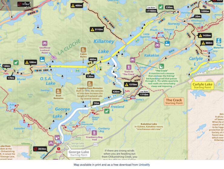
Chrismar offers a large, medium-scale (1:50,000) paper map of the whole Killarney Provincial Park which is perfect for planning your trip. Unlostify offers both digital and hard-copy maps that are excellent for planning and tripping. Contact Killarney Park staff or local outfitters for more information. A Paddler’s Guide to Killarney and the French River by Kevin Callan is a great resource.
Part of the famous Temagami paddling area, Lady Evelyn Smoothwater canoe maps and Temagami region canoe route maps are numerous. The Ontario Parks Temagami Canoe Routes paper map is great for planning. Chrismar offers a series of five Adventure Maps. They range in price from $8.95 to $14.95. These maps are available at most local outfitters and through Ontario Parks. The Friends of Temagami produce and sell the Temagami Adventure Planning Map ($39) and Obabika Loop/Maple Mountain Companion Map ($18) online or at retailers across Ontario. Temagami, A Wilderness Paradise by Hap Wilson is a must-have guide book for canoe trip information. Temagami canoe routes are featured in several of Kevin Callan’s guide books including the Top 60 Canoe Routes of Ontario. Contact Lady Evelyn-Smoothwater Park staff or local outfitters for more information. Get tips on planning a best ever Temagami canoe trip.
The Ministry of Natural Resources has produced a canoe route pamphlet: Magnetawan River Canoe Route. You can also use Topographic maps to navigate the river. The Magnetawan River Loop is included as one of the Top 50 Canoe Routes of Ontario guidebook by Kevin Callan. Read more about this trip.
Unlostify offers both digital and hard-copy maps that are great for planning and tripping. Ontario Parks sells a waterproof Camping and Facilities Guide Map that shows campsites and canoe routes. Contact The Massasauga Park staff or local outfitters for more information.
Chrismar offers The Adventure Map for the Mattawa River Provincial Park & Area. At 1:40,000 scale, this waterproof map shows extraordinary details of access points, campsites, portages, points of interest, roads, trails, etc. It is perfect for planning and tripping. Contact Samuel de Champlain Park staff or local outfitters for more information.
Chrismar offers a series of three of The Adventure Maps for the Missinaibi Provincial Park. At 1:50,000 scale, these waterproof maps show extraordinary details of access points, campsites, portages, points of interest, roads, trails, etc. It is perfect for planning and tripping. Contact Missinaibi River Park staff or local outfitters for more information.
Chrismar offers The Adventure Map for the Mississagi River Provincial Park & Area. At 1:80,000 scale, this waterproof map shows extraordinary details of access points, campsites, portages, points of interest, roads, trails, etc. It is perfect for planning and tripping. Contact Mississagi River Park staff or local outfitters for more information.
Chrismar offers The Adventure Map for Obatanga Provincial Park. At 1:50,000 scale, this waterproof map shows extraordinary details of access points, campsites, portages, points of interest, roads, trails, etc. It is perfect for planning and tripping.
Chrismar offers The Adventure Map for Quetico Provincial Park. At 1:125,000 scale, this waterproof map shows extraordinary details of access points, campsites, portages, points of interest, roads, trails, etc. It is perfect for planning and tripping. A Paddler’s Guide to Quetico and Beyond by Kevin Callan is a great resource. Contact Quetico Park staff or local outfitters for more information.
Contact Restoule Park staff or local outfitters for more information.
Chrismar offers The Adventure Map for the Spanish River Provincial Park & Area. At 1:60,000 scale, this waterproof map shows extraordinary details of access points, campsites, portages, points of interest, roads, trails, etc. It is perfect for planning and tripping. Contact Spanish River Park staff or local outfitters for more information.
Chrismar offers The Adventure Map for the White River Provincial Park & Area. At 1:50,000 scale, this waterproof map shows extraordinary details of access points, campsites, portages, points of interest, trails, etc. It is perfect for planning and tripping. Contact White Lake Park staff for more information.
Chrismar offers The Adventure Map for Woodland Caribou Provincial Park. At 1:110,000 scale, this waterproof map shows extraordinary details of access points, campsites, portages, points of interest, trails, etc. It is perfect for planning and tripping. Contact Woodland Caribou Park staff or local outfitters for more information.
The Grand River Conservation Authority provides digital maps and information on river access points for canoe or kayak trips. Contact The Grand River Conservation Authority or local outfitters (Grand River Rafting Company or Grand Experiences Outdoor Adventure Company) for more information.
The Saugeen Valley Conservation Authority provides digital maps and information on river access for canoeing and kayaking trips. Contact them for more information.
There’s no better time to start planning your canoe trip than now. Be inspired by a guidebook, find the perfect route and get a canoe map to help make your dream trip come true.