
Ontario’s Moose Hotspots
Your best chance of seeing a moose is by paddle.
By Marshall Veroni


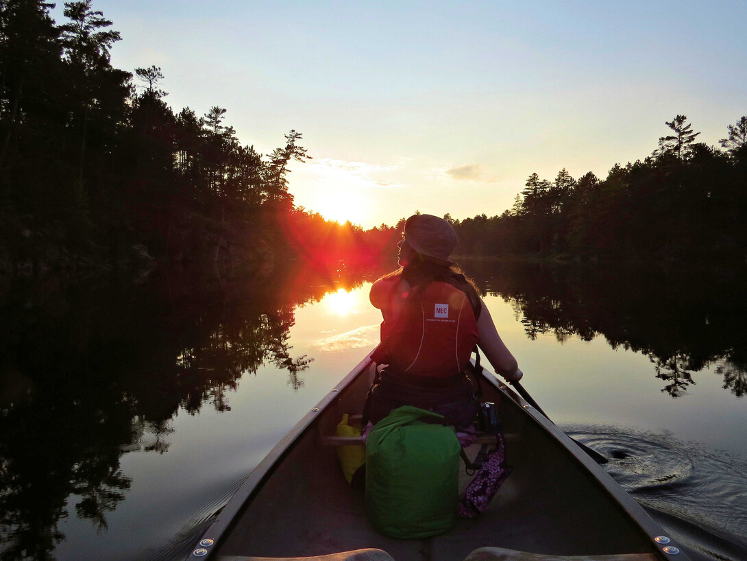
The Mattawa River is a rugged and historic waterway that’s been travelled for thousands of years. Indigenous people first travelled the river, followed by explorers, voyageurs and coureurs des bois starting in the 1600s. In more recent years, the waterway has become a very popular canoe trip route for recreational paddlers.
At a length of 76 km, the Mattawa River flows east out of Trout Lake in the city of North Bay, in and out of a number of flatwater lakes, down rapids, over waterfalls, through dams, and drains into the Ottawa River in the town of Mattawa. Mattawa means “meeting of the waters” in the Algonquin language.
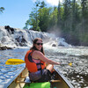
The river is accessible to just about any type of paddler. Beginners will enjoy the flatwater Mattawa River canoe route sections and there are 13 short, well-marked portages along the way to avoid rougher waters. Those with whitewater skills will have no problem paddling many of the rapids and may enjoy the thrill of the river during higher water levels as well.
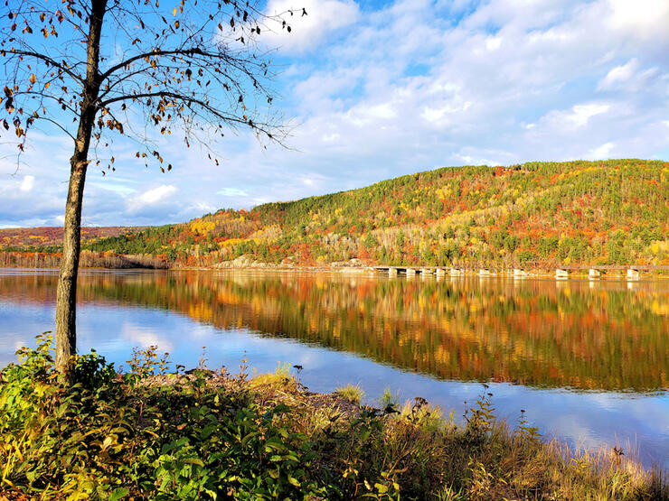
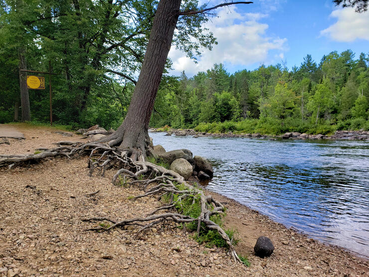
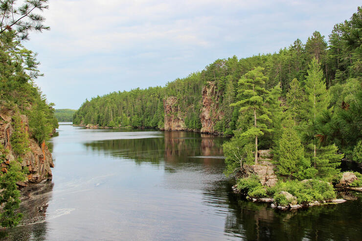
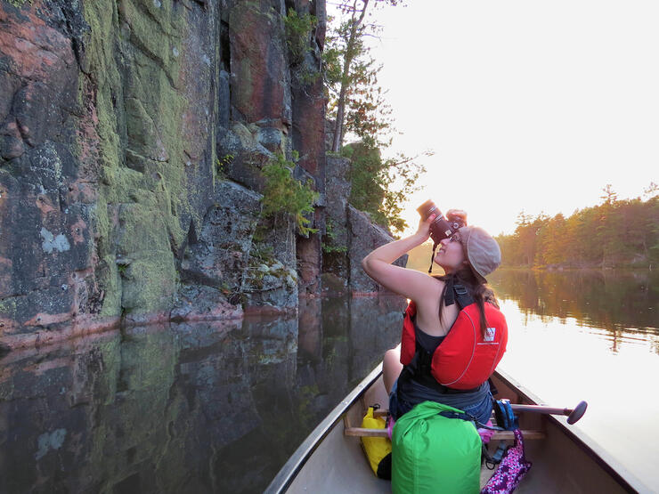
The Mattawa River offers paddlers a landscape full of rugged beauty, from rocky shorelines and powerful waterfalls, to towering cliffs and pristine pine forests. Much of the landscape along the river has remained untouched by development, offering sights that appeared much the same to those who travelled the river hundreds of years ago. For the history buff, there are several interesting historic locations to stop at along the river, many of which feature signs and informational plaques to educate visitors.
Due to both the cultural and natural heritage of the Mattawa River, great effort has gone towards protecting the waterway. The Mattawa River was designated a Canadian Heritage River in 1988, and the majority of the river falls within the boundaries of either Mattawa River Provincial Park or Samuel de Champlain Provincial Park.
When planning a canoe trip on the Mattawa, it’s pretty amazing to know that whichever route you choose, you will be following in the footsteps of many who have come through the area for thousands of years before.
Most people who paddle the Mattawa choose to travel downstream, west to east. You can start at whichever access point you want, depending on the length of canoe trip you wish to go on. To complete a Mattawa River canoe trip, you will need to leave a vehicle at the take-out where you will be ending your trip, arrange for someone to pick you up or hire a shuttle service.
The Trout Lake to Mattawa canoe trip
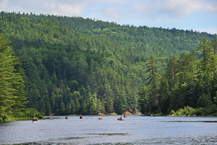
The most popular canoe trip route involves paddling the entire length of the river, from Trout Lake to Mattawa. This route can take anywhere from two to four days, depending on your skill level and preferred pace. Beginners and those who want to slow down and stop to enjoy the many sights along the way should set aside four or five days.
You can start your trip at either the west end of Trout Lake at Olmsted Beach in North Bay (overnight parking available), or, if you want to avoid paddling across the lake, at the east end at the boat launch at the end of Macpherson Drive (no overnight parking available). The latter option will put you on the river just west of the Stepping Stones, a band of large boulders stretching most of the way across a narrow section of the Mattawa.
The town of Mattawa marks the end of this route for most; however, some choose to end their trip a little earlier at Portage Campion, the take-out at the Campion Rapids, within Samuel de Champlain Provincial Park.
Depending on your skillset and the current water levels, there are up to 13 short portages to complete along the route, the longest being 450 m in length.
If you want to shorten your trip or avoid the larger lakes and motorboats along the west half of the river, a great access point to start at is Blanchard’s Landing, located just north of Rutherglen and reachable off Highway 17 via Talon Lake road. Overnight parking is available.
The Pimisi Bay to Samuel de Champlain Provincial Park day trip
The most popular day trip along the Mattawa River is from Pimisi Bay to Portage Campion in Samuel de Champlain Provincial Park. This trip can be completed in as few as four to six hours—but make sure to give yourself extra time as there are many great spots to stop along the way.
Canoes can be launched at the Pimisi Bay Picnic Area located along Highway 17 (no overnight parking available) a few kilometres east of Rutherglen. From there, paddlers can travel across Pimisi Bay and follow the river downstream to the east. There are up to eight short portages along this route.
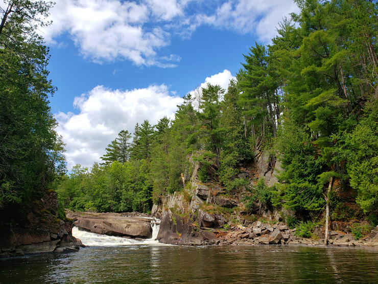
Some of the highlights of this short journey include the beautiful Paresseux Falls, a six-metre-high waterfall, and Hell’s Gate (or Porte de l’Enfer), a cave voyageurs once thought to be home to a man-eating demon. In reality, this cave was one of only a few Indigenous ochre mines in Ontario.
Pimisi Bay to Talon Chutes day trip
The route from Pimisi Bay to Talon Chutes and back makes for another great little trip, which can be completed in less than an hour. Start again at the Pimisi Bay Picnic Area, but this time paddle west upstream for just over a kilometre—here you’ll find yourself at the bottom of Talon Chutes.
Talon Chutes is a great area to explore. There are towering cliffs along the river, a waterfall, a dam located at the top of the portage, and huge potholes in the rocks near the portage created by glacial waters that once flowed through the area. As its name suggests, there used to be a log chute around the waterfall. Many people enjoy swimming in the deep water at the east end of the portage.
The Mattawa River Canoe Race is held near the end of July each year, and sets racers paddling between Trout Lake and Mattawa Island Conservation Area. This race is 64 km long and is open to both professional and recreational paddlers. There is also a shorter 13-km family and youth Mattawa canoe race that launches from within Samuel de Champlain Provincial Park.
The current record for a team of two paddling the entire race length is five hours, 27 minutes and 53 seconds.
The Mattawa River Canoe Race is currently postponed until July 2024.
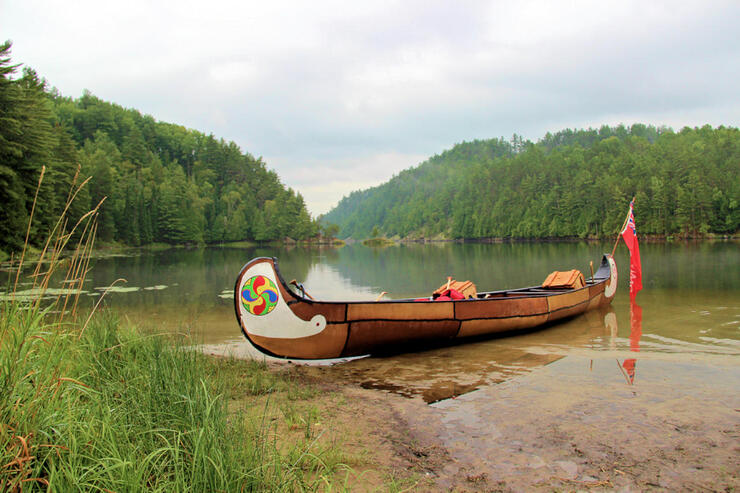
You can experience the life of a voyageur during the fur trade by embarking on a Voyageur Adventure Tour at Samuel de Champlain Provincial Park. These guided tours will take you back in time as you paddle a 30-foot-long replica voyageur canoe. The hour and a half long tour takes paddlers along a beautiful section of the Mattawa River to a hidden waterfall.
There are 11 public access points located along the Mattawa River between North Bay and Mattawa. Some allow overnight parking, while fees apply at others. There are also several private resorts and marinas that may allow overnight parking for a small fee; you can contact these businesses to ask about parking availability.
Some public Mattawa River access points have already been mentioned above, but others include:
The majority of the Mattawa River is located within Mattawa River Provincial Park, which is a non-operating Ontario Park. This means you do not have to purchase a camping permit or reserve a backcountry campsite ahead of time. You must, however, make sure to follow park rules that can be found on the Ontario Parks website.
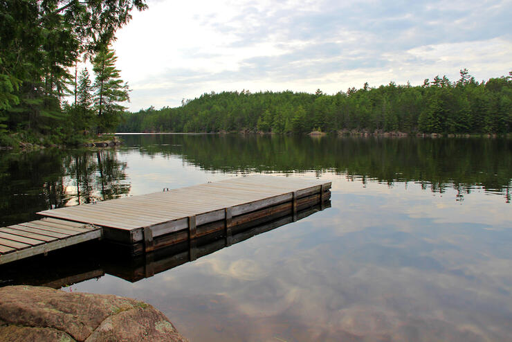
There are established campsites located along the river that can be found on The Adventure Map’s Mattawa River and Area map (see below). These campsites are fairly basic—each offers a fire ring, but only some have privies (a.k.a. thunderboxes). The campsites are not regularly maintained, but do see a lot of use, and what they lack in amenities, they more than make up for with amazing riverside views.
Should you wish to enjoy a Mattawa River canoe trip with a bit more luxury, you may want to look into booking campsites at a few different campgrounds located along the Mattawa River. There is Camp Conewango located on Rice Bay, Talon Lake Campground and Marina located at the far east end of Talon Lake, and Samuel de Champlain Provincial Park located at the far east end of the Mattawa River.
Algonquin North Wilderness Outfitters is the only local outfitter that serves the Mattawa River and area. Located at the junction of the Trans-Canada Highway 17 and Highway 630, 19 km west of Mattawa, Algonquin North offers a wide range of services, from canoe rentals to complete canoe trip outfitting to shuttle services. They also offer special package trips, including a self-guided canoe day trip with shuttle service for the Pimisi Bay to Samuel de Champlain Provincial Park route.
The Adventure Map by Chrismar offers an excellent Mattawa River and Area map available for purchase on their website. You can also find this map at local outfitters or outdoor retail stores such as MEC, Algonquin Outfitters and Outdoors Oriented. This Mattawa River canoe route map features information about access points, portages, campsites, paddling distances, and the history of the river and surrounding area. If you want to canoe the Mattawa River, you’ll want to make sure you have one of these maps.
One area along the Mattawa River I particularly enjoy is the section located east of Campion Rapids within Samuel de Champlain Provincial Park. If you are camping in the park, or are looking for a nice day trip on the river, this is a great spot for you to check out, with no portages along the way!
Starting a little downstream of Portage Campion, paddlers can make their way east for just over a kilometre to a hidden waterfall, Simpson Falls, located at the end of a coldwater creek on the north side of the Mattawa River. Pull your canoe up on the sandbar and walk up the creek to find the waterfall hidden in the forest!
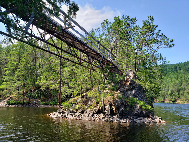
If you continue paddling a few more kilometres downstream, you’ll reach The Gut—somewhat of an inlet on the Mattawa River. Here you’ll find yourself surrounded by cliffs and rocky shorelines, and will also pass by a smaller waterfall. Take a break at the footbridge at the east end of The Gut and enjoy a picturesque view downriver.
Eau Claire Gorge Conservation Area
Kiosk Access Point and Campground - Algonquin Provincial Park
La Vase Portages Conservation Area
Voyageur Multi-Use Trail System
Canadian Ecology Centre
Mattawa River Resort and Cardinal Restaurant
Van Doeler’s Ranch
Sid Turcotte Park
Mattawa Museum
Maxwell Pottery
The Mattawa River is a rugged and historic waterway that’s been travelled for thousands of years. Be sure to add a Mattawa River canoe route to your bucket list.
