
A Bird's-Eye View of Thunder Bay
Mount McKay Lookout - Anemki Wajiw is a must-do in this Northwestern Ontario city
By Jim Byers


There is no shortage of fabulous hiking areas in Northwest Ontario. While in Thunder Bay, be sure to take the short drive to Pigeon River Provincial Park. There's a hike for every skill level and an abundance of beautiful, scenic views to be enjoyed.
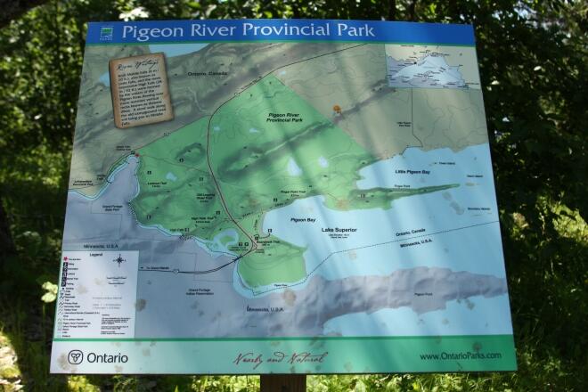
Our introduction to the trails of Pigeon River Provincial Park began with a quick study of the trail map planted beneath a tree on the edge of the gravel parking area just off Highway 593.
The Old Logging Road Trail, it promised, would take us 2.5 km across the northwest quadrant of the park, and eventually lead us to High Falls and a network of other trails branching off from the tourist center on Highway 61 near the U.S. border crossing.
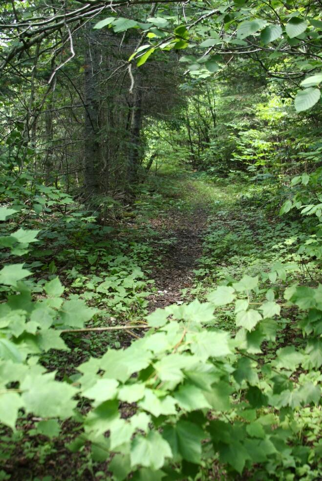
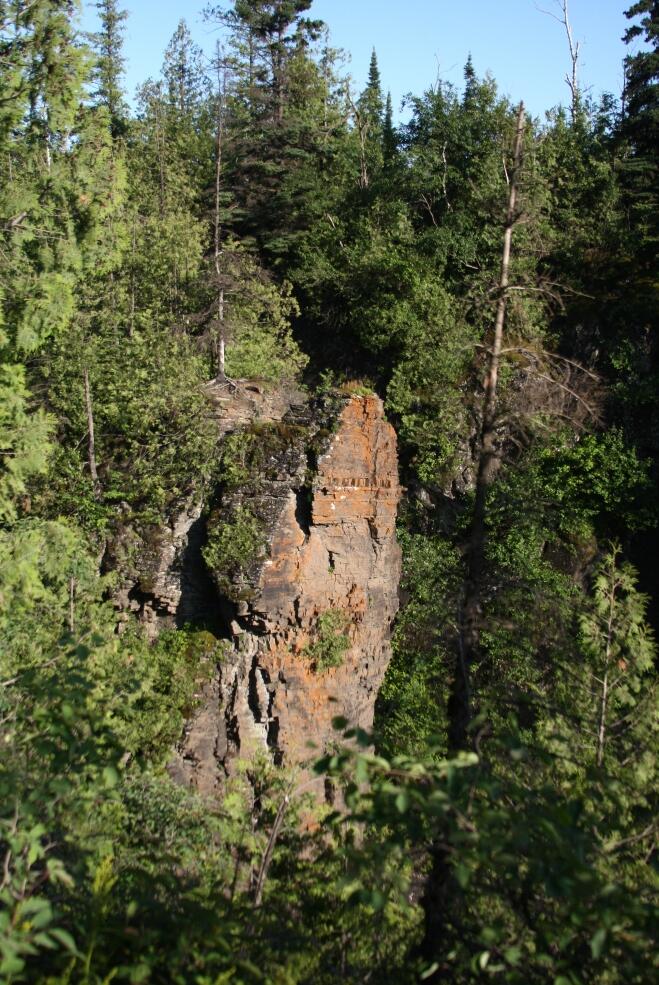
Entering the trail system where we did was kind of like accessing the park from the back door. In the distance we could hear the rabble of the Pigeon River where it tumbled over Middle Falls, before it swept past the gravel trail we followed towards the thick of the woods.
A short distance in, we passed a sign indicating the start of the Lookout Trail, a 1.6-km hike up steep banks, dotted with giant trees, that eventually emerges at a point with a view over the woods to glistening Lake Superior in the distance.
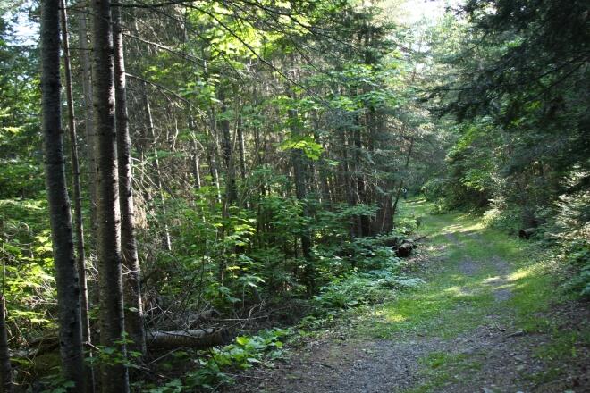
But we felt like explorers traversing the seldom-used Old Logging Road Trail on an expedition to find High Falls. So we continued on, following the rise of the land through narrow stretches of trail, to spots where it opened up, letting in soft light through the canopy above, over downed trees, and around the saturated ground beside a beaver pond.
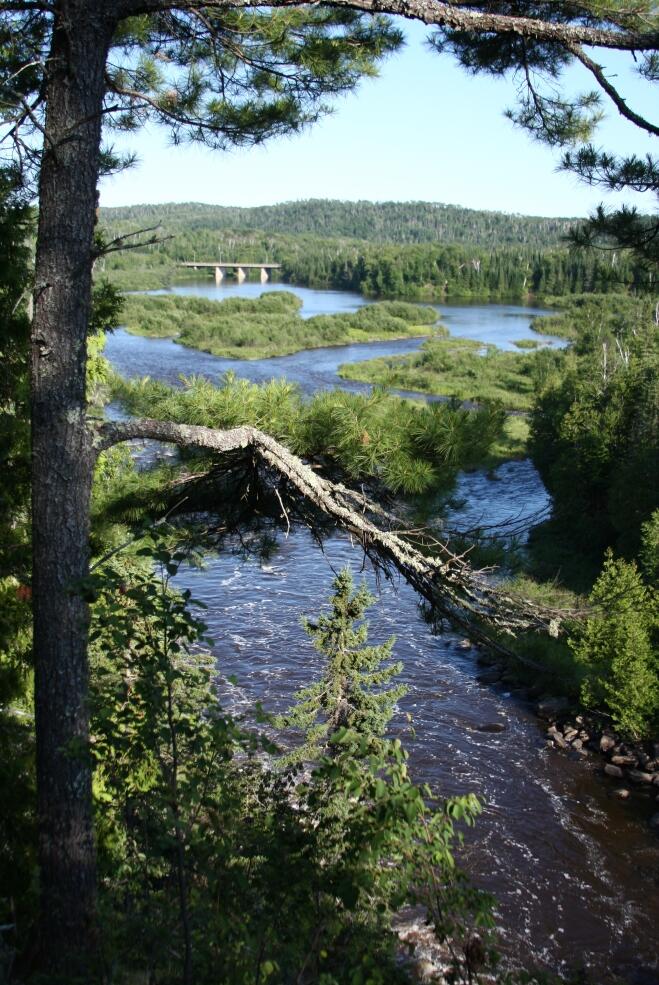
The trail emerged from the bush at the edge of Highway 61 and then from there, just inside the tree line, it tracked the course of the highway towards the border, meeting up with the trail system that leads to High Falls in one direction and out to Little Pigeon Bay in the other.
The trails at the tourist center side of the park are more maintained, more well-travelled. There is even a boardwalk, completely accessible, that takes a lovely winding tour through the woods to Pigeon Bay.
The loop that leads to High Falls is made up of wide, leafy avenues through the woods and of well-trodden dirt paths paralleling the river with historical markers along the way. We found the remnants of an overgrown old stone chimney and fireplace, the last remaining evidence of a lodge built in the 1930s that used to serve hunters and anglers visiting the area.
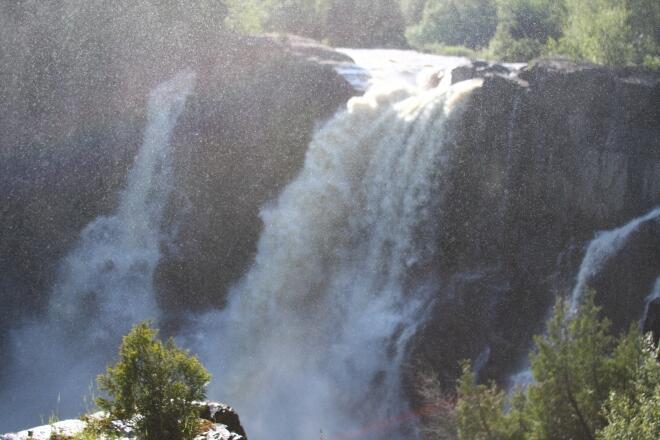
And of course there is dramatic High Falls itself, with the river plummeting over the edge down 92 feet and cutting a tumultuous path through a spectacular gorge. The Pigeon River acts as the border between Canada and the U.S., and as such both countries claim the falls. While Ontario boasts many falls much taller (including the nearby Kakabeka Falls), High Falls is the tallest waterfall in Minnesota and the views, as one would expect, were amazing. But on that day, for us, the adventure was in getting there.