
10 Secluded Beaches
These Beautiful Sandy Beaches are a Must This Summer
By Heather Bot


When driving east from Sault Ste. Marie, Highway 638 offers a scenic alternative to the more heavily travelled Highway 17. Spanning 52 km from Echo Bay to Bruce Mines, this secondary highway meanders its way through varied terrain, offering a fresh view at every turn.
Heading east from Echo Bay, the highway is flanked by vistas of rocky ridges as it dips into the pastoral lowlands of Sylvan Valley before entering a forested stretch north of McCarrel Lake. From here, the road passes by a handful of small farms nestled between tree-covered hills as the route passes through the tiny settlement of Leeburn. The highway then veers south at its intersection with Poplar Dale Road, then passes through some rugged terrain as it skirts between Rock Lake and Dunns Valley. The road then flattens out as it passes through sprawling farmland near the small communities of Rydal Bank and Bruce Station, before finally reaching its terminus at its intersection with Highway 17 at Bruce Mines.
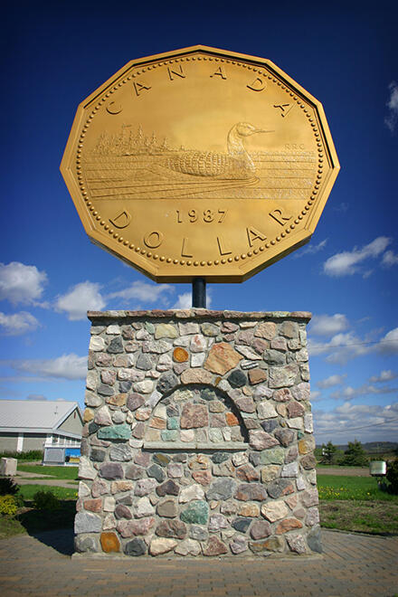
At the western terminus of Highway 638 lies the town of Echo Bay, which is home to the “Big Loonie.” Officially known as the Loon Dollar Monument, this roadside attraction was erected in 1992 in recognition of local resident Robert Ralph Carmichael, who created the design for Canada’s one-dollar coin in 1987.
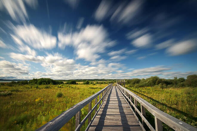
Adjacent to the “Big Loonie” is Echo Bay’s nature boardwalk. Nearly 600 m in length, the boardwalk was built in the middle of a significant wetland and offers nine viewing platforms for birdwatchers as well as a number of informative signs displaying facts about the wetland.
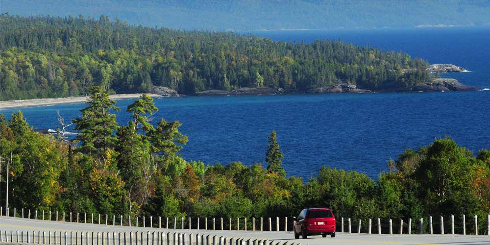
Heading east from Echo Bay, Highway 638 immediately ascends to the top of a ridge that overlooks the town of Echo Bay and Lake George to the West. An excellent view can be found a short distance from the highway on Lakeview Drive.
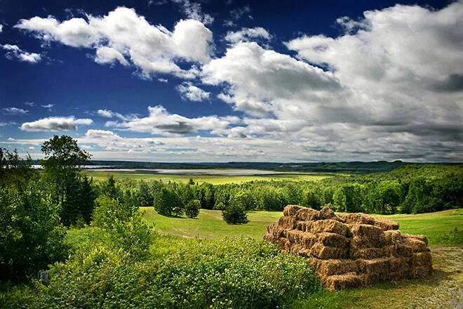
Just a few minutes east of Echo Bay, Highway 638 descends into Sylvan Valley, a picturesque pocket of rolling farmland surrounded by tree-covered ridges and rocky bluffs. Autumn is a particularly good time to visit as the surrounding hills come alive with colour, providing a striking backdrop to the tranquil rural scenery.
On calm, clear summer mornings, Sylvan Valley is often shrouded in thin veils of fog, creating a dreamlike scene that makes for some wonderful photo opportunities.
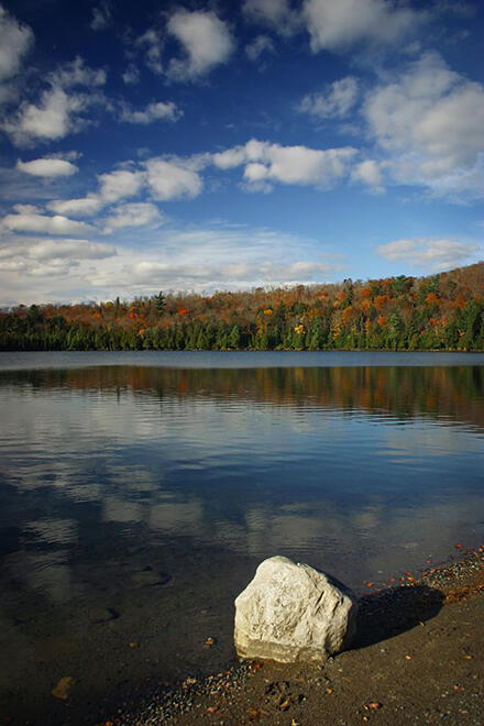
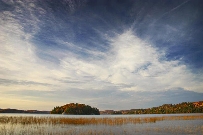
As Highway 638 climbs out of Sylvan Valley, it enters into a forested area where a number of lakes can be found just a few minutes from the highway. Tower Lake (pictured) is located one kilometre north of the highway on Tower Lake Road. There is a public park located at the south end of the lake.
Continuing eastward along Highway 638, the forests that line the road give way to patches of farmland as the road approaches the small community of Leeburn.
Heading east from Leeburn, Highway 638 skirts around some large outcrops of rock before veering south at its intersection with Poplar Dale Road.
Immediately after veering south, Highway 638 intersects Highway 670. This short gravel highway leads further east into another picturesque rural valley – Dunns Valley.
Just south of Highway 670, Highway 638 intersects Mill Beach Road, which leads a short distance to a public beach on Rock Lake.
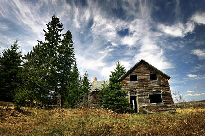
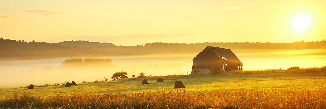
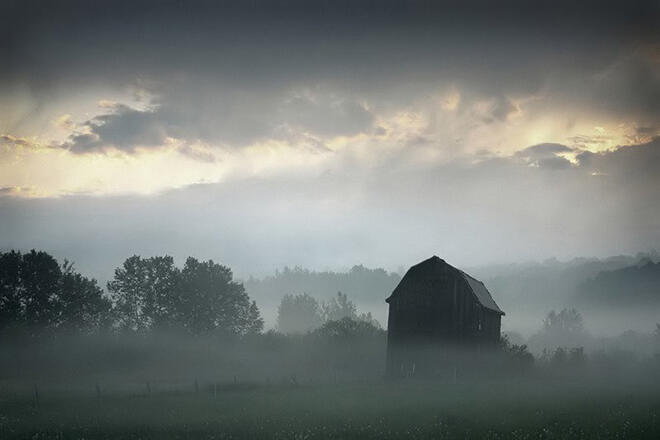
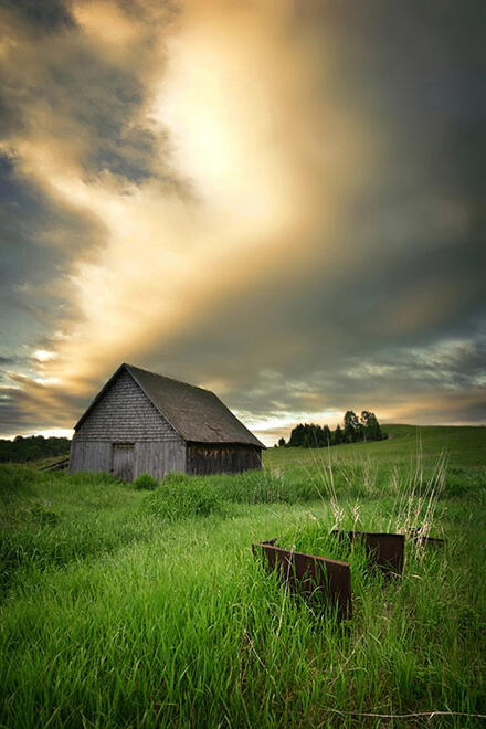
The drive along Highway 638 leads past a handful of old barns and abandoned farmhouses, such as this one found just north of Rydal Bank.
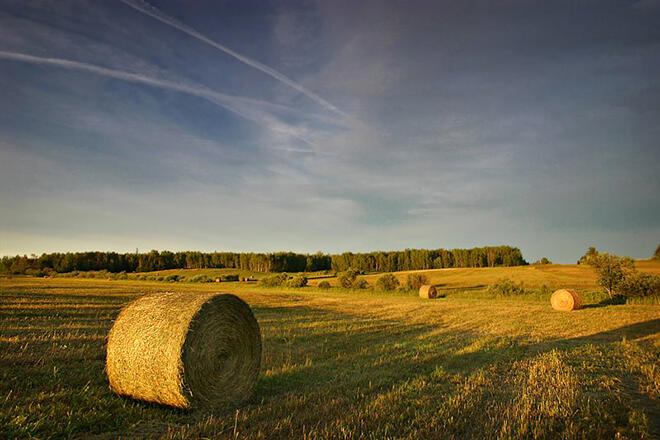
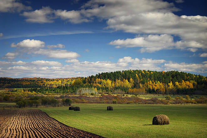
As Highway 638 approaches the small community of Rydal Bank, the landscape changes to one of sprawling farmland.
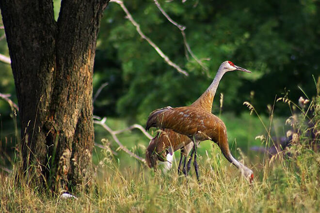
Sandhill cranes can often be seen feeding in fields near Rydal Bank and Bruce Station.

The remnants of an old train bridge can be seen next to Highway 638 where it crosses Black Creek, just south of Rydal Bank. A rail line once extended north from Bruce Station, but this stone bridge is just about all that remains.
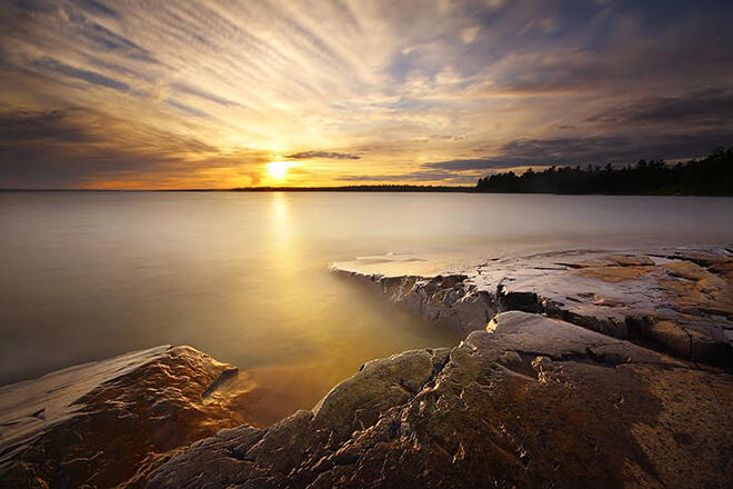
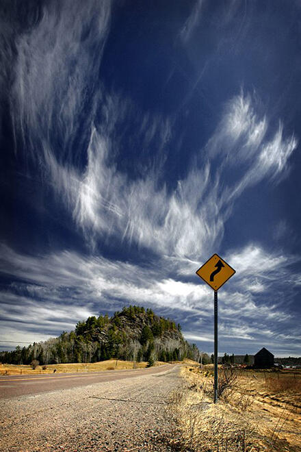
The town of Bruce Mines marks the southern terminus of Highway 638. Bruce Mines is a great place to enjoy a meal, shop for antiques, or take in a sunset on Lake Huron’s North Channel.
To see more of Travis Favretto’s photography, you can visit his website at www.travisfavretto.com.