Ontario Motorcycle Events
Let's Ride!
By Mike Jacobs


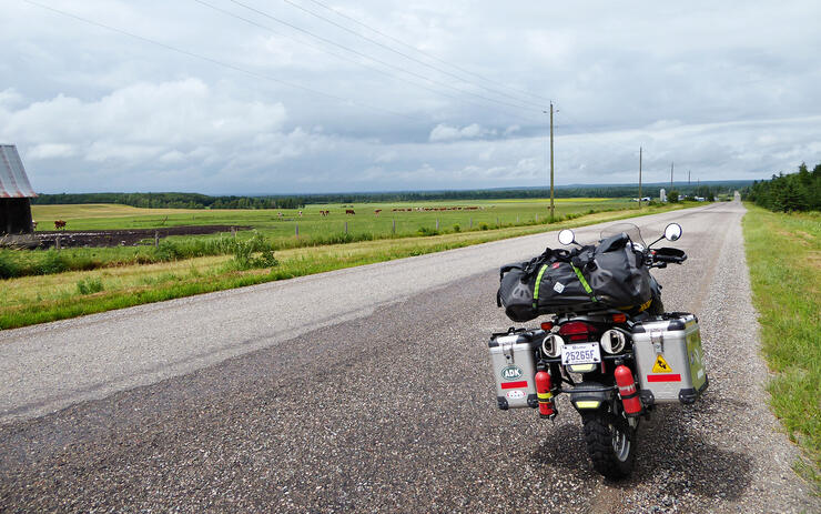
Even before I had my motorcycle licence, I knew I wanted to do adventure riding. As an avid canoe-camper, I’ve always had a love of nature, so marrying the freedom of motorcycling with the ability to leave the asphalt and venture into the bush seemed the perfect fit for me. Last summer I spent a day at S.M.A.R.T. Riding Adventures in Barrie, Ontario, learning some off-road skills, and this summer I returned to explore the pristine, remote wilderness of Ontario on my 2006 BMW f650GS. I rode Northeastern Ontario’s Great Legends Tour and added some off-roading north of the Trans-Canada Highway in the Cochrane District.
My trip planning began in the spring when, travelling on the 401 during March Break, I wandered over to the tourism side of an On Route rest stop and picked up the Big Adventure Motorcycle Map and Tour Guide. Although I grew up in Ontario, I’d never been further north than Muskoka, and I've always wondered what lies north of there. Over the din of six lanes of traffic, the Great Legends Tour that stretches from North Bay all the way up to Kapuskasing was calling me.
Once the circuit was decided, I used the Go Tour Ontario Interactive Online Touring Tool, a website offered by the Government of Ontario, to find some off-road rides. Choosing ADV from the first pop-up menu presents you with 13 different off-road rides to choose from in the second. Selecting one of those brings up a map with the route highlighted and a description of the ride. A nice feature of the tool is that it can show you where on your ride you will have cell service. That was important to me because I’d be riding solo.
I noticed that there are a few ADV routes in the Kapuskasing to Cochrane area, so decided to reserve a campsite for three nights at René Brunelle Provincial Campground, just north of Moonbeam. It would be my home base to drop my panniers and explore the area unencumbered.
I started my ride in the Town of Mattawa, taking Highway 533 that snakes northwest across the mountain. It’s actually one half of the Mattawa Mountain Ride, and I can see why. It’s not dirt—in fact, sections of the asphalt have recently been repaved—but it’s got to be one of the twistiest roads in the area and takes you 60 km through dense bush. I then picked up the 63 that took me across the border into Quebec at the Timiskaming Dam and to the 101 North. The 101 is a beautiful road. It starts in a forested area and climbs and climbs up as you follow the Ottawa River, opening up eventually into farmland with more mountains on the distant horizon.
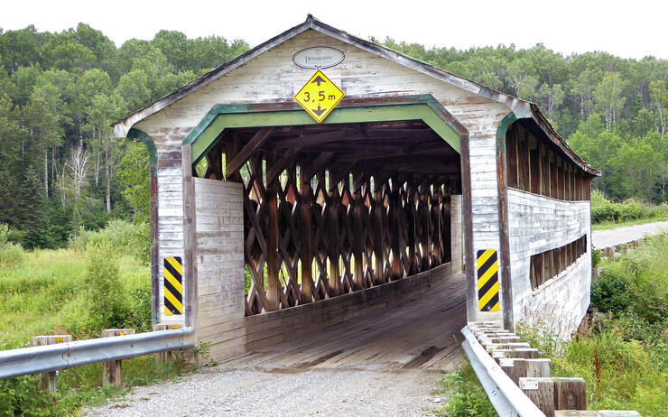
Just north of Saint-Bruno-de-Guigues, I saw a sign indicating a covered bridge was near. Since adventure riding is all about exploration, I decided to follow the signs along some dirt roads. They led me to Pont Dénommée, and riding through a covered bridge is always worth the detour.
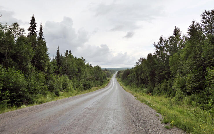
Soon, I crossed back into Ontario and headed further north on Highway 11, a section of the Trans-Canada Highway and the road that would be the backbone of the next section of my trip. Now there’s the option to continue on Highway 11 into the small community of Matheson, but be sure to split off at Englehart and follow the suggested route of the Great Legends Tour because Highways 624 and 672 are well worth the diversion. They are smaller and twisty with rolling hills that climb more into the north. There’s a definite sense of leaving one geographical region and entering another, and by the time you reconnect with the 101, just south of Lake Abitibi, the deciduous trees have disappeared, leaving a sparse landscape of coniferous trees and wetlands. This is what I imagined the North to look like.
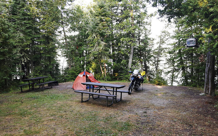
I headed now west and connected back up with Highway 11. By this time it was getting late in the afternoon and I was happy to have a straight, perfectly paved road to make some distance because I was going all the way to Moonbeam. My site at René Brunelle Campground was right on the water. That night I thought I was watching the Aurora Borealis, but it was actually a spectacular lightning storm behind a bank of clouds. The thunderclouds in these parts roll across the lake, and you see and hear the storm coming long before the first drops of rain hit your tent.
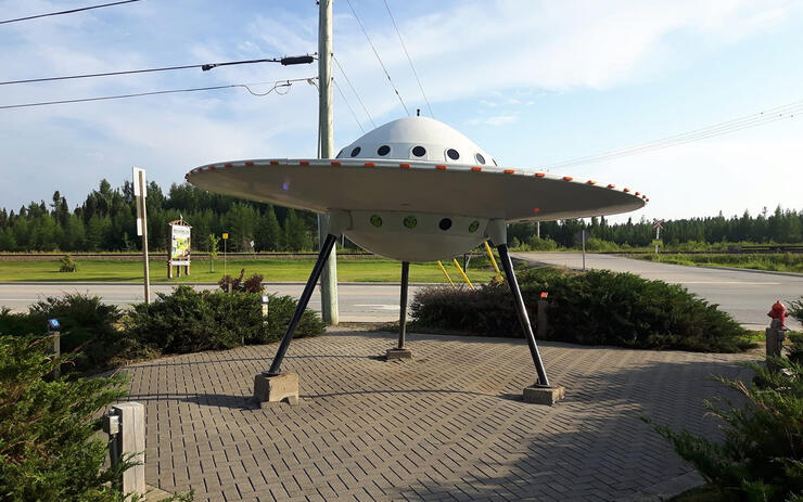
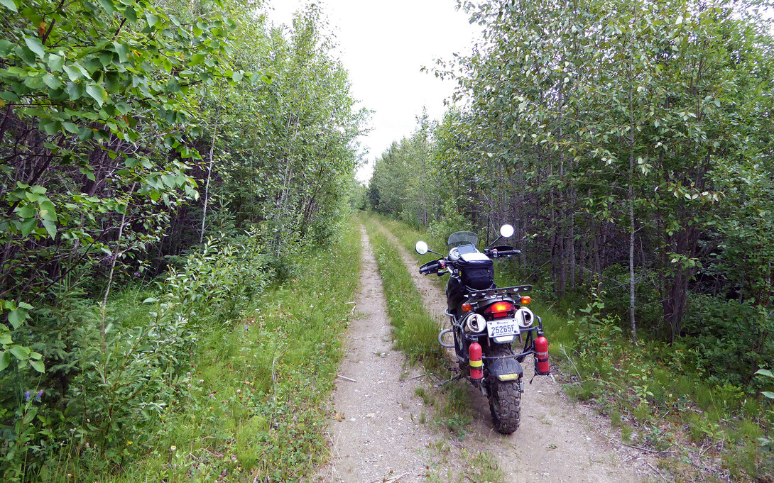
The next day was my first day of off-road riding. I left my bags and panniers tucked into the vestibule of my tent and headed off. I thought the girl at the gate would know the area well, and could direct me to the head of the Lumberjack Trail that starts in Moonbeam and ends in the Town of Kapuskasing. She said there are a lot of trails in the area because “there’s nothing else to do,” and told me about the Pepinière Trail. The staff at the Visitor’s Centre in Moonbeam were also helpful in orienting me; just look for the flying saucer.
There I also picked up the Aventure Nord Ontario map, which shows all the off-road routes I’d seen online and a helpful classification of the trails by difficulty.
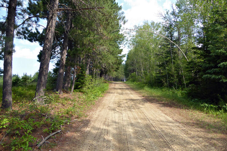
For the Pepinière Trail, just look for Nursery Road that intersects Highway 11 just east of Moonbeam. This dirt road leads to a sandy trail flanked by pine trees. There are some challenging little hill climbs in the sand.
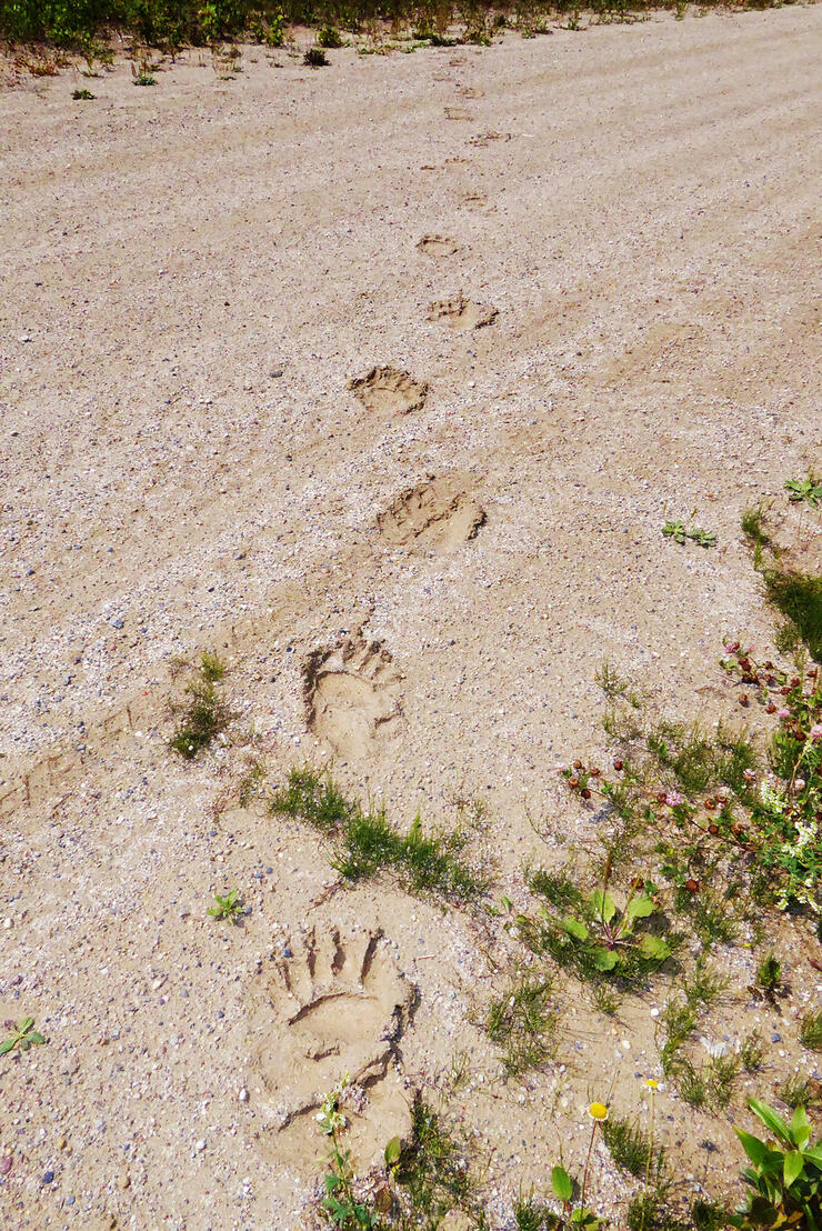
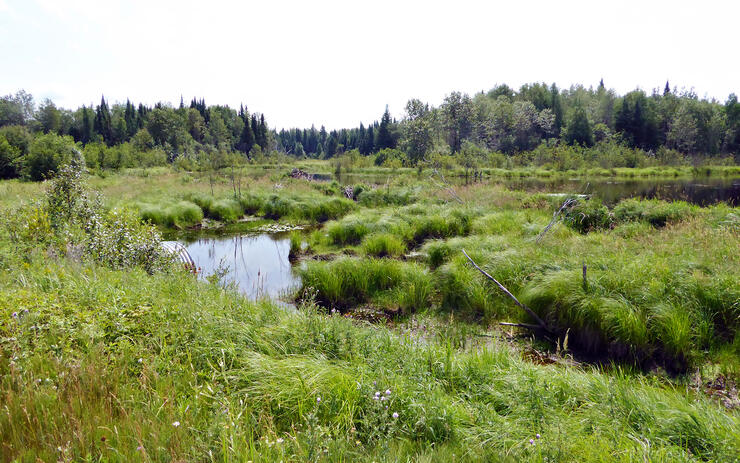
When you hit the T-junction, turn right. That gravel road loops over the top of the park and takes you all the way into Kapuskasing. You’ll see some wildlife prints—perhaps some you’d rather not see—and some wetlands. In addition to bear tracks, I also saw wolf and hare tracks in the wet silt.
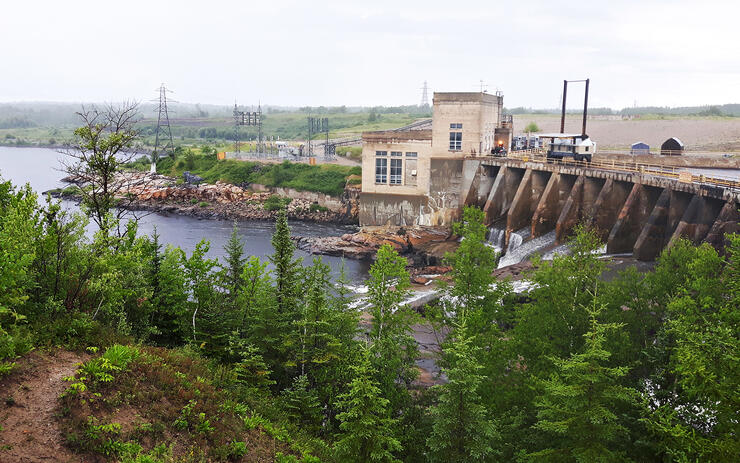
The next day I rode into Cochrane to visit the Polar Bear Habitat. While coming back, I saw a road called Lookout Road just west of the bridge in Smooth Rock Falls. Again, exploring dirt roads is part of the fun of riding an adventure bike, so I thought I’d see what’s up this one. It naturally led to a pretty spectacular view of the dam.
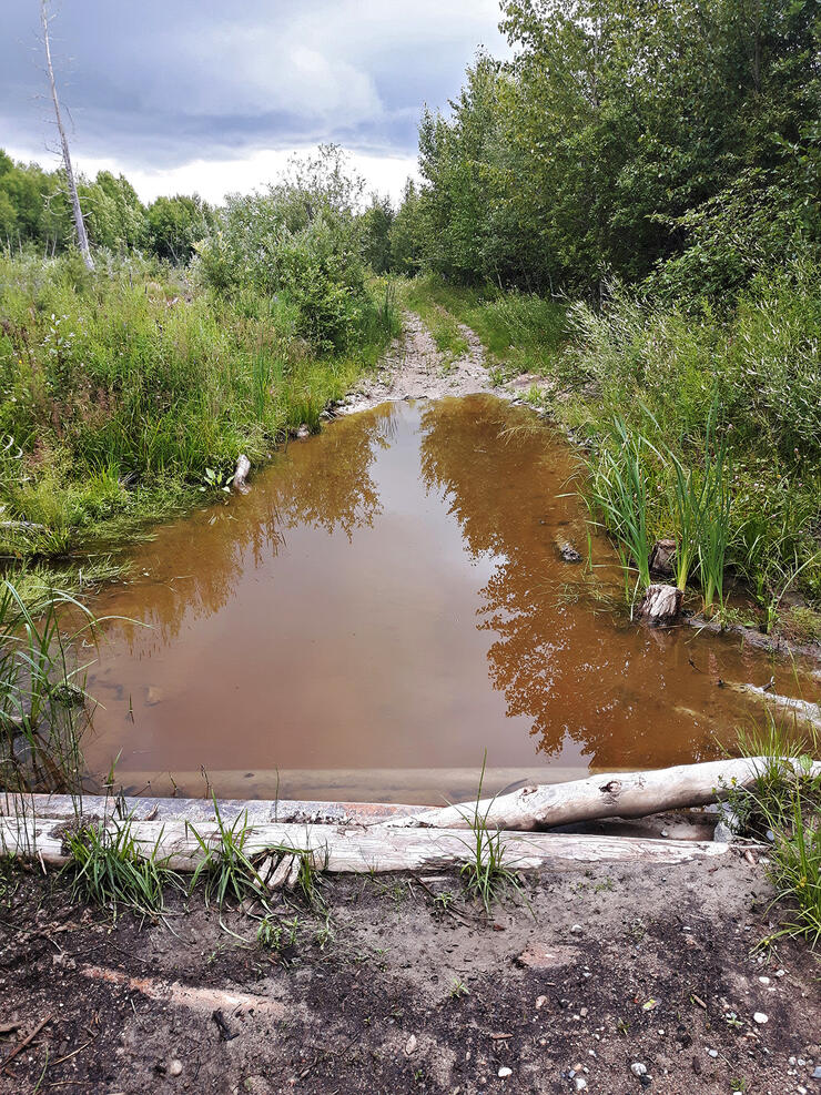
It generally was fairly easy, but contained some rocky hill climbs and challenging muddy sections. Eventually I arrived at a water-crossing, and since I was on my own and prudence is the better part of valour, I decided to turn back at this point.
That was enough off-roading for this trip. The next day I had to start heading south, but not before checking out Kapuskasing, a town built on the forestry industry, as so many towns are in this region. Be sure to visit The Ron Morel Memorial Museum at the old train station that shows the town’s rich history. I didn’t know that there had been an internment/POW camp in Kapuskasing during WWI.
The next day I started down the western leg of the loop. It took me through the City of Timmins, then further south on the 144 into Sudbury. The 144 north of Sudbury is another amazing piece of road. It reminded me much of Highway 6 going down onto Manitoulin Island, the surface perfect and the road full of sweeping turns that carve through different types of rock.
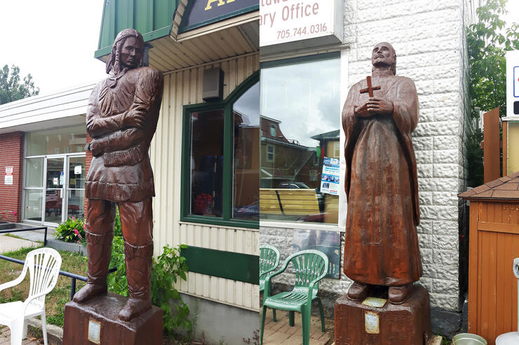
At Sudbury, I picked up Highway 17, the original Trans-Canada Highway, and took that all the way back into Quebec, passing again through Mattawa with its famous street-side woodcarvings.
I arrived during Voyageur Days and the festivities were in full swing, including a lumberjack competition and a concert in the park planned for the evening. That got me thinking about the voyageurs that travelled this country hundreds of years ago. I’m glad I ventured up into these towns with roots reaching deep into Canadian history. Riding the Great Legends Tour gives you a sense of what it must have been like for those brave men and women who ventured into a beautiful but unforgiving wilderness.