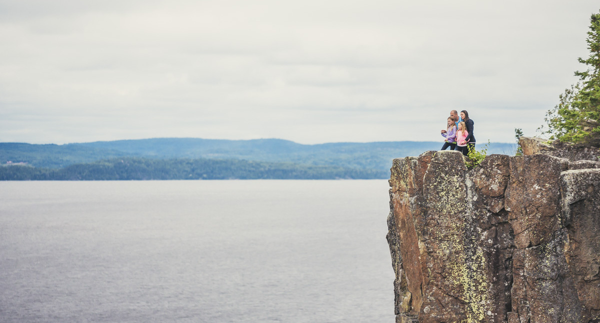
Spring Fishing in Kirkland Lake
Discover prime lakes, top bait shops, and comfortable stays for the ultimate spring fishing adventure
By Len Talarico


Northeastern Ontario is as much a region of water as it is of land, something that only by hiking it (or seeing it from the air) are you able to truly appreciate. With tens of thousands of lakes, and every size and shape of creek or river feeding and emptying them, it’s little wonder that waterfalls are almost as plentiful as the lakes and rivers themselves.
Yet there’s something magnetic about waterfalls that makes them different from lakes or rivers. Whether it’s the sound or the beauty of the cascading water, the power being released in its rushing downhill descent, or just the fact that no two waterfalls are alike, there’s something about waterfalls that draws people to them.
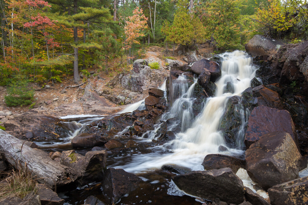
Take Duchesnay Falls, only minutes outside of North Bay, Ontario. It drew me north to explore not only its multiple cascades, but the pretty hiking trails on either side of them.
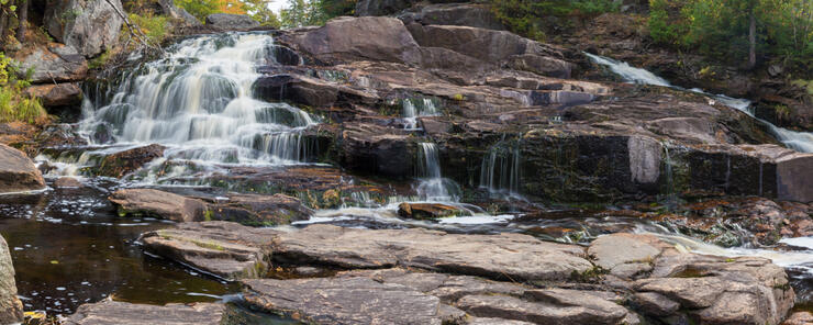
Duchesnay Falls is one of Northeastern Ontario’s most popular waterfalls, no doubt due in part to the fact that it is so accessible: the largest cascade is literally a few minutes’ walk off Highway 17, within easy view and earshot of the road. But starting at the end of these falls is literally just the beginning.
This is the beauty of Duchesnay, in fact. Just when you think you’ve “seen the falls,” you hike a few dozen yards upstream and find another one. And another. And so on and so on.
Each piece of the river system offers something a little different: some of the drops in height are dramatic and steep, like the western cascade that tumbles the final 8 – 10 metres to the bottom and where logs that have been swept downstream in the spring rush of high water litter the base.
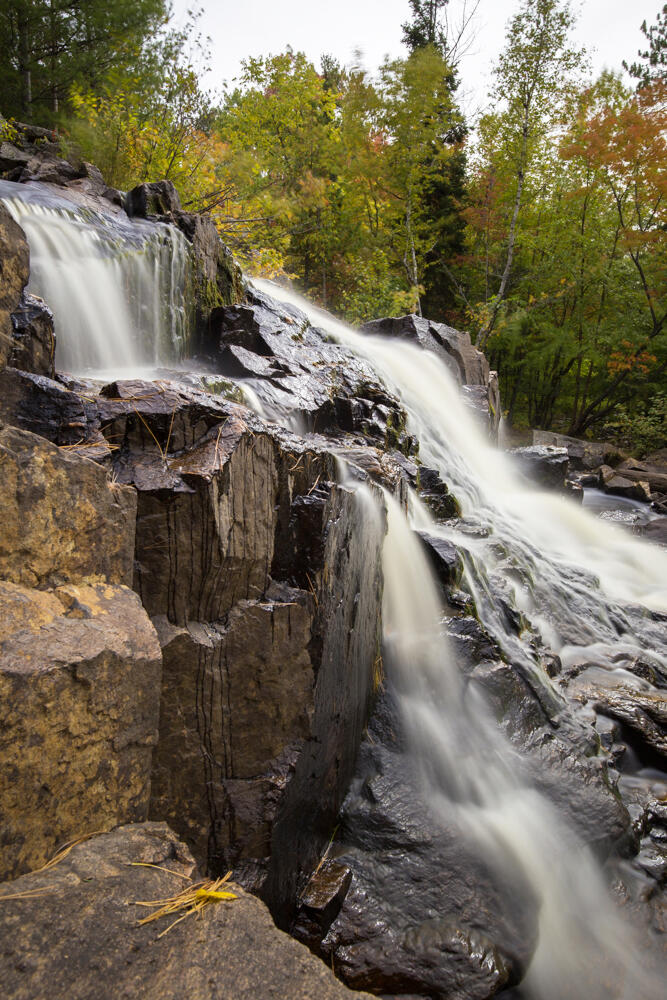
Higher upstream, water flows over a flatter “staircase”10 to 20 metres long, eventually spilling over a steeper edge to collect in a pool before continuing downstream. It’s easy to see how on a hot day, that pool would look temptingly refreshing but be aware that swimming is strictly forbidden here (at least that’s what the sign says!).
For hikers who are adventurous and sure-footed, it’s possible in low-water season [like when I visited in October] to walk across the flat rocks farther upstream before the water drops into the pool. It’s a very different story in the spring, however, when the water volume is high, and the river divides into two streams, one course rushing down to the steeper western cascade and the other fork taking a slightly flatter descent to the east.
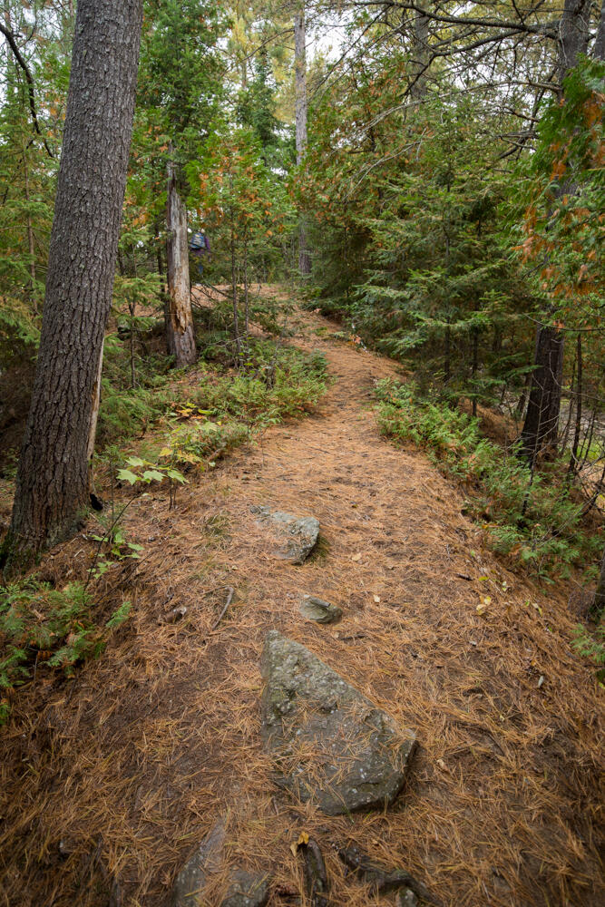
Hike farther north and the waters flatten out more, spilling over a series of shallower ledges where the flow of the creek seems gentler, and swirling pools of water form abstract designs along the shore, almost begging for a photo. Here, with the river narrowing and widening, twisting and turning between rocks and the banks overhung with trees, there are plenty of picturesque views all along its length for photographers.
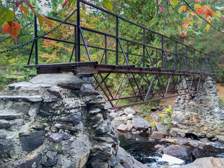
To capture its beauty from both sides, there is a sturdy metal bridge that crosses the river about a kilometre upstream from the base of the falls, and connects the eastern and western trails giving hikers the perfect place to complete a short loop back to the road and the beginning of the trail.
But Duchesnay Falls continued to draw me in, so I decided to continue along the eastern trail to a point farther upstream to the next bridge. Unfortunately, after another half kilometre or so up the trail, I arrived at the point where the bridge should have been, and discovered that it had been destroyed. Bottom line: Nature: 1, Man: 0
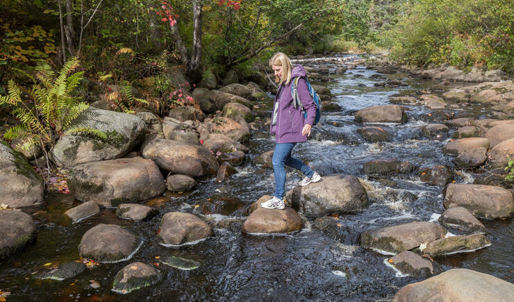
Luckily for me, the water was low so I was able to cross the river on the exposed rocks, climb the bank on the other side, and after a bit of confusion looking for the right path, hook up with the western trail. Hugging the river more closely than the eastern trail, and with more views and access to the water, I actually found this route to be prettier than the eastern one, and I followed it back to where I had begun the hike an hour or so before.
As it turned out, Duchesnay Falls proved to be much more than just a waterfall by the side of a road. Maybe it was the badly marked paths, my zig-zagging across dry rocks and wet river crossings, or even that broken bridge where I had to scramble up the rocks to continue my hike . . . but I definitely felt like I was on a mini-adventure hiking these trails.
And I couldn’t help but think that if waterfalls possess a character all their own, Duchesnay Falls was a little like Northeastern Ontario itself: ruggedly handsome, a little rough around the edges, but with a natural appeal and authenticity that made me want to go a little deeper to get to know it better.
There is a small parking lot on the north side of Hwy 17, about ½ kilometre west of the North Bay Regional Health Centre, and just east of the Hwy 17B exit.
Neither the eastern nor western trails are particularly well-marked from here, and there are no trailhead signs or markers to speak of. But the falls themselves are only 50 metres or so from the highway. So, to “find” the eastern trail, look for an opening at the western corner of the parking lot itself and follow the sound of the water on your left. To access the western trail, follow a short path running right next to the highway for about 20 metres until it crosses over the river, where you’ll find the base of the trail that takes you to the bottom of the lowest falls on your right.
You can also take a much longer route to the falls via a 20 km network of Nature Trails that begin at Nipissing University/Canadore College.
To get above the lowest level of the falls on either the eastern or western trails requires a somewhat steep climb with tricky footing, but once you get past that, both eastern and western trails are much easier. “Extra-curricular” activity like climbing on rocks or crossing streams ups the difficulty to 3 - 4.
(Be cautious and stay far from where the falls drop, as these rocks are very slippery when wet.)
None at the falls, but North Bay is only a few minutes down the road.
Just off Hwy 11 and less than 10 minutes from Duchesnay Falls is the Hampton Inn by Hilton, an attractive mid-rise hotel with modern amenities and a convenient location near shopping and several restaurants. Their king room was large and spotless with a very comfortable bed. Free WiFi was included, and the complimentary full, hot breakfast the next morning was more than enough to start the hike out on just the right foot!
Evaluated by an occasional hiker, 50+, reasonably fit with no mobility issues and who is able to walk 3-5 kilometres and climb 5-10 flights of stairs with no difficulty)
LEVEL 1: Easy. Trails are easy to follow, with good footing and gradual slopes, although surface would not be suitable for strollers. (May even have handrails, stairs or other assists in certain places.) Comfortable, closed footwear recommended.
LEVEL 2: Moderate. Trails have the occasional incline, with roots and/or rocks to step over. Running shoes with good tread and support, or hiking footwear recommended.
LEVEL 3: Moderate with some challenging areas. Trails may be rocky, requiring careful footing, with some steep inclines, or the trail could involve sustained uphill hiking for longer sections. Hiking footwear recommended.
LEVEL 4: Challenging. Requires agility and a good level of cardiovascular fitness as there may be steep sections, climbing over and around large boulders, roots, etc. May involve water crossings on rocks or logs with rough or narrow surfaces where balance is required. Hiking boots/footwear required.
LEVEL 5: Expert. (Basically a sustained Level 4 throughout most of the trail, with occasional sections that are easier) Hiking boots required.