The Ontario That Almost Was: The French River and the Georgian Bay Ship Canal
This waterway would have allowed Great Lake freighters to travel directly from Lake Huron to Montreal.
By Backroads Bill Steer
A professor at Canadore College and Nipissing University, as well as the founder of Canadian Ecology Centre in Mattawa.
April 12, 2023
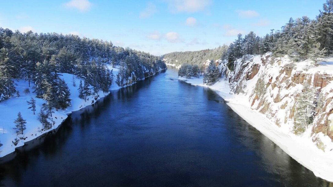
As you cross the largest snowmobile bridge in the world on the French River, consider the magnificent view. At one time, if history had become reality, you might be looking at ocean-going freighters!
It's difficult to pinpoint events that changed the course of history. Generally, many series of smaller events lead to momentous results. Never mind Northern Ontario, Canada would be a different place if the Georgian Bay Ship Canal had become a reality.
Ships the length of two football fields laden with grain from the prairies using the French River and Lake Nipissing? This vision at one time almost became a reality. Highway 69 may not have become a reality.
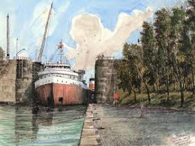
The proposed Georgian Bay Ship Canal was promoted as a project with the magnitude of a Panama Canal. This waterway would have allowed Great Lake freighters to travel directly from Lake Huron to Montreal.
As early as 1837, pre-Confederation, the Family Compact members of the Assembly of Upper Canada ordered a survey of the possible route. The War of 1812 was still fresh in the minds of the politicians and an inland waterway would skirt American influence.
Canada's first Prime Minister, Sir John A. Macdonald, recognized the potential of the project: "The Ottawa Ship Canal and the Pacific Railroad must be constructed and no voice should be raised against the great national work which would open the western states and the colonies to the seaboard.”
There were a number of advantages claimed for the proposed ship canal. For one, it was the shortest route from the upper Great Lakes to the ocean harbour of Montreal.
The Way
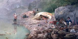
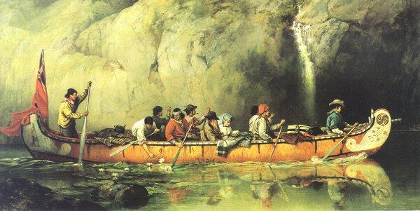
The surveyed waterway was essentially a scheme to canalize a number of rivers and lakes which exist along the old voyageur fur trading route of the French, Mattawa and Ottawa Rivers.
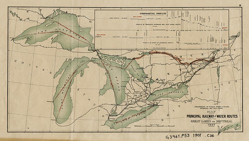
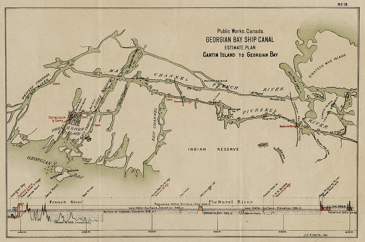
In 1904, the Department of Public Works was instructed to undertake a detailed field study of the route. The finished report of 1907 included a geological survey of rock formations, depth soundings of Lake Nipissing and engineering details of dams and canals. The original 600 page document contains a wealth of detail and gives evidence of an impressive study. The navigable waterway was estimated to be 70 kilometres long. The French River, including the creation of a lock and dam at the Chaudiere Rapids, would be an important bridging point which would allow the lake level to rise. This was necessary to accommodate ships that would have a draft of almost seven metres deep. The high steel gates, at the Big Chaudiere Dam on the French River, were designed in preparation for such a canal. Take a look this summer as you travel by boat or canoe through the Upper and Lower French River.
From the report, the engineers stated that a total of eight single and three double locks were needed to connect the various bodies of water. There would have been 11 changes in water levels ranging from three to 19 metres. In conclusion, the report stated, "...the probable cost of a deep waterway can be established for $100 million...the work taking 10 years to complete."
The chief engineer for the project promised that a "630 ft. (approximately 200 metres) freighter, moving at 12 miles per hour could navigate the entire distance of the passage in 70 hours."
Panama Canal
What we fail to realize when looking at this project, is that the magnitude was on the scale of the Panama Canal. The Welland Canal would pale in comparison. The Georgian Bay Ship Canal was one way to foster nationalism and an economic response to the demands of the new frontier, the prairies.
With the movement of cattle, grain, lumber and minerals through the Nipissing Passageway, a significant economic impact would have been created. A new port on Georgian Bay would have become the logical location for various processing plants. Goods manufactured in the area would have been transported to lucrative Southern Ontario markets.
The mega project's demise can be attributed to the might of the powerful railway conglomerates of the day that had their own visions of transportation. The technology to construct the plan was in place, but the railway companies thought it was best to lay down railway tracks, rather than try to blast through the Canadian Shield. Canals that had previously been constructed, throughout North America, were not turning profits. It would have taken billions of dollars. Another reason, overlooked by the early surveys of the 1850s, was identified in the fieldwork of 1906. The immense physical changes were great, not unlike the scope of the James Bay power project.
Apart from practical considerations, the political ramifications certainly were overwhelming. The competition between Toronto and Montreal as Canada's leading centre, was a determining factor in turning support away from such a project. No project that would benefit the development of Montreal would ever be allowed.
In 1953, work began on the St. Lawrence Seaway. It was a longer distance than the Georgian Bay Ship Canal and involved much American ownership. The dream of a once, navigable waterway, from Lake Huron to Montreal was dead.
Don’t miss this amazing display of the fascinating history and geological features of the French River! You can weave your way through time as you experience the life of early Aboriginal people, explorers, missionaries and voyageurs.
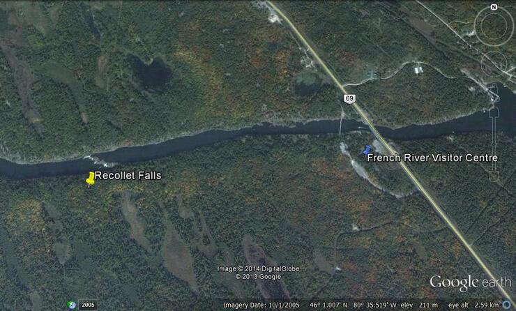
Find a souvenir at the Centre’s shop, see a spectacular view of the French River gorge and take the trail to the scenic and historic Recollet Falls. (The snowmobile bridge has a span of over 300’ and rises to 50’ above the French River. )
The Visitor's Centre (N46° 01’ 00.8” W80° 35’ 01.6” or WGS 84 Zone 17 T E 532220 N 5096007) is located on the west side of Highway 69, 80 km (50 miles) south of Sudbury and 95 km (60 miles) north of Parry Sound. It is a four-season destination, a great place to trailer to and unload your snowmobiles from; the parking lot is maintained throughout the winter. OFSC trail C; go to www.ofsc.on.ca - you can purchase GPS tracks online. Or take your snowshoes, Recollet Falls is just over a kilometre to the west, a must-see in the winter or any time of the year.
has a passion for Northern Ontario and the great outdoors.
He is the founder of the Canadian Ecology Centre and remains as the General Manager/Head Master of one of Canada’s leading environmental education centres. It is based on the CEC’s M.A.D.E. principle – Make A Difference Environmentally. He also developed the national geomatics certification program.
He is Back Roads Bill on the CBC. He holds degrees and diplomas from Laurentian University, Nipissing University, McMaster University and Durham College.