Timmins: The Complete Guide to Hiking & Biking Trails
Explore hundreds of kilometres of trail systems in one of Ontario's premier wilderness destinations!
By Tourism Timmins
The City with a Heart of Gold offers year-round beauty, history, and small-town charm.
April 12, 2023
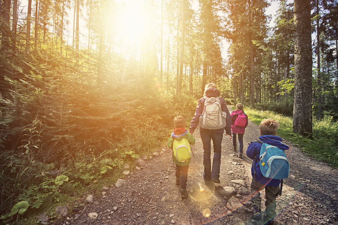
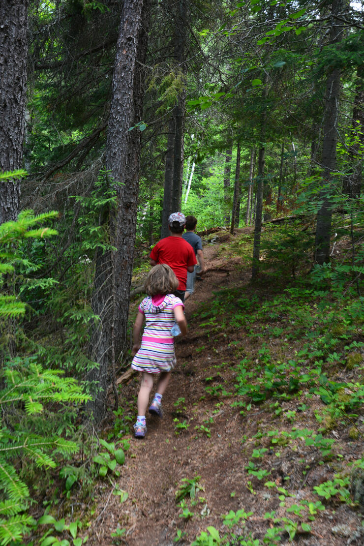
Timmins has a lot to offer the outdoor enthusiast! There are hundreds of kilometres of Northeastern Ontario wilderness trails to explore in and around their city - check out the list below! There are also incredible snowmobile trails and the Porcupine Ski Runners to check out for winter activity.
Archie’s Rock
Archie’s Rock is an interesting geological formation that dates back to the last ice age when a number of huge boulders were deposited on top of one another and in the middle of a dense forest. Scientists have suggested that these rocks, and the rock formation itself, are directly related to melting glaciers. Leave your vehicle on Little Star Lake Road near Highway 101. Hiking or biking, the trip requires a 1-km walk to the rock formation.
Route: From Little Star Lake Road to Archie’s Rock
Trail Length: 3 km
Level of Difficulty: Easy walking but more difficult climbing the rocks at the end
Seasons: All
Bart Thompson Trail
Walkers can park their cars at Legion Drive and follow the trail as it enters a spruce/pine forest. A short distance off the trail, you will find evidence of early geological forces that shaped the landscape and produced the gold-bearing rock directly beneath your feet. The return trip can be made using residential roadways or connecting to the south loop of the Bart Thompson trail that winds around Porcupine Lake.
Route: Loop from Legion Drive, South Porcupine to Government Complex in Pottsville
Trail Length: 10 km
Level of Difficulty: Easy walking
Seasons: All
Bridge to Bridge
This trail follows the Mattagami River to the Lafleur Bridge on the west side and returns to Mattagami Park on the east side of the river. Exotic wildlife, such as elk, can be seen in fenced-off paddocks at Cedar Meadows Resort on Norman Street.
Route: From Mattagami Bridge on Algonquin to Lafleur Bridge
Trail Length: 6 km
Level of Difficulty: Easy walking
Seasons: All
Circle Timmins
This trail will take the walker or cyclist around the periphery of the old town of Timmins.
Route: Loop starting from Terry Fox Walk on Pine Street South
Trip Length: 13 km
Level of Difficulty: Easy walking on established trails
Seasons: Spring to fall
Gillies Promenade
The Gillies Lake Conservation Area is the location of the most popular walking trail in Timmins. It is well-lit at night and access is possible from many points around the lake. There are two available parking lots: off Brunette Road north of Highway 101 and off Highway 655 about 1 km north of Highway 101.
Route: Around Gillies Lake
Trail Length: 2.5 km
Level of Difficulty: Easy walking
Seasons: All
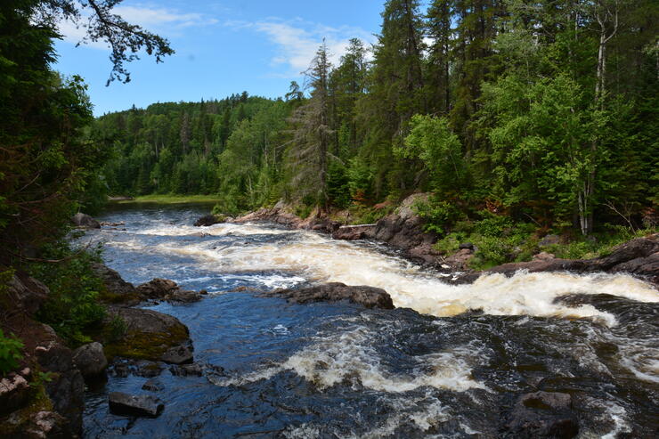
Along the High Falls route.
Grassy River/ High Falls
High Falls is a series of rapids and waterfalls with a total drop of about 40 metres. Grassy River was the site of river runs in the early days of the timber industry. Logs were floated down from Peterlong Lake further upstream to the mills in Timmins. The trail is often used by ATVs in the summer and snowmobiles in the winter.
Route: From Dalton Road to High Falls
Trail Length: 12 km one way
Level of Difficulty: Easy walking but a long trip for one day
Seasons: All (cross-country skiing in the winter)
Hersey Lake Trails
This is an extensive trail system throughout the Hersey Lake Conservation Area with many branches that make every outing a new experience. In the summer there is good swimming at Hersey Lake, the central hub of the trail system. A picnic area and shelter along with washroom facilities can be found there.
Route: From Highway 655 to Hersey Lake
Trail Length: 11.5 km
Level of Difficulty: Easy walking or biking with a few hills
Seasons: All (cross-country skiing in the winter)
Ivanhoe Lake
Walk over ground that was once the bottom of Ivanhoe Lake and now exposes a quaking bog, viewable from a platform with an interpretive panel. Another trail leads up and over esker ridges, passes beaver lodges and follows the shore of Saw Lake.
Route: Quaking Bog, Saw Lake and Teck Lake
Trail length: 4.6 km
Level of Difficulty: Easy to moderate
Season: spring to fall
Kettle Lakes
The park is located about 37 km east of Timmins. The route is mainly through jack pine forest with stretches of poplar and birch trees. The trail is fairly flat with some gentle hills along the way. Side trips can be made through the campground roads. Island Lake Campground is a beautiful region with an excellent swimming beach.
Route: Loop around Kettle Lakes Provincial Park
Trail Length: 14 km
Level of Difficulty: Easy biking on park roads
Seasons: Summer and fall
Nickie’s Trail
Nickie’s Nature Trail is an interpretive trail with podiums along the way describing the flora and fauna, with periodic rest stops, two areas with comfort stations and picnic tables, and a gorgeous viewing platform at Sunset Bay. There are three trail loops of varying lengths to suit everyone’s walking pleasure. This trail was established for all of us to develop and enjoy in memory of the late Nicole Duciaume-Poan – a Timmins-area native. It is hoped that the same love and respect that Nickie had for nature and this trail, which she walked, will grow in each of us.
Route: Loop around Little Star Lake
Trip Length: 3 trail loops: 1.6 km, 9 km, and 1 km
Level of Difficulty: Easy to moderate
Seasons: Spring to winter
Porcupine Lake Trail
Part of the Bart Thompson Trail system. Access is from any point around the lake. Most of the trail is along a wooded path near the water although roads are incorporated at the north end through Porcupine and Pottsville. Along the trail is the Whitney Cemetery at Deadman’s Point, a historical point of interest where over 40 people were buried after the famous fire of 1911 wiped out the community.
Route: Loop around Porcupine Lake
Trail Length: 8.5 km
Level of Difficulty: Easy walking
Seasons: All
Ross Stringer Memorial – Rotary Trail
This is a walking/bicycle trail that connects the two communities of Schumacher and South Porcupine. The trail wanders through a mixture of trees ranging from poplar to white spruce to black spruce and, in the higher elevations, jack pine. It is relatively flat with some hilly sections.
Route: Loop from South Porcupine to Schumacher
Trail Length: 8.5 km
Level of Difficulty: Easy walking/biking with a few hills
Seasons: Spring to fall
Scout Rock Trail
In the winter, this trail is used by walkers and skiers. In the spring, summer and fall, cyclists and walkers travel its pathways. The trail wanders through low-lying areas with marsh marigolds in the spring to higher spots that were once used for farming, and finally through a ravine opening onto College Street across from Denise Park. In the spring the cherry blossoms make for a beautiful display on the trail just east of the hospital.
Route: From Timmins District Hospital to Denise Park
Trail Length: 4 km
Level of Difficulty: Easy walking
Seasons: All
Terry Fox Waterfront Trail
This trail follows an old rail bed that once connected the downtown with local sawmills. Popular with walkers and cyclists, the trail ends at the river waterfront, part of the Mountjoy Historical Conservation Area that was set aside following the disastrous flood of 1960.
Route: From Pine Street South to Mattagami Waterfront
Trail Length: 2.5 km one way
Level of Difficulty: Easy walking
Seasons: All
Showing 'Edited Body' is no longer supported.
About Tourism Timmins
The City with a Heart of Gold offers year-round beauty, history, and small-town charm. Come visit and discover friendly people and great Northern hospitality. Find out more at Tourism Timmins.