Complete this 2-minute survey to be entered to win a gift basket stuffed with goodies from Northern Ontario—valued at over $1,000! For U.S. residents only.
10 Best Ontario Snowmobile Destinations for Staging Day Loops
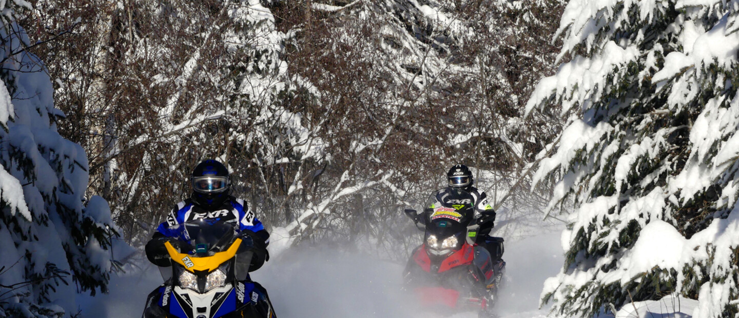
Avid snowmobiler Craig Nicholson on why stay ‘n’ play rides are your best bet for snowmobiling this winter. And why day loops are the best way to get out on the trails.
By Craig Nicholson—The Intrepid Snowmobiler
Craig Nicholson is an International Snowmobile Hall of Fame powersports journalist, who specializes in writing about snowmobiling.
September 26, 2024
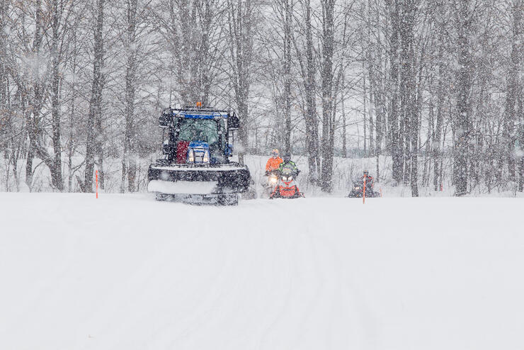
Many snowmobilers from Ontario areas like the Golden Horseshoe and 401 Corridor are eager to get out and ride this winter. Fortunately, the Ontario Federation of Snowmobile Clubs (OFSC) has continuously reconfirmed its commitment to delivering the best possible snowmobiling experiences this season–and that starts with getting trails ready to ride across the province’s snowbelt. So with the cooperation of Old Man Winter, snowmobile trails will be available to ride wherever there’s snow this winter.
Groomer starts its nightly run at the tail end of a snowstorm. Credit: Photo by Martin Lortz
Stay ‘n’ Play Options
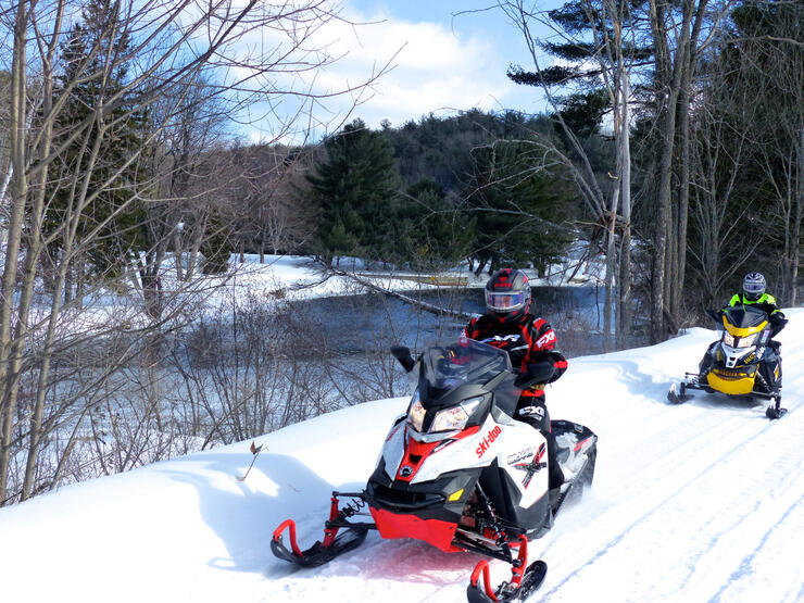
To assist with this transition, I’ve published a list of Snowmobile Trail Riding Tips. Among many other considerations, it concludes that a smart choice for ride plans this winter is to “stay ‘n’ play.” That is, shorter getaways, riding day loops out of one location. Ontario offers countless opportunities like this for those who can’t ride from their own backyard, and what follows are snapshots of some of my favourites from recent winters.
I’ve listed them alphabetically. Each one includes trail accessible lodging, well-maintained trails and enough different day loops to fill a 3-day getaway. If you have more time than that, try doing two of these destinations back to back. Do one, then trailer on to the next for another three day adventure. There are also plenty of other great Ontario snowmobiling options to discover, so you’ll have no shortage of interesting choices this winter!
Bancroft & Area
Riding north from Bancroft beside the York River. Credit: Photo by Craig Nicholson
The Town of Bancroft (pop. 3,880) is located at the juncture of Highways 28 and 62. It’s a two-hour drive north of Highway 401 at Belleville. Bancroft is also where the grooming operations of the Old Hastings Snow Riders, Maple Leaf Snow Skimmers and Paudash Trail Blazers converge. So from Bancroft, snowmobilers can choose to ride three different trail systems, each with more than enough trails for a great day’s ride, including snow tours such as the Bon Echo Loop and the Hastings Highland Tour.
Bon Echo Loop (257 km in District 2) – B106E south to E east thru McArthur Mills (fuel), to 1009 south, to E1010 south thru Cloyne (food & fuel), to 1009 west, to 960 west, to 961 west, to E106 north past Gilmour (fuel), to B106E into Bancroft.
Madawaska Highlands Loop (220 km in District 6) – B106E north from Bancroft, to E109 east to Barry’s Bay (food & fuel), to B102 & B west to Whitney (food & fuel), B106E south into Bancroft.
Southwestern Loop (150 km + added trail options in District 2) – B106E north to 179 west, to E109 west, to E south thru Harcourt (food & fuel), to E110 north, to 612 north, to 179 east, to B106E south into Bancroft.
Park ‘n’ Ride Locations: Bird’s Creek (where TOP B108E crosses Highway 62 just north of Bancroft). Old Hastings clubhouse (at L’Amable on Highway 62 south of Bancroft). Maps Needed: OFSC Districts 2 & 6 Tourism Region: Ontario’s Highlands, Bancroft & District Chamber of Commerce Snowmobile Ride Planner: Big Time in Bancroft
Cochrane & Area
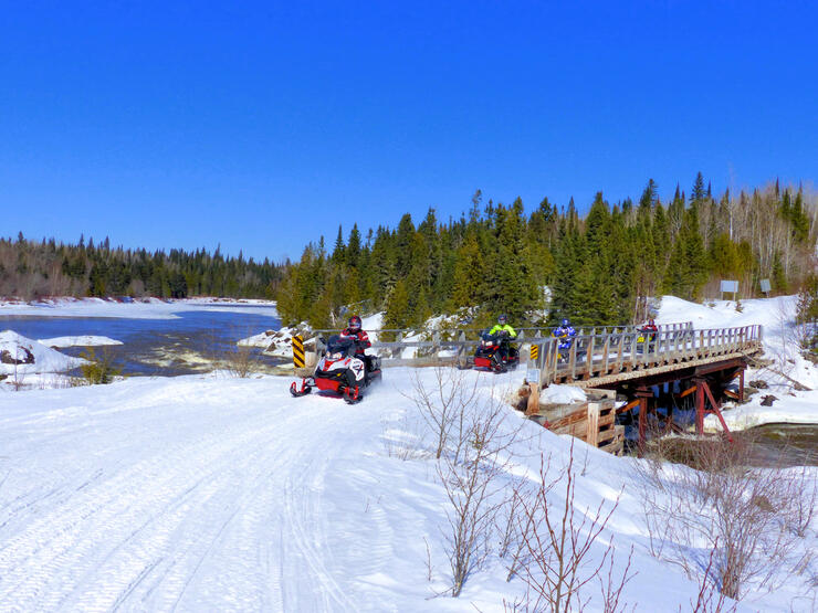
Crossing the Frederick House River on Trail L103 south of Cochrane. Credit: Photo by Craig Nicholson
The Town of Cochrane (population just over 5,000) is positioned due north from Toronto on Highway 11. It’s about a 4-hour drive from North Bay and 7 to 8 hours from the Greater Toronto Area on good highways all the way. What’s more, Cochrane is big enough to have all the services and amenities you need. But small enough that it’s friendly and easy to get around.
Cochrane anchors the eastern end of the popular Northern Corridor and offers plenty of snowmobile-friendly lodgings and eating choices. That’s one good reason the town is also right up there on the short list of Ontario’s most reliable snow destinations. Another is that it’s riding season usually stretches from December to April. So if you’re looking for the best snowmobiling Ontario has to offer, Cochrane is as good as it gets. This status is in large part thanks to the yeoman’s work done by the Polar Bear Riders Snowmobile Club.
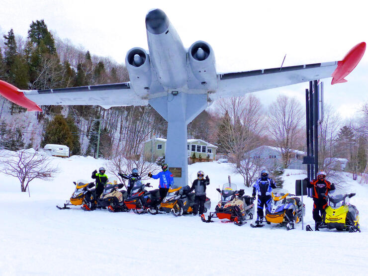
Photo op at Haliburton’s icon Royal Canadian Legion Avro CF-100 Jet Fighter Memorial beside Trail B103. Credit: Photo by Craig Nicholson
As part of Ontario’s popular “cottage country”, the Haliburton Highlands are located due south of Algonquin Park. At the edge of the Canadian Shield, the area is sandwiched between Muskoka to the west and east of the Ottawa Valley.
Tow your sleds about two hours northeast of the Greater Toronto Area. This will bring you to the village of Haliburton. Not only does this vibrant cottage town offer access throughout the Haliburton Highlands on trails maintained by the Haliburton County Snowmobile Association. But it also links to the eastern parts of Muskoka, the northern end of the Kawarthas and northeast into the Madawaska Highlands. Alternatively, you can book a day ride in the nearby Haliburton Forest & Wildlife Reserve, Ontario’s only private trail system.
Where To Ride From Pinestone (Note: other trail options can make rides shorter or longer)
Northwest to Muskoka (270 km in Districts 6 & 7) - 7 east to B103 north, to B west, to 16 north, to 64 west, to D101B north, to 77 west thru Dwight (lunch), to 78 north, to D101B south, to 61 south on Raven Lake stake line, to 64 west, to 11 south, to B east, to B103 south to 7 south back to Pinestone.
Northwest to Whitney (333 km in Districts 2 & 6): 7 east, to B103 north, to B east to Whitney (food & fuel), to B106E south to E109 south, to E south to Harcourt (food & fuel), to E108 west, to B103 north to 7 west back to Pinestone.
Shorter Family Ride Options
Around Haliburton loop –B103 south, to B112 west thru Minden (food & fuel), to B east, to B103 south, to 7 back to Pinestone.
Fenelon Falls & Back – 7 east to B103 south (rail trail) to Fenelon Falls for food & fuel.
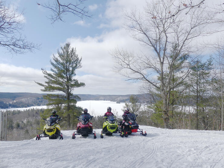
Dorset Lookout Tower north of town overlooks the Lake of Bays. Credit: Photo by Craig Nicholson
This region has become iconic as Ontario’s ultimate cottage country playground. No wonder then, that this notoriety has also made Muskoka a magnet for winter lovers in search of memorable snowmobiling.
Of course, no sledding destination can be credible without good snow and trails. And Muskoka can deliver both. Positioned just east of Georgian Bay, the region is in a lake effect snowbelt. Moreover, its numerous tourism opportunities make Muskoka an ideal location for couples and families. Especially those looking for snowmobiling getaways that also include other social, cultural and winter activities. What’s more, Muskoka is tops for places to rent a sled and gear or book a guided snowmobile ride.
Northeast Muskoka was where we did most of our riding. This area includes Baysville, Dorset and Dwight, and extends north to Kearney. Benefitting from the highest elevation in Muskoka and many old resource roads, this area east of Lake of Bays typically tends to get started earlier, have more snow, and go later than the others.
Northern loop (140 to 250 km depending on route around Huntsville) with food & fuel at Dwight, Kearny, Huntsville.
Park ‘n’ Ride Locations: Dorset (Raven Lake landing, Hwy 35), Gravenhurst (Gull Lake & Muskoka Wharf), Huntsville (519 Etwell Rd), Port Sydney (Smith’s Ultramar, Hwy 11) Maps Needed: OFSC District 7 Tourism Region: Ontario’s Highlands, Muskoka Tourism Snowmobile Ride Planner: Snowmobile Muskoka
North Bay & Area
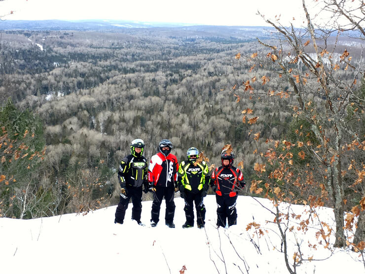
Panoramic view from Redbridge Lookout on Trail NB 304. Credit: Photo by Craig Nicholson
It’s almost as if the huge hill just north of town on Highway 11 marks the final transition between south and north. That makes North Bay a favourite launching point for those doing saddlebag rides to points farther north or for the RAN (‘Round Lake Nipissing) Tour.
But it’s also a great sledding destination in its own right. It offers enough day ride loops to satisfy day loop visitors who go to snowmobile North Bay. Less than 4 hours north of the Greater Toronto Area, the City of North Bay is straight up Highway 11. Far enough to feel like you’ve arrived on Northeastern Ontario snow, but close enough that getting there’s easily doable for a weekend getaway.
With many big city amenities, this city of 51,500 is comfortable embracing winter, including downhill skiing at Laurentian Ski Hill. Local trails lead directly to numerous hotels and services, And also to hundreds of kilometres of groomed trails to explore and loop opportunities to discover.
Explorers Snow Tour (250 km): Circle to Mattawa (food & fuel) via A east and returning by A112A west.
Loop #2 (250 km): NB710 across Lake Nipissing to pick Up C110D south into Port Loring (food & fuel), returning by D102C north.
Loop #3 (150 to 205 km): A/D north for 2 options. One is a 150-km roundabout via A102Q east, NB308 south & BF201 south that’s perfect for a part day ride before trailering home. Two is A/D north to D to Marten River (food & fuel), returning on A104D south, D east and A/D south.
Riding staked fields through farm country near Orillia. Credit: Photo by Martin Lortz
Orillia (population: 30,000) is located on Highway 11 at the north end of Lake Simcoe. That’s about 90 minutes of trailering north of the Greater Toronto Area. Normally its location benefits from lake effect snow coming off Georgian Bay. What’s more, area trails offer a good mix of open field and forest riding. This includes some at the southern edge of the Canadian Shield. All in all, there are enough options to make your ride as long or short as you wish. In cooperation with the Orillia & District Snowmobile Club, Orillia provides an excellent snowmobile corridor through town via TOP B112B.
Visiting Sauble Falls on the Saugeen River Tour, Trail B108. Credit: Photo by Craig Nicholson
From Niagara Escarpment to rolling farm fields, you’ll find it all when you stage out of Owen Sound (pop. 22,000), for several day loops. Located at the base of the famous Bruce Peninsula, Owen Sound provides snowmobilers with small town hospitality. Then it adds big city amenities less than three hours from the western Greater Toronto Area. One of the pleasures of snowmobiling in the Grey Bruce region is the feeling of being off in the middle of nowhere. But really, you’re very close to everything.
Sledding the Ottawa Valley hill country. Credit: Photo by Craig Nicholson
Pembroke (population: 24,000) is located at the southeast corner of Algonquin Park along the Ottawa River on Highway 17. Conveniently, it’s little more than a four-hour drive from the Greater Toronto Area and only 90 minutes west of Ottawa.
Positioned in the heart of the beautiful Ottawa Valley, Pembroke is at the juncture of TOP Trails A and B. From here, the town offers excellent access to the Snow Country Snowmobile Region’s network of well-groomed and signed trails. What’s more, it’s centred in a major snow belt that extends from Whitney and Barry’s Bay in the west, through the Madawaska and Calabogie Highlands. And around “behind the Park”, the strip of territory sandwiched between Algonquin Park and the Ottawa River.
Northwest Ride (various loop possibilities ranging from 120 km riding only to Petawawa or to 380 km via Stonecliffe) – Ride A north behind Algonquin Park to Rolphton or Stonecliffe for gas and then explore the 100-series club trails back to Deep River. Return to Pembroke on A.
Western Ride (226 km) – Travel B west to B102 through Barry’s Bay and Killaloe. Then head north on B101A to 122 back to Pembroke.
Southeast Ride (various loop possibilities ranging from 177 km to 250 km riding full route as detailed) – Sled A south to 119 to Eganville (food & fuel). Then take E102 south to 108 east to B101A to 114 to B101Q west to B to 106 to 116 to B back into Pembroke.
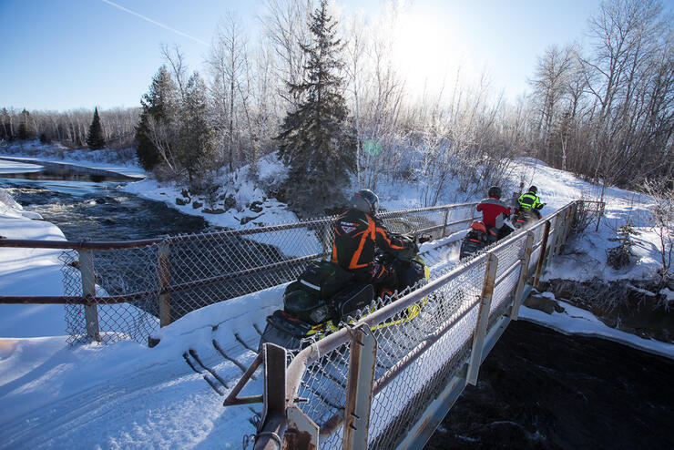
One lane bridge crossing east of Sudbury. Credit: Photo by Martin Lortz
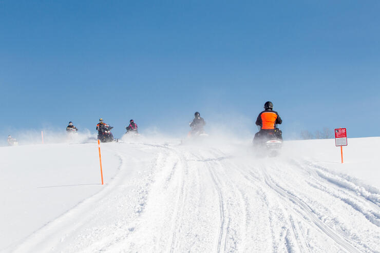
With a population of about 165,000, The City of Greater Sudbury is the largest urban centre in Ontario completely surrounded by snowmobile trails. The so called “Nickel City” is located less than a four-hour trailer drive north of the Greater Toronto Area on the mostly four lane Highways 400 & 69. So, the 390-kilometre drive to Sudbury from points south is a breeze.
Greater Sudbury is also a popular snowmobiling destination in its own right. It’s not surprising with a city of this size that trail routing and access is mostly around the periphery and that the most trail accessible motels are on the outskirts. Due to some recent trail closures, the best locations for best trail access to every snow tour around Sudbury are probably Chelmsford or Lively, both on the west side of Sudbury. From them, 2,000 kilometres of trails, spoke out to places like Espanola, Killarney and Wanapitei Lake. So, there’s plenty of great day riding to be had staging out of the Sudbury area. This includes four premier snow tours, designated loops that make area exploring and adventure even easier.
Chiniguchi Wolf Loop (210 km + return distance to lodgings) – This snow tour is positioned northeast of Sudbury. Essentially, its trails (C, C105 & C206D) circle the largest area water body, Wanapitei Lake. The C trail on the west side passes by towns like Capreol and Hanmer where services are available. Note that there are no services on the north section of this loop, with fuel, but not food available at the Sportsman’s Lodge on Lake Kukagami on the east side.
Cartier Moose Loop (225km) – Located northwest of Sudbury, this snow tour follows old logging roads through the Laurentian Highlands on trails D, C115D, C & C111D. On this loop’s west side, there’s fuel and food in Cartier and at Windy Lake Motel & Restaurant.
Rainbow Elk Loop (167 km + return distance to lodgings) - This snow tour extends southwest from Sudbury all the way to Killarney. Unlike the Cartier and Chiniguchi Loops, the Rainbow Elk Loop also involves some lake running, albeit on clearly marked and staked trails. Food, fuel and lodgings are available in Killarney at the Sportsman’s Inn.
Deer Loop (142 km + return distance to lodgings) – This snow tour is positioned west of the Rainbow Elk Loop. On route, there’s fuel and food outbound at Nairn and Espanola.
At the ice caves at the end of Trail AL 301 in the Almaguin Highlands. Credit: Photo by Craig Nicholson
There’s lots of snowy country along the 130-kilometre stretch of the 4-lane Highway 11 corridor between Huntsville and North Bay. It includes Sundridge, a village of less than 1,000 people on the west shore of Lake Barnard. The town is a great gateway to the Almaguin Highlands, a majestic, 8,000 square kilometre swathe of Canadian Shield wilderness that’s tucked away between Muskoka and Lake Nipissing.
This part of Ontario is sprinkled with rural communities, unspoiled lakes, mixed woodlands, rolling hills and rocky crags. So it’s perfect terrain for the nine snowmobile clubs in the area to deliver an excellent network of sledding trails for your Sundridge day riding.
Snowmobile South Loop (245 km) – C104D west to NN410 north to C105D east to NN400 south to C104D east to D south to AL301 (ice caves) to AL303 (Sand Lake, food & fuel) to D south to D101B south to D102B west to 95 north to D north to D123 north to D north to C104D west back to Sundridge.
Ride North Loop (260 km) – C104D west to NN410 north to NN415 north to C105D west to NN450 west to AR 550 west to D102C north (Port Loring or Restoule for food & fuel) to C110D north to D south to C105D west to NN410 south to C104D back to Sundridge.
RIde West Loop (254 km) – C104D west thru Magnetawan & Ahmic Harbour (food & fuel) to C101 south to C103D east to D east thru Sprucedale (food & fuel) and at Kearney take D123 north to AL302 east to AL303 to Sand Lake (food & fuel) to D north to AL300 west to D123 north to D north to C104D west to NN400 north to C105D west to NN410 south to C104D east back to Sundridge.
Park ‘n’ Ride Locations: Almaguin Highlands Information Centre, Sundridge - Corner of Hwy 124 & Albert St. Maps Needed: OFSC District 7, 10, 11 Tourism Region: Explorers’ Edge Snowmobile Tour Planner: Ride Sundridge
Plan Ahead and Double Check
No one can know for certain what conditions will be like in any of these destinations this winter, but typically, they are all great snowbelt places to ride. So make the best of it by planning ahead. Before you leave home, confirm the availability of trails and services on the OFSC Interactive Trail Guide and with local tourism offices and snowmobile clubs. Prior to leaving each morning, double check to reconfirm the status of each day’s ride so there are no last minute surprises. Be sure to follow the Ride Smart advice for socially responsible behaviours when interacting with each other or visiting trail accessible services and communities. Then go enjoy your Ontario trail ride!
Popularly known as The Intrepid Snowmobiler, Craig Nicholson is an International Snowmobile Hall of Fame journalist who specializes in recreational snowmobiling activities. Craig has snowmobiled in every region of Canada and many states. His one-of-a-kind tour book, “Canada’s Best Snowmobiling – The Ultimate Ride Guide”, chronicles his adventures, as does his website and Facebook page.