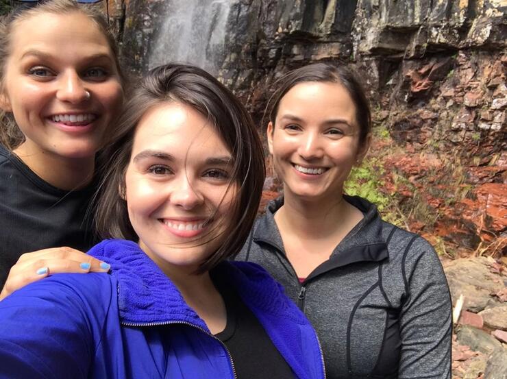
Growing up in such a rural part of Ontario, when it came to spending time with friends instead of a mall or movie theatre, we would usually be found on a trail somewhere. Now don’t get me wrong, we still love a good shopping mall—but living in Superior Country has always given us great access to so many beautiful hiking trails, waterfalls, and scenic views. So on Sunday, I made plans to catch up with my girlfriends and thought: what better way to do it than under the sun at the bottom of a waterfall?
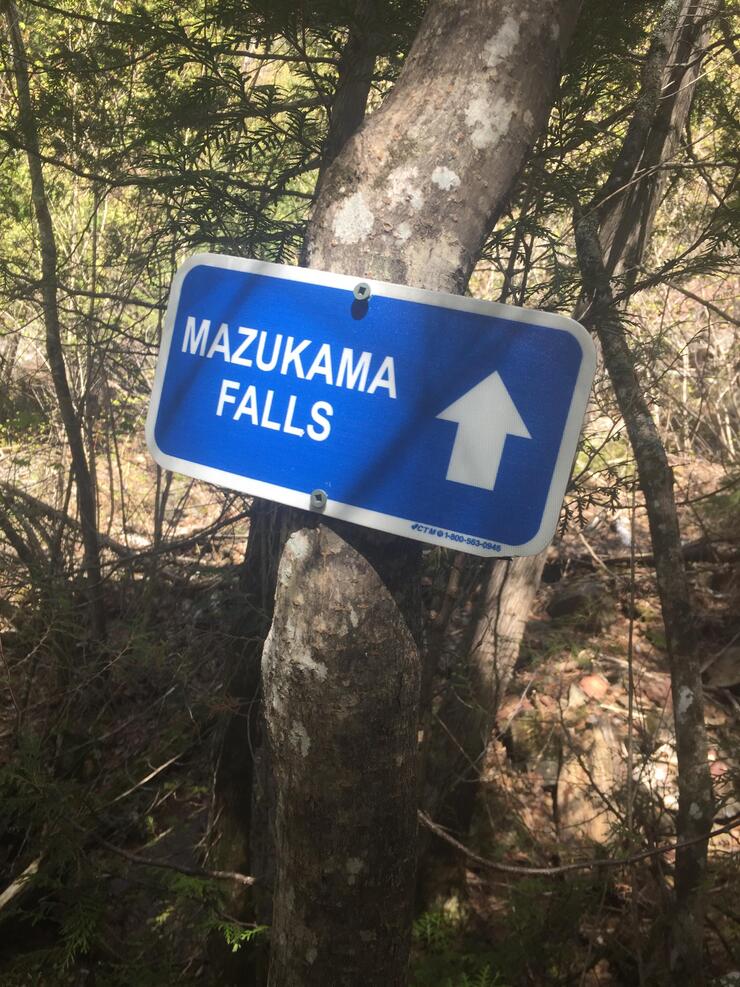
We wanted something that would be fun and good exercise, but wouldn’t take the whole day, as the “Sunday Scaries” were fast approaching. We decided on the Mazukama Falls Loop, but only up until the waterfalls, where we would have lunch, catch up, and then head back the way we came.
This trail is located on Highway 17, approximately 20 km east of Nipigon, Ontario. You drive down the highway, and once you’ve passed “Ozone Creek” there will be a gravel road (Camp 81 Rd.) on the left-hand side at the bottom of a large hill, which you will need to turn onto. Once you’ve turned onto the road, the trailhead is only about 200 m away. There is a large space where you can park your vehicles and get organized before taking on the trail.
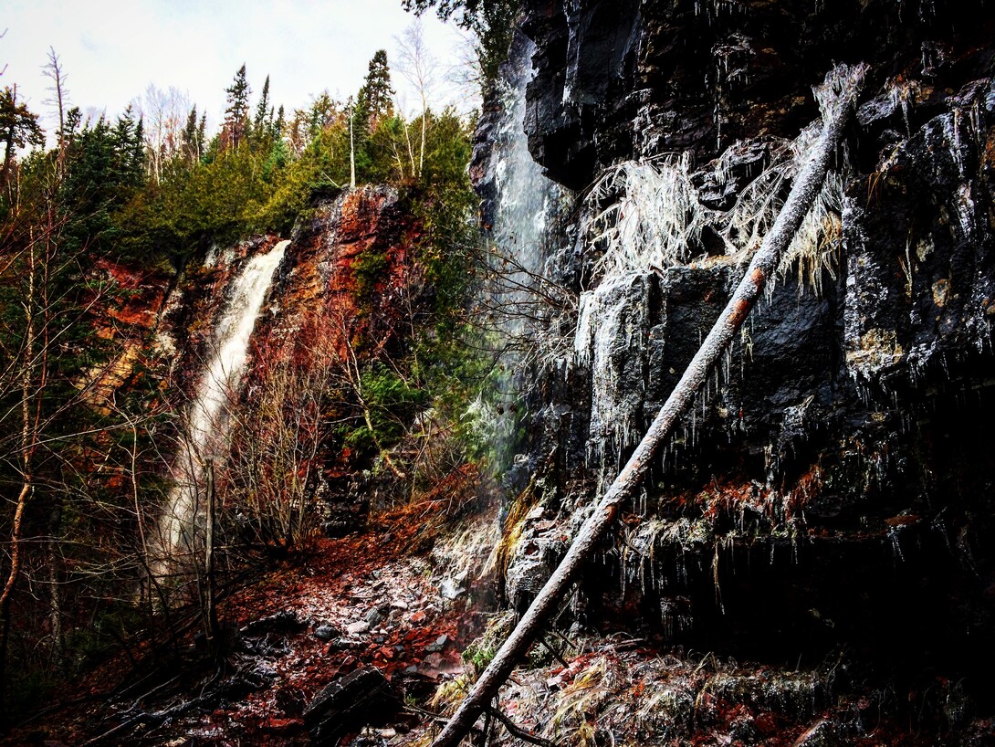
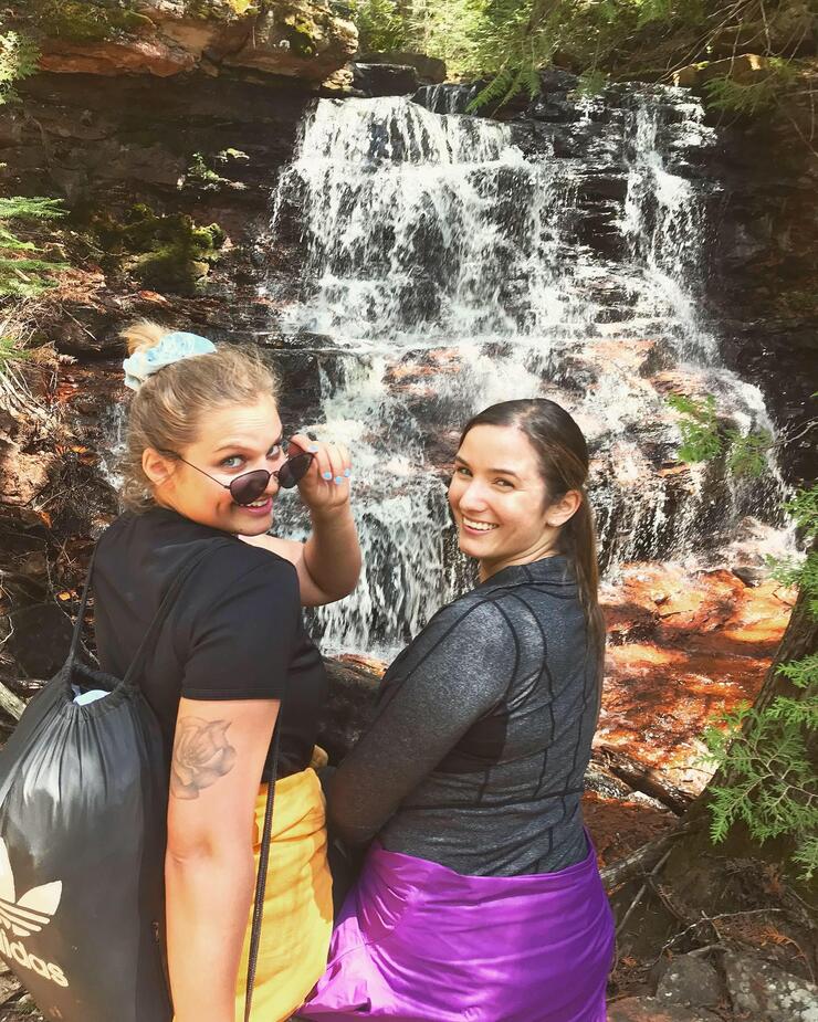
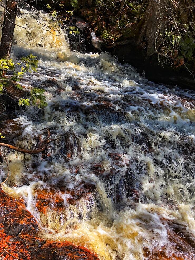
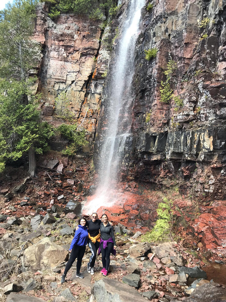
Now for anyone like us who doesn’t want to waste a good photo op (cough cough, Instagram moment, cough cough) this trail was perfect, because before reaching the gorgeous, 25-metre-high waterfalls, there are several smaller falls and cascading streams. To continue on the trail, you need to cross these streams, and there are multiple large logs perfect for you to climb on to get across.
I’m talking classic Dirty Dancing moment here, people! I just imagined Patrick Swayze on the other side, and it made the climb that much easier. I may have danced a little and almost went for a quick swim because I’m not nearly as coordinated as Jennifer Grey, but I tried. However, if heights and moving water aren’t your thing, there are other routes around the streams.
The trail is well maintained and has a lot of bright blue and white markers to guide you. On our way up, we stopped at every cute little mini-falls and every rock that we could perch on for a photo, and in total it took us about 45 minutes to reach the main falls. However, if you were to hike straight there, at a good pace, it would only take about 20-30 minutes.
When it comes to difficulty, I can only speak for the first portion up until the falls, as I have yet to do the whole loop (and when I do, you will be sure to hear from me). It is a gradual incline for the first half, and there are lots of loose rocks and logs to climb over. As you get closer to the falls it becomes steeper, and for some portions you need to climb using a rope. It depends on your physical abilities, but the average person would be completely fine; those who are less active, in their everyday life, may find it a tad more difficult.
It was a beautiful day, the sun was out, and as we sat, chatted, and ate our lunch, we cooled off with the mist of the falls spraying down over us. There are a lot of flat rocks to sit on and relax; however, if you are to visit them on a hot summer's day, you have perfect access to stand right underneath the waterfalls and cool off or take that social media-worthy “Sorry TLC, I chased waterfalls” picture. I like to do this closer to the end of July or beginning of August, when we reach the warmest days of our Northern Summer.
Showing 'Edited Body' is no longer supported.
About Casey Clearwater
Casey is a writer and photographer born and raised in Northern Ontario's Superior Country region. She has enjoyed travelling the world but her passion for home has always brought her back. Her love for the great outdoors has her exploring on her free time through hiking, fishing, hunting etc.