Top 10 Interesting Facts About Thunder Bay
Did you know these weird and wonderful facts about TBay?
By Bonnie Schiedel


Looking for a epic adventure? Head east of Thunder Bay (approx. 2.5 hr) and explore the Casque Isles Trail.
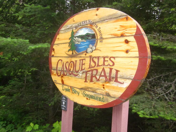
The trail follows the shoreline of the largest of the Great Lakes, Lake Superior, for 53 kilometres from Rossport to Terrace Bay. The Casque Isle Trail, part of the Voyageur Trail Association, is divided into five sections of varying lengths and degrees of difficulty.
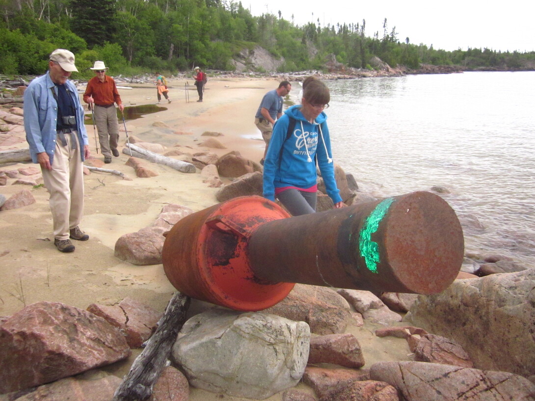
The Lyda Bay segment of the Casque Isles Trail is 6 km long and is said to be the most popular section of the entire trail. Setting out from the Aguasabon Gorge parking lot, the trail starts off on a well defined old bush road. After only a few hundred meters, we arrived at Danny’s Cove which, for some, would be a perfect place to pitch a lawn chair, blanket and picnic basket for the rest of the day.
The cove features a sandy beach and shallow water which will beg visitors to wade into or take a dip in the refreshing waters of Lake Superior. No one would blame visitors who are quite content to stay here and imagine it is their own private beach.
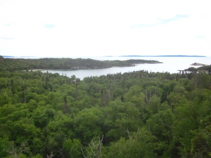
But there are so many more rewards for hikers who venture on. It seemed we would leave one beach, hike through a short section of boreal forest and then emerge on a completely different beach -- as though in a different land. The shoreline seemed to alternate from sand to boulder beaches, to rocky outcrops consisting of glacier carved, wind and wave eroded Canadian Shield bedrock.
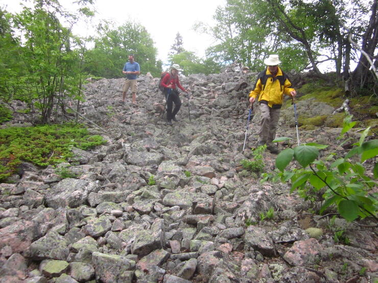
One of the most amazing features along this section of the Casque Isles Trail is the raised boulder beaches which are found hundreds of feet up and away from the shoreline of today’s Lake Superior. These beaches, which remain barren of plant life after thousands of years, reveal ancient shorelines of what was once a huge inland sea.
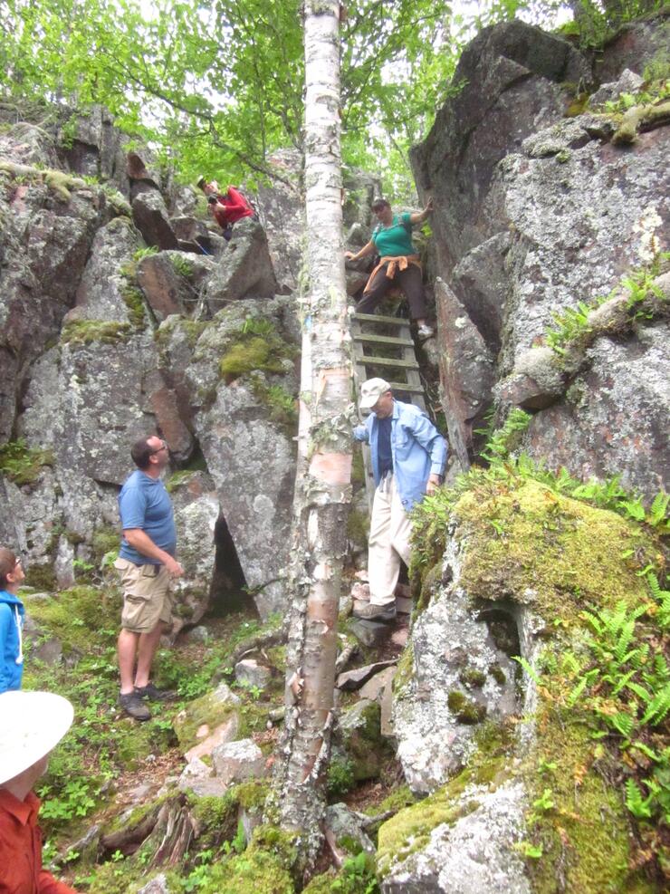
The trail includes a steep climb, with the help of some ropes, up a boulder strewn cliff to Lyda Bay Lookout and a gorgeous view of the Lake Superior shoreline to the east. Similar hidden beaches, coves and lookouts await hikers elsewhere along the Casque Isles Trail’s four other sections. Their distances range from six to 13 kilometres. Each can be accomplished as part of day hikes, but also offer enough features within a reasonable distance of their respective trailheads to make shorter walks well worthwhile for novice hikers or those just wanting to access some amazing views of Lake Superior’s diverse shoreline.
Other highlights to be found along the Casque Isles Trail include Indian Pictographs on the Mount Gwynne and Death Valley segments near Schreiber; and ancient stromatolites which are uniquely shaped rock fossils estimated to be about 2-billion years old. These can be seen near Flint Island on the Schreiber Channel section of the trail.
A brochure and maps for the Casque Isles Trail are available on the Schreiber & Terrace Bay websites.
Epic Adventures Hike Club holds monthly outings which everyone is welcome to join for a drop-in fee of $2.00. A schedule of upcoming hikes is available on their website.