
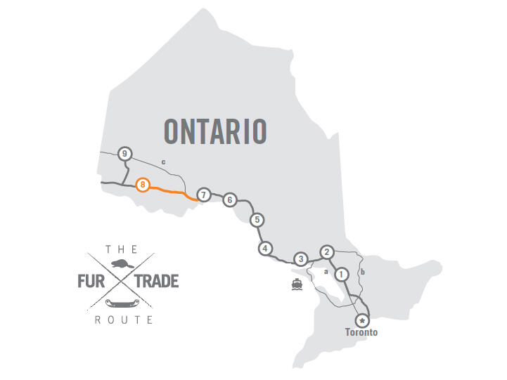
The Complete 2024 List of RV Shows in Ontario
Add these RV events to your calendar.
By Celeste Percy-Beauregard


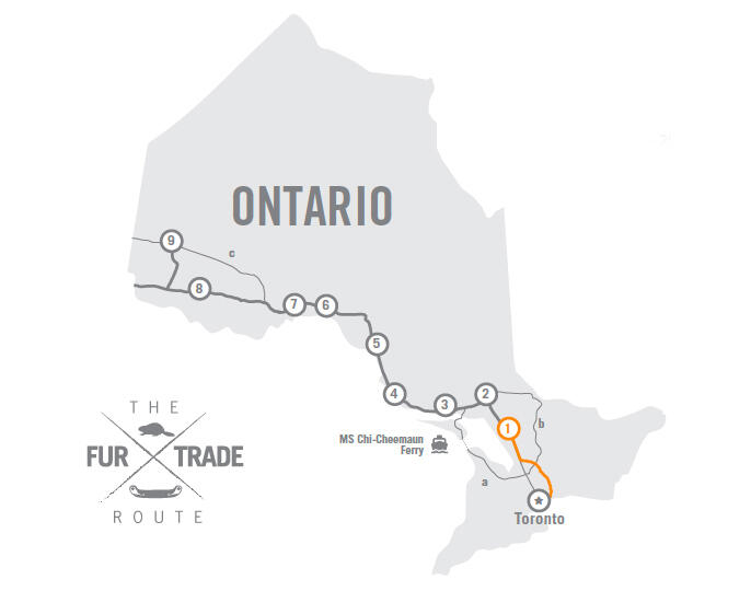
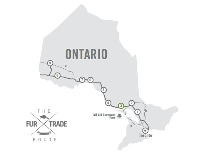
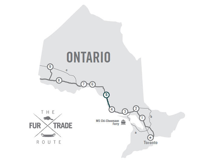
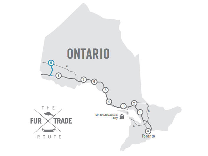
Just thre hours north of Toronto, near Perry Sound, Northern Ontario begins. It's here, on the edge of Georgian Bay, that cottage country gives way to the solid rock landscapes of the Canadian shield. And it's here the lucratic fur trade between the French, British, and Indigenous Nations eventually led to the founding of Canada.
This immense, rocky landscape is integral to Canadian history. Hundreds of Indigenous nations lived and worked here for thousands of years before French and English fur traders arrived to set up trading posts. (For a great primer on how the fur trade shaped Canada, check out the award-winning Bush Runner: The Adventures of Pierre-Esprit Radisson). These trading posts were followed by railroads, and eventually highways--blasted through rock cuts and running along rugged shorelines, connecting resource towns to the outside world. Driving through Northern Ontario is a drive through Canada's historic past.
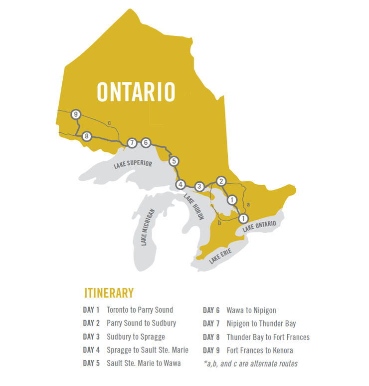
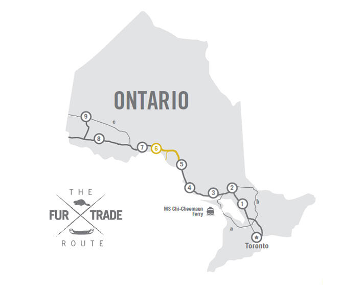
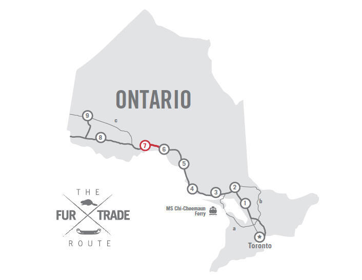
While originally travelled by foot and canoe, this route is now a lesuirely and historic 9-day drive from Toronto to Kenora. From there, RVers can travel on to Winnipeg and beyond, or head back to Southern Ontario. Read on to learn more about planning your trip.
While the 20-hour, 1,850 km drive from Toronto to Kenora can be done easily in 9 days, many travellers take two or three weeks to do the route and enjoy all the sights along the way. A month is recommended if you're doing a round trip. Don't forget all the additional kilometres you'll travel to campgrounds, and for shopping and sightseeing. Then stretch your legs with some day trips hiking in the beautiful scenery--much of it unchanged since the fur trader's time.
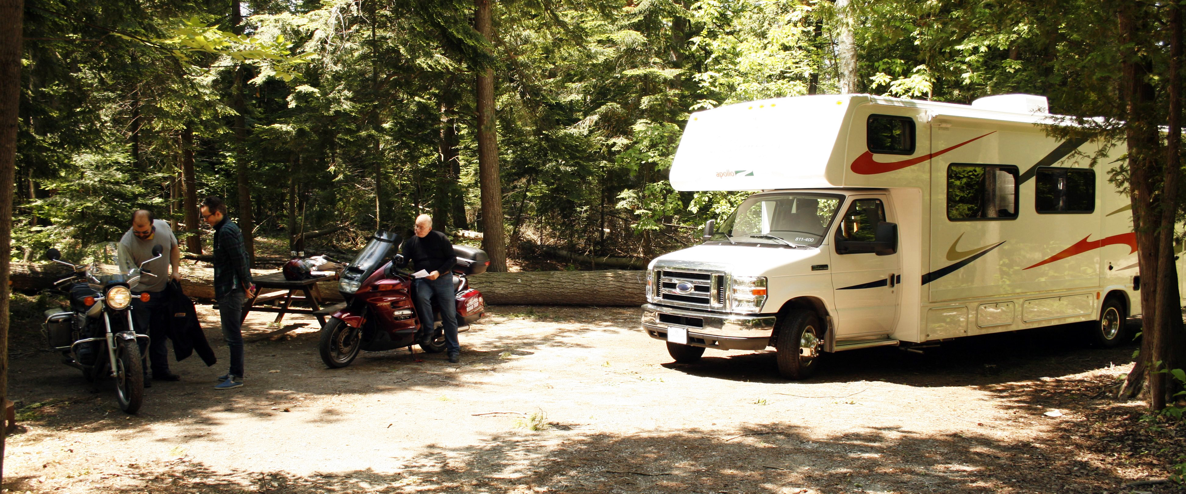
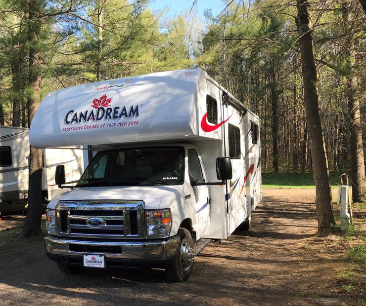
Whether you're planning a round trip or looking to book a one-way adventure, here are the best places to go to check out to rent an RV in Ontario: CanaDream, Cruise Canada, Fraserway RV, and Best Time RV. Special one-way rates are offered by RV rental companies in Toronto who need to relocate motorhomes to Calgary and Vancouver during April and May. Be sure to book early.
There are more than 30 provincial parks along the fur trade route. Most of these parks open in late May and close in September. A park pass is required and must be displayed on the dash of a vehicle at all times. Electrical, fresh water and sani-dumps are available in all provincial parks that accommodate RV camping.
Campsite reservations at Ontario Provincial Parks: 1-888-668-7275
www.ontarioparks.com
The federal government is guardian of Canada’s National Park Pukaskwa, National Historic Sites along the route and Fort St. Joseph, and the Lake Superior National Marine Conservation Area.
Contact: 1-888-773-8888
www.pc.gc.ca
Participating campgrounds in Ontario's private campground association are listed by number in the Camping in Ontario Directory.
www.campinginontario.ca
Chi-Cheemaun Ferry - Fabulous two-hour crossing of Georgian Bay Tobermory— Bruce Peninsula / South Baymouth—Manitoulin Island.
http://www.ontarioferries.com/en/ms-chi-cheemaun-en/
RVs over length 20' - $17.75 + $2.70 / ft. | $22.48 + $3.25 / ft.
Shoulder Season: May 3 to June 13, 2019, and September 3 to October 14, 2019
RV rental stations in Vancouver and Calgary are connected by the Trans Canada Hwy 1 to Hwy 17 at the Manitoba border with Ontario, just east of Winnipeg, where the prairies change suddenly to the great Canadian Shield and Boreal Forest.
Obtain detailed travel information on the entire province:
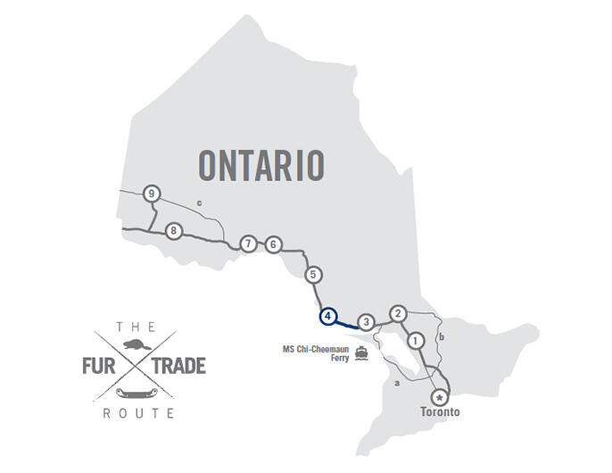
Main Route - 250 km
Highway 12 from Toronto to Coldwater. Highway 400 from Coldwater to Parry Sound.
Alternate route (a) available from Toronto to Tobermory where the MS Chi-Cheemaun, a passenger and vehicle ferry brings visitors across Georgian Bay to Manitoulin Island.
Alternate route (b) available on from Toronto through North Bay to Sudbury (adds 275 km).
• Toronto - Stock up on essentials at a big box store or supermarket. We recommend the purchase of a small barbeque and a small gas canister for outdoor dinners along the way.
• Go north from Toronto RV rental stations - There are numerous highways heading north from Metro Toronto. We chose to follow Highway 12 through farmland and horse ranches around Sandford and Brock Township with stone houses built in the 1890s.
• Orilla - A large Catholic church sits on a hill that dominates the approach to Orillia from the east side of Lake Simcoe and gives an insight to the early settlers whose headstones reveal the Irish ancestors.
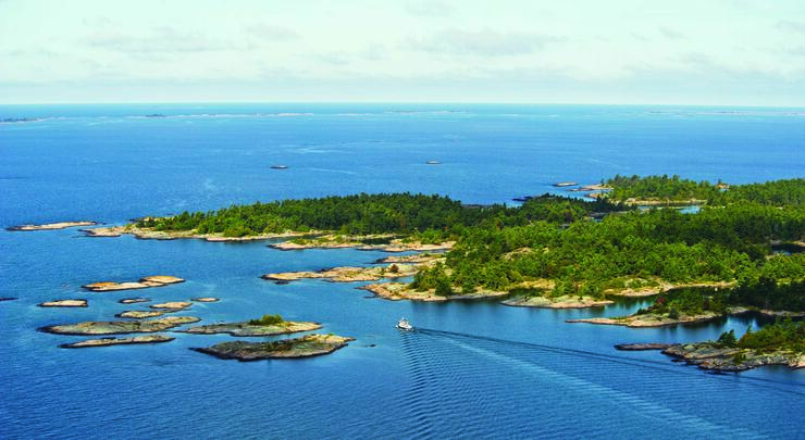
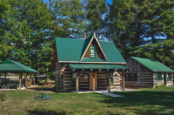
• Parry Sound is cradled on Georgian Bay with a large harbour and a rail bridge trestle spanning right across town, and a Tower Hill with a 360-degree view of Georgian Bay surrounded by mixed forests. The Bobby Orr Hall of Fame can be found here on the waterfront. This is a tribute to one of Canada's greatest hockey players. Learn more about Parry Sound here.
• Island Queen Cruises operates two- and three-hour cruises from the pier in Parry Sound for a close-up look on Georgian Bay’s wild and rugged outer islands. Click here to learn more about Island Queen Cruises.
Where to camp near Parry Sound.
KOA Parry Sound - Three hours north of Toronto, it is ideal for the second night on the road. Located in Seguin, just 20 minutes to downtown Parry Sound. Services: Electrica, sani-station, flush toilets/showers, swimming pool. Click here to learn more about KOA Parry Sound.
Horseshoe Lake Camp & Cottages, Seguin - Mixed forest overlooking Horseshoe Lake. Services: Electrical, showers/flush toilets, laundry, beach, canoes. Click here to learn more about Horseshoe Lake Camp & Cottages.
Route - 180 km
Highway 400 from Parry Sound until it merges into Highway 69. Continue down Highway 69 until you meet Highway 637 where you can exit to visit Killarney Provincial Park (optional side route) or continue along Highway 69 to Sudbury.
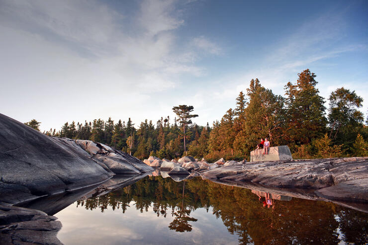
The day begins with a noticeable change in landscape towards the Shield. The granite rock formations created by catastrophic events at the end of the ice age, illustrate the direction and magnitude of the slow-moving glaciers more than a kilometre thick, almost 2 million years ago.
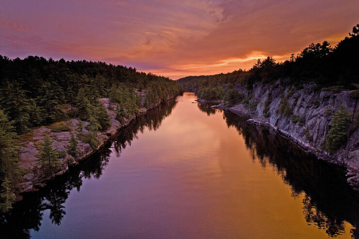
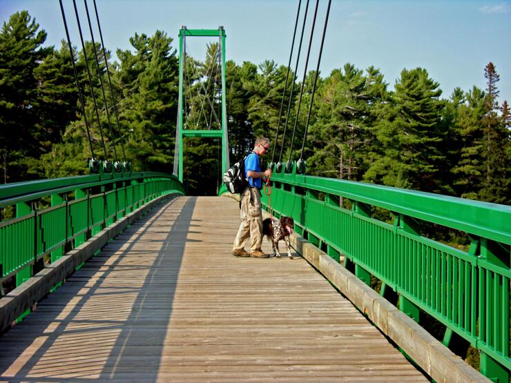
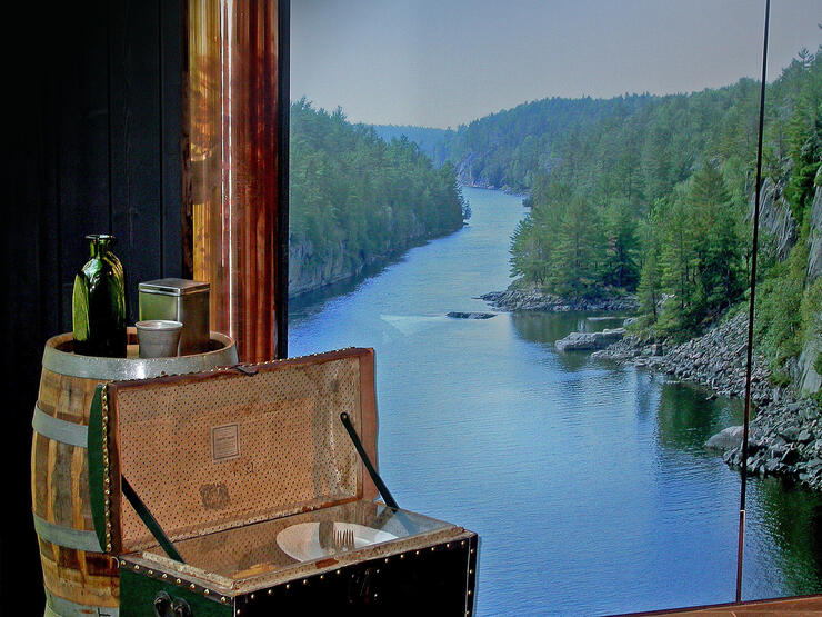
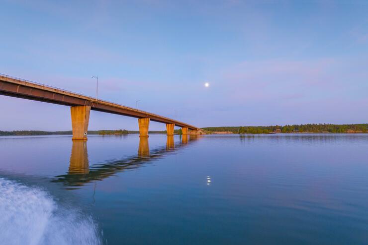
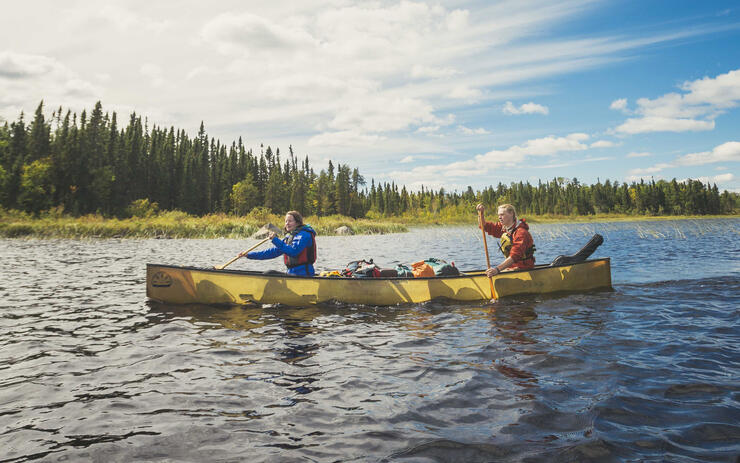
• French River Provincial Park. A visitor centre and museum at the National Historic Site on the French River pays tribute to the Lake Nipissing Canoe Route. Voyageurs followed the river west to secure furs from the Objibwe on a voyage of trade and exploration leading north and west of Lake Superior as early as 1659. The French River, although relatively small was most significant in providing access to westward travel. The world’s longest snowmobile bridge spans 512-feet and sits 90 feet above the river. The visitor centre is open Thursday to Monday in spring and fall, and daily in the summer.
Services: Backcountry camping only—no RV camping available at this site. Flush toilets, laundry, canoe & kayak rentals, park store (seasonal), visitor information centre. Click here to learn more about French River Provincial Park.
• Britt. Also known as Byng Inlet North. A railroad ghost town with the old pier remnants of a company town.
• Killarney Provincial Park. Highway 637 (125 km) return to Highway 69. Dominated by La Cloche Mountains with pink granite and white quartzite hills overlooking the coastline of Georgian Bay. Killarney Provincial Park is recognized as a nationally certified Dark Sky Preserve by the Royal Astronomical Society of Canada.
Services: George Lake Campground is open for camping all year. Electrical, showers/flush toilets, laundry, park store (seasonal), and canoe rentals nearby.
Where to camp near Sudbury.
Sportsman’s Park, Alban - Located 30 minutes south of Sudbury. Services: Electrical, showers/flush toilets, and sani-dump. Click here to learn more about Sportsman's Park.
Carol’s Campsite, Sudbury - Services: Electrical, sani-dump, laundry, and wifi. Click here to learn more about Carol's Campsite.
Route - 175 km
Head west on Highway 17 to McKerrow where you can turn left onto Highway 6 to Manitoulin (optional side route), or continue along Highway 17 to Spragge.
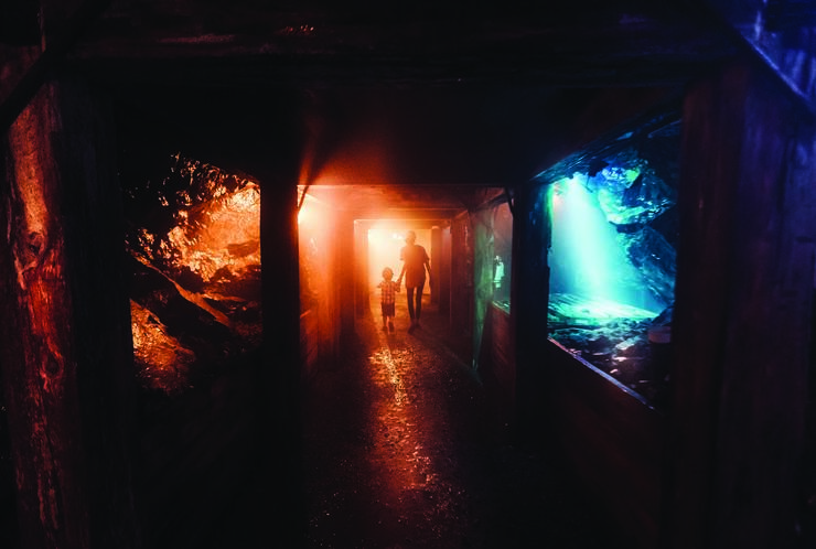
• Sudbury. Approaching Sudbury, you will soon see the 380-metre super stack on the horizon that is now disabled as metal smelters have increasingly become enviro-friendly, as shown by land rehabilitation to make it a green community for miles around. The Dynamic Earth museum needs a full day to visit, starting at the Big Nickel on the hill, with mining exhibits featuring every kind of geology, and a one-hour tour underground tour with exhibits showing the history of mining technology in the Canadian north.
• Manitoulin Island and Georgian Bay Coastal Route. Turn left at McKerrow on Highway 6 to Whitefish Falls, cross Great La Cloche Island to Sheglulandah where roads lead to all the villages and beach resorts. Click here to learn more about the Georgian Bay Coastal Route.
• Back on Highway 17, you encounter a cluster of provincial parks.
• The Spanish Marina and Four Seasons Waterfront Complex offers a birdwatcher's paradise from a viewpoint overlooking Lake Huron and the “Provincially Significant Wetlands” with waterfowl feeding on wild rice and other aquatic vegetation at the mouth of the Serpent River. Information plaques tell of the life in the lumber camps and company towns in the 1800s. Click here to learn more about the Spanish Marina.
Where to camp near Spragge.
Serpent River Campground, Spragge - Located on Highway 17 alongside the Serpent River (halfway between Sudbury and Sault Ste. Marie). Services: Electrical, showers/toilets, and a convenience store offering home-made fresh pizza. Click here to learn more about Serpent River Campground.
Brennan Harbour RV Park, Spanish - Located on Georgian Bay at the mouth of the Spanish River. Services: Sani-dump from mid-May to mid-October. Click here to learn more about Brennan Harbour RV Park.
Route - 170 km
Continue west on Highway 17 to Sault Ste. Marie or stay overnight at a campground along the way.
This route takes us along the north shore of Lake Huron.
• Blind River hosts the Northern Ontario Logging Memorial to forest workers, and the Timber Village Museum showing life in the early lumber camps.
• Iron Bridge. The Tulloch/Carlyle house are two replicas of the first homesteads, located east of Iron Bridge.
• Bruce Mines saw the discovery of copper in 1846, resulting in the first copper mine in North America. Tom Thomson of the Group of Seven painted “View over a Lake Shore with Houses” in 1912. Learn more about Bruce Mines
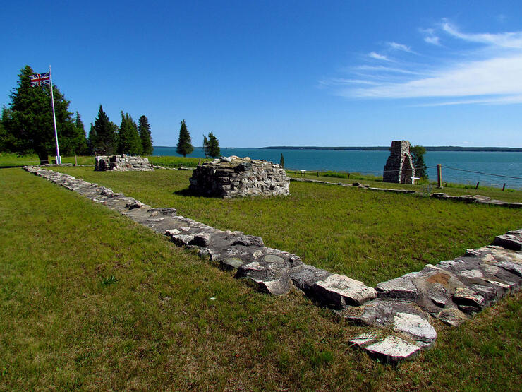
• Fort St. Joseph National Historic Site. Located on St. Joseph Island 56 km east of Sault Ste. Marie. The British chose the location for the proximity to the navigation routes controlling the fur trade and access to the Great Lakes. The fort served as the base for the first British military manoeuvres against the Americans in the War of 1812. Hilton Beach has a general store. Click here to learn more about Fort St. Joseph National Historic Site.
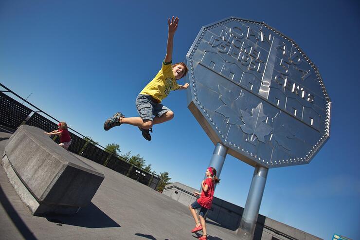
• Echo Bay, where the Loon Dollar monument was erected to commemorate Canada’s centennial in 1987. The Canadian one-dollar “loonie” gets its name from the loon, whose lonesome call you hear echo across the northern lakes.
Where to camp in and around Sault Ste. Marie:
Ojibway Park - Located in Garden River, south of Sault Ste. Marie just outside Echo Bay on Highway 17B after the Echo Bay Bridge. Beachfront on sandy shores of Laying Water Beach. Operated by Garden River First Nation.
Services: Electrical, shower/flush toilets, sani-dump, pavilion rental. Click here to learn more about Ojibway Park.
Sault Ste. Marie KOA - 10 minutes from downtown.
Services: Electrical, some cable TV hookups, showers/toilets, sani-dump, laundry, high-pressure RV wash, gift and souvenir store. Click here to learn more about Sault Ste. Marie KOA.
Sault Ste. Marie is a major centre along the St. Mary’s River and the shorelines of both Lake Huron and Lake Superior. City highlights include the Canadian Bushplane Heritage Centre and the Ermatinger Clergue National Historic Site as reminders of northern settlement. Take a walk around town to visit numerous Heritage Properties and the 1923 Pilgrimage of History Plaques featuring buildings with historical and architectural significance.
• Canadian Bushplane Heritage Centre. The de Havilland DHC-2 Beaver is the classic Canadian single-engine bush plane with pontoon floats designed to land and takeoff at outposts on small lakes, or to drop firefighting crews closest to forest fires. On display is CF-OBS, the second oldest Beaver that was built in 1948 that was operated by the Ontario Provincial Air Service throughout the northwest. Discover the history of forest firefighting in combating wildfires in the far north brought to life through the 20-minute movie before you visit the exhibits. Click here to learn more about the Canadian Bushplane Heritage Centre.
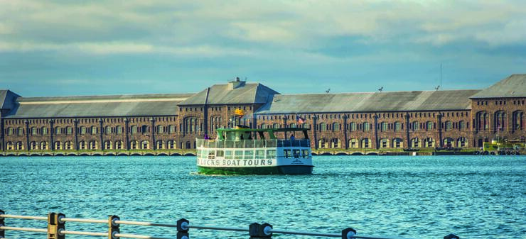
• Sault Ste. Marie Canal National Historic Site. Lake freighters and ocean carriers transit the locks as part of the St. Lawrence Seaway through the Great Lakes between Montreal and Thunder Bay. The world’s last Emergency Swing Bridge was built to control flood waters which slowed the raging torrent to a trickle. On the US side of the border, in Sault Ste Marie, Michigan, Soo Locks Boat Tour takes about two hours all through the American Soo Locks, Canadian Locks, St. Mary’s Rapids, three hydroelectric plants, and historic waterfronts on both sides of the Canada-US border. Click here to learn more about the Sault Ste. Marie Canal National Historic Site.
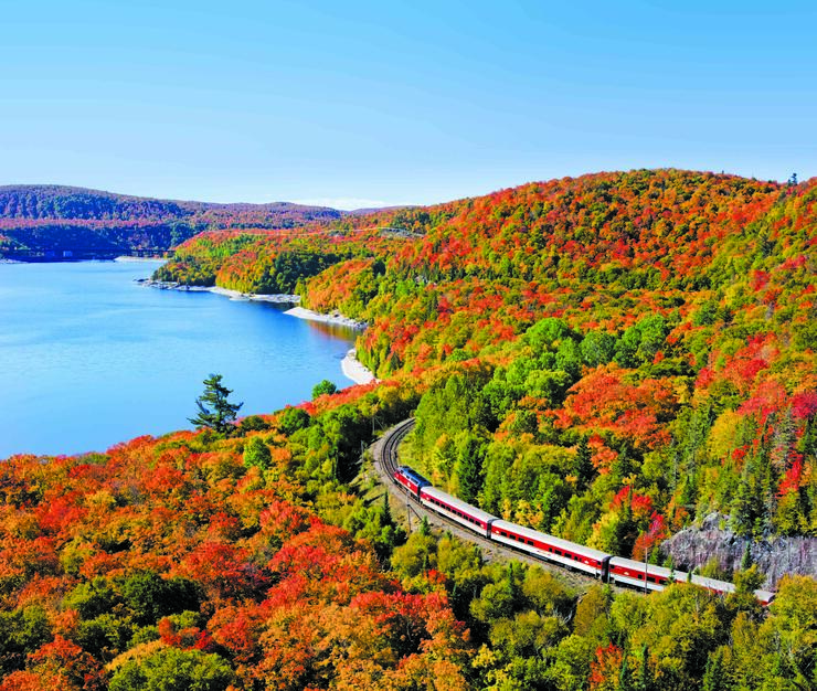
• The Agawa Canyon Tour Train departs from downtown Sault Ste. Marie. A one-day excursion into the heart of the Canadian wilderness where in 1918, the Group of Seven rented a boxcar to house their studio in the bush. The 180-km rail journey follows the shores of lakes and rivers and ends at the bottom of the Agawa Canyon. A dining car serves hot and cold meals. This trip is magnificent in September and October for fall colour viewing and always sells out early. Operates daily from early June to October. Click here to learn more about the Agawa Canyon Tour Train.
Route - 300 km
Head north on Highway 17 from Sault Ste. Marie to Wawa.
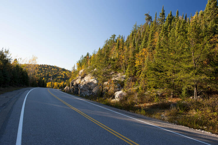
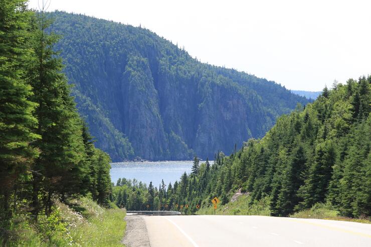
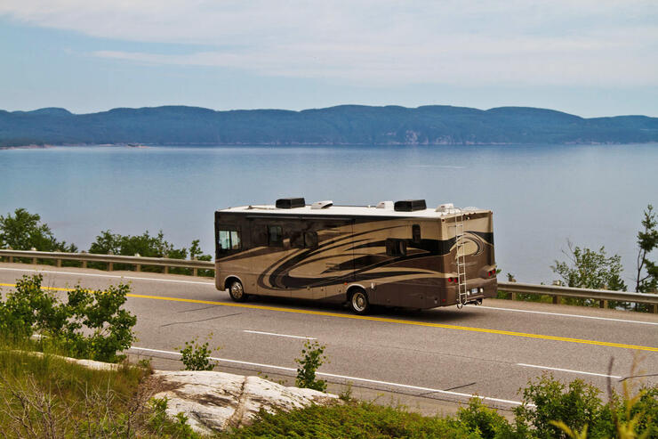
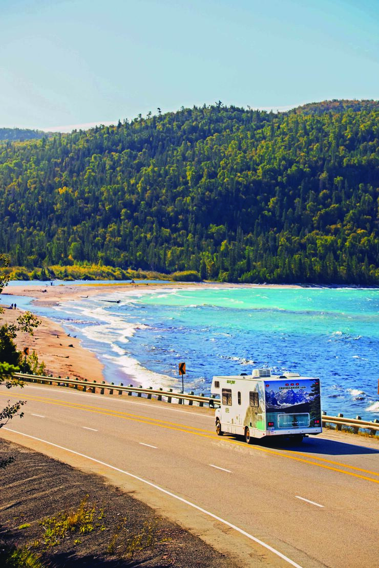
The Lake Superior route is renowned as one of the great RV drives in the world.
• Chippewa Falls drops 13 metres in two stages with a rest stop just to the side of the highway bridge. A plaque marks the half-way point on the Trans-Canada Highway between St. John, Newfoundland, and Victoria, BC. Look for another G7 easel by Arthur Lismer entitled “The Little Falls”. Click here to learn about hiking Chippewa Falls.
• Pancake Bay Provincial Park. 76 km northwest of Sault Ste. Marie. Voyageurs preferred this wide sandy 3-km long beach for stopovers on the canoe route around the top of Lake Superior. A plaque on the lookout trail tells of the sinking of the Edmund Fitzgerald that broke up in a violent winter storm made famous by Canadian folk singer Gordon Lightfoot. Click here to learn more about Pancake Bay Provincial Park.
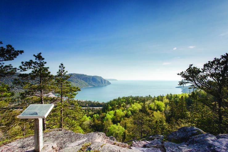
• Lake Superior Provincial Park is one of the larger parks on the eastern shore of Lake Superior. Displays illustrate the effect of “rebounding” on the Shield, a term to describe how bedrock rises after removal of the massive weight of glaciers. Another G7 easel marks the area where J.E.H. MacDonald came to Algoma Country “to find gems of the Canadian landscape.” Lake Superior Provincial Park is recognized as a nationally certified Dark Sky Preserve by the Royal Astronomical Society of Canada. A visitor centre highlighting the park’s cultural history, natural features, and recreational opportunities is located at Agawa Bay. Click here to learn more about Lake Superior Provincial Park.
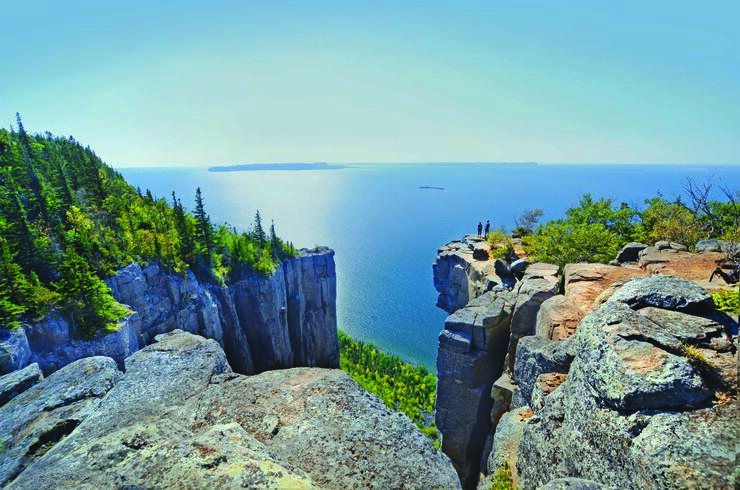
• Agawa Rock. 8 km north of Agawa Bay within Lake Superior Provincial Park. Pictographs painted on sheer cliffs rising from Lake Superior. Red ochre figures are painted on a giant canvas of stone to record the stories of generations of Ojibwe. Proper footwear is recommended for access along a cobblestone path on the shoreline. Paintings can only be viewed when the lake is calm. The trail is open mid-May to mid-September. A park permit is required. Click here to learn about the Agawa Rock Pictographs.
• Michipicoten. Magpie River Valley features a 75-foot waterfall at the outflow of the reservoir. Click here to learn about the Michipicoten First Nation.
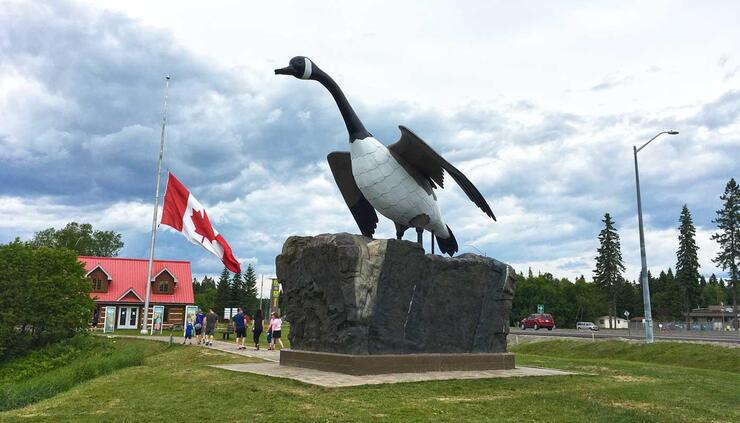
• Wawa. The Land of the Big Goose statue. A legendary town settled by pioneers located three hours north of Sault Ste. Marie. Follow the “Signs of History” around the town that explain the early beginnings. Look for a statue of early settlers. Information centre at the south end of town. Click here to learn more about visiting Wawa.
Where to camp near Wawa.
Wawa RV Resort & Campground, Wawa - One mile north of town. Open May 1-October 28.
Services: Electrical, outdoor heated pool, laundry, wifi, showers. Click here to learn more about Wawa Resort & Campground.
There are numerous provincial parks along this route that have campsites available. Seasonal openings between May and September. Permits can be purchased at the Visitor Centre located at Agawa Bay. Learn more about RVing this area here.
Route - 360 km
Continue north on Highway 17 from Wawa to Nipigon.
• White River. Started as a railroad divisional point where large blocks of ice were cut from lakes in winter to refrigerate boxcars filled with perishables being shipped across the long northern route. Historical Society Museum and historic markers. Famous for Winnie-the-Pooh statue built to commemorate the black bear cub that became the mascot for Canadian troops serving overseas during WWII. Click here to learn more about visiting White River.
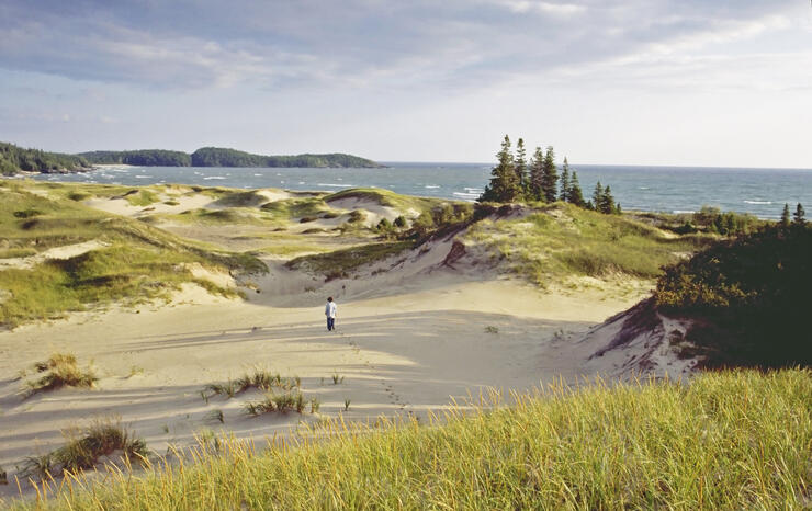
• Pukaskwa National Park. Heron Bay. Main entrance to camping and visitor centre is 25 km east of Marathon on Highway 627 at Hattie Cove. Features a boardwalk over the sand dunes to the sandy beach on Horseshoe Bay. Canoe rentals - $20/½ day is recommended when the bay is calm. Electric sites 15 km in from Highway 17. Showers/flush toilets. Visitor centre with displays. Hiking trails. Click here to learn more about Pukaskwa National Park.
• Marathon was a staging area during construction of the CPR rail line through solid bedrock, mid-way between Sault Ste. Marie and Thunder Bay. Visit Pebble Beach with polished stones along the shore of Lake Superior. Click here for more about visiting the town of Marathon.
• Neys Provincial Park. Neys Camp 100 was one of the first POW camps that housed German soldiers and enemy civilians during WW II. Prisoners were transported by ship from England, arriving in January 1941, and held until fall 1943 when the camp was relocated. Prisoners were permitted to leave the confines of barbed wire to work in lumber camps and cut cordwood. Click here for more on visiting Neys Provincial Park.
• Terrace Bay. The last easel of G7 on the route from Sault Ste. Marie. Follow the Casque Isles Hiking Trail for two km to Terrace Bay beach where you walk knee-deep through ryegrass. Pre-arrange a boat tour to Slate Islands which shelters a large herd of Boreal Woodland Caribou. Enjoy views from a scenic lookout from the Patterson Lighthouse in town lookout located behind the Tourist Information Centre. Click here for information on visiting Terrace Bay.
• Aguasabon Falls and Gorge is just a half-mile off Highway 17. Boardwalk to the 100-foot waterfall and gorge. Click here to learn more about Aguasabon Falls and Gorge.
Where to camp near Nipigon.
Stillwater Tent & RV Park, Nipigon - Services: Electrical, shower, wifi, gift shop, laundry, sani-dump. Click here to learn more about Stillwater Tent & RV Park.
Route - 290 km
Continue north on Highway 17 from Nipigon to Thunder Bay.
• Rainbow Falls Provincial Park has a beautiful sandy beach. Click here to learn more about Rainbow Falls Provincial Park.
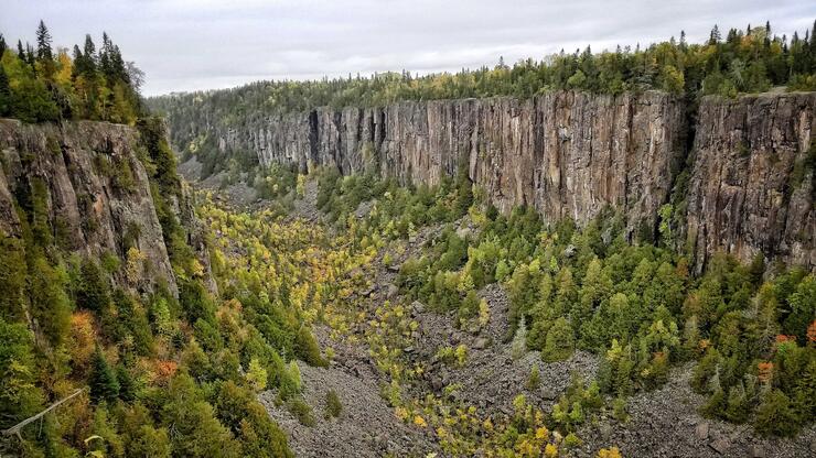
• Ouimet Canyon Provincial Park has a unique geological feature with 100-metre cliffs and two viewing pods along a short trail. Click here to learn more about Ouimet Canyon Provincial Park.
• Sleeping Giant Provincial Park offers views of the "Sleeping Giant" from the tip of Sibley Peninsula. Click here to learn more about Sleeping Giant Provincial Park.
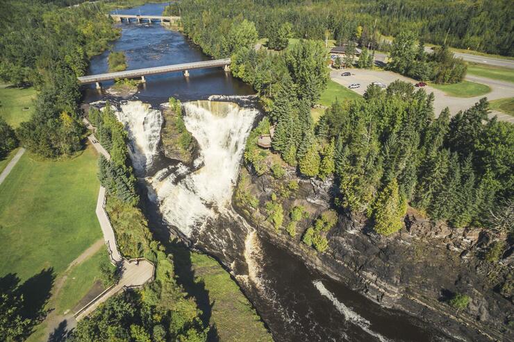
• Kakabeka Falls Provincial Park. A 40-meter waterfall that required a portage on the historic canoe route connecting Lake Superior with Lake of the Woods. Click here to learn more about Kakabeka Falls Provincial Park.
• The Terry Fox Monument and Scenic Lookout has a 9-foot statue erected in memory of Terry Fox, the courageous one-legged runner who embarked on a 5,300-km run across Canada to raise money for cancer research. His unique hop-and-skip style inspired Canadians to support his Marathon of Hope that has grown worldwide.
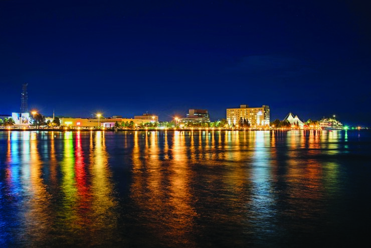
• Thunder Bay takes its name from the immense Thunder Bay at the head of Lake Superior. The city has grown into a major transportation hub with an inland port served by two transcontinental railroads delivering grain from the Prairies. Visit the developed harbour front for a choice of fine restaurants. Click here to learn about Thunder Bay's fantastically diverse food scene.
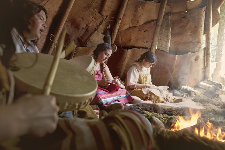
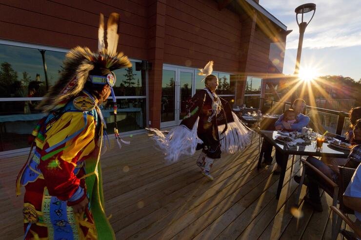
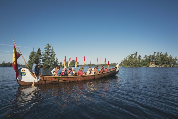
• Visit Fort William Historical Park was the world's largest Fur Trade Post at its time. It is an exact replica of the North West Company's inland headquarters. Fur traders would bring their goods from the far west for trading, and the voyageurs would then haul bales of beaver pelts all the way to Montreal for shipment to Europe. Meet Scottish fur traders, French voyageurs and the Ojibwe who toil at the fort. Click here to learn about RVing to Fort William Historical Park.
Where to camp near Thunder Bay
Wolf River Park, Dorion - 75 km east of Thunder Bay. Services: Electrical, showers/outhouse, sani-dump. Open May 18-October 8. Click here to learn about camping Wolf River Park.
KOA Campground, Thunder Bay - On Highway 11/17 just east of Thunder Bay. Services: Electrical, convenience store, firewood. Winner of KOA Campground of the Year award. Click here to learn more about RV camping at Thunder Bay KOA.
Happy Land Campground, Kakabeka Falls - Services: Electrical, showers/sani-dump, heated pool. Open all year. Click here to learn more about Happy Land Campground.
Main Route - 335 km
Depart west from Thunder Bay on Highway 17. Turn left onto Highway 11 which will take you to Fort Frances.
Alternate Route - There is an alternative northern route on #17 to Ignace, Dryden, and Kenora that is slightly shorter (c).
Sunset Country. A vast area in Northwest Ontario with 150,000 lakes bound by the Boreal forest.
• Atikokan - The Centennial Museum and Historic Park describes the Steep Rock Iron Mine discovery in 1938, its opening in 1944 to extract iron ore from a giant pit, and its ultimate demise in 1974. Four massive electric dredges were used to remove 270 million cubic yards of dirt from the lake to access the ore body. Iron pellets were shipped by ore carrier across the Great Lakes to steel mills in Hamilton and Pittsburgh. Click here to learn more about visiting Atikokan.
• Quetico Provincial Park - Dawson Trail - Turn off on Highway 11 (148 km west of Thunder Bay). A major wilderness park with RV camping limited to Dawson Trail Campground. Showers/flush toilets, laundromat, visitor centre, hiking trails, canoeing. Click here to learn more about Quetico Provincial Park.
• Fort Frances - A border town across Rainy River bridge to International Falls, Minnesota. Follow the La Verendrye Parkway along the shores of Rainy River as it flows 129 km west out of Rainy Lake to Lake of the Woods. Historic plaques describe the Voyageurs Highway and the rivalry between the Hudson Bay and Northwest Company for furs along the canoe route. A description at the base of a 100-foot forest fire lookout tells of the early warning radar bases that dotted the north during the Cold War. A shuttered pulp mill is a reminder of the boom and bust times in the region.
Continue along Highway 11 past the junction with #71 to Kay-Nah-Chi-Wah-Nung Historical Centre, “the Place of Long Rapids,” with the largest group of Indigenous burial mounds in Canada reflecting more than 8,000 years of reoccurring habitation. Some mounds are more than 7 metres in height. The visitor centre has limited hours of operation. Click here to learn more about visiting Fort Frances.
Where to camp near Fort Frances
Caliper Lake Provincial Park, Nestor Falls: Situated on a bluff overlooking Caliper Lake from a stand of old growth red and white pine. Services: Electrical, showers/flush toilets, laundry, seasonal opening. Click here to learn more about Caliper Lake Provincial Park.
Tomahawk Resort, Sioux Narrows: Cabins with an RV park. Services: Electrical, showers/toilets, laundry. Click here to learn more about Tomahawk Resort.
Route - 225 km
Continue west on Highway 17, then turn north onto Highway 71 to Highway 17. Follow Highway17 to downtown Kenora. Highway 17A is a by-pass route on the Trans-Canada Highway.
Ontario / Manitoba border - Trans-Canada Highway 17 in Northern Ontario becomes Highway 1 at the Manitoba border 42 km west of Kenora.
There are numerous sport fishing camps along the highway, and charter air service into bush camps.
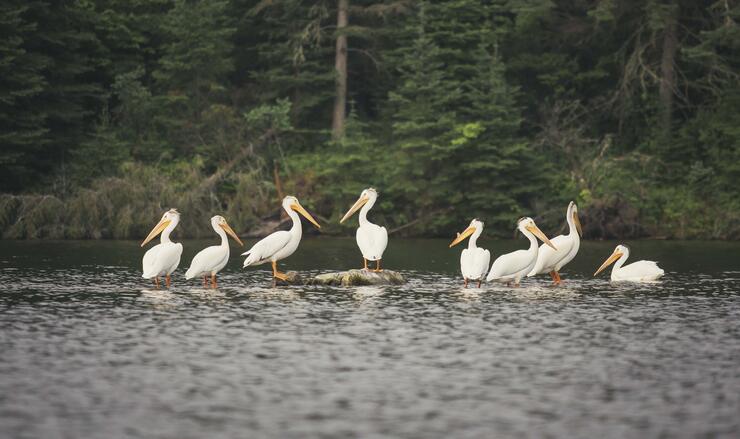
• Nestor Falls / Sioux Narrows - Two quaint towns with numerous tourist fishing camps on the eastern shores of Lake of the Woods. The Nestor Falls attract flocks of pelicans that feed in the white water below the falls. Visit the Northern Ontario Sportfishing Centre for a thorough introduction to sportfishing in the area. Historic site of a legendary battle between the invading Sioux and local Cree and Objiway. Click here to learn more about Nestor Falls - Sioux Narrows.
• Sioux Narrows Provincial Park - Located just off Highway 71. Services: Electrical, showers/flush toilets, laundromat. Click here to learn more about Sioux Narrows Provincial Park.
• Rushing River Provincial Park - Located 25 km south of Kenora. White water that gives name to the river that drains Dogtooth Lake, surrounded by a forest of jack pine and balsam. Services: Electrical services, showers/toilets, laundromat, kayak rentals, hiking trails. Click here to learn more about Rushing River Provincial Park.
• Lake of the Woods - A very large scenic lake with scattered islands famous for recreational boating and fishing. Look for private campgrounds around the lake shore. Click here to learn more about Lake of the Woods.
• Kenora - Once known as “Rat Portage” after trapping muskrats, the canoe route by-passed the rapids at the outlet to the Winnipeg River. Visit the Lake of the Woods Museum nicely situated in downtown on the shores of the lake that explains the fur trade, native culture, mining, and railroad history. It contains a replica of a birch bark canoe used by Indigenous people to gather wild rice, and examples of beaded buckskin jackets and moccasins made from animals trapped in the region. Enjoy a relaxing cruise around the iconic Lake of the Woods on the M.S. Kenora to view multi-million dollar homes and cottages owned by celebrities from around the world. Depart from the wharf at the Matiowski Farmer’s Market. Click here to learn more about things to do while visiting Kenora.
Where to camp near Kenora:
The Willows RV Park & Campground, Kenora
Services: Electrical, wifi, showers/washrooms, waste disposal, hiking trails. Click here to learn more about the Willows RV Park & Campground.
And that's it! If you made it this far, you're ready to take this amazing trip for real. Make sure to post your adventures on social media using the hashtag #RVOntario.
Produced by Destination Northern Ontario in co-operation with: Destination Ontario, Ontario Parks, Camping in Ontario, RV Rental Association of Canada, Best Times RV, CanaDream, Cruise Canada, and Fraserway RV: